A few years back, I’ve done this nearly perfect trek in the French Alps called “Tour du Beaufortain”. I’ve done it in 6 days (5 nights) but this hike has so many accessible entry points and variants that you could easily make it into anything from a short weekend outing (1 or 2 nights) to a 10-day hike.
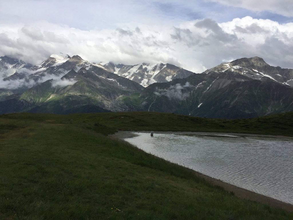
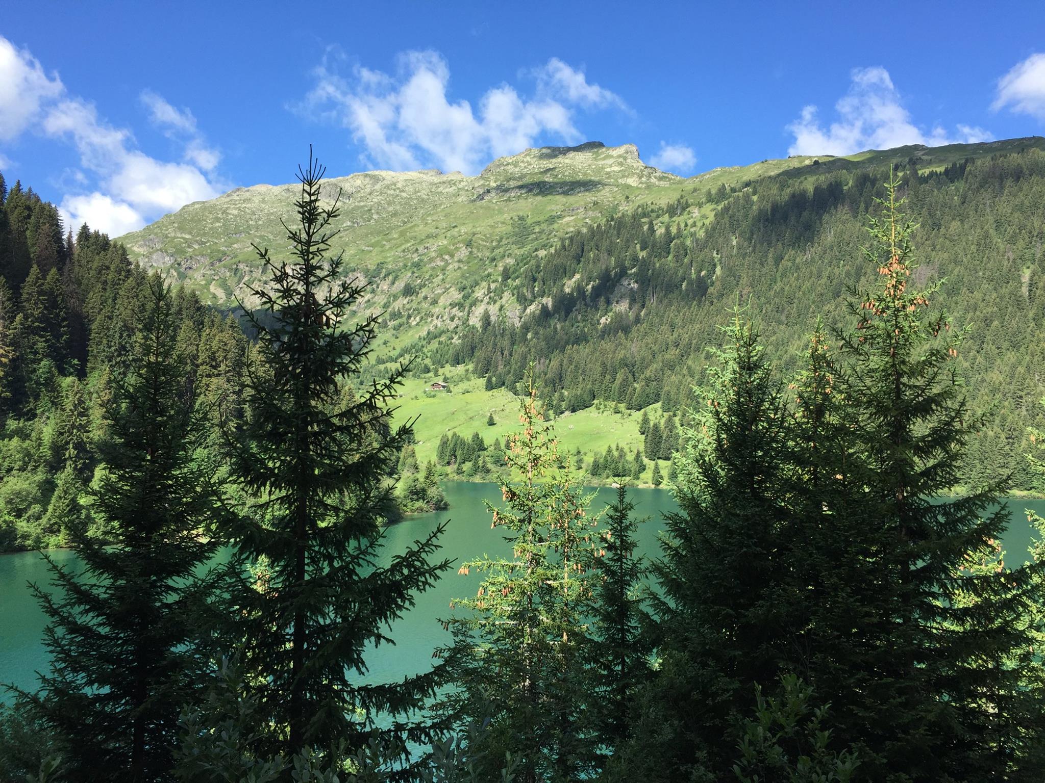
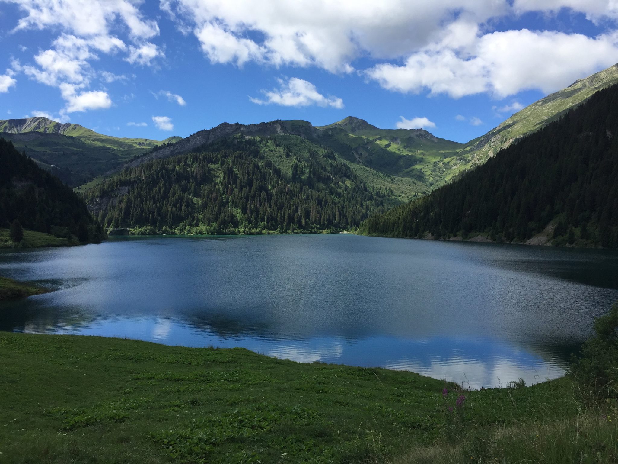
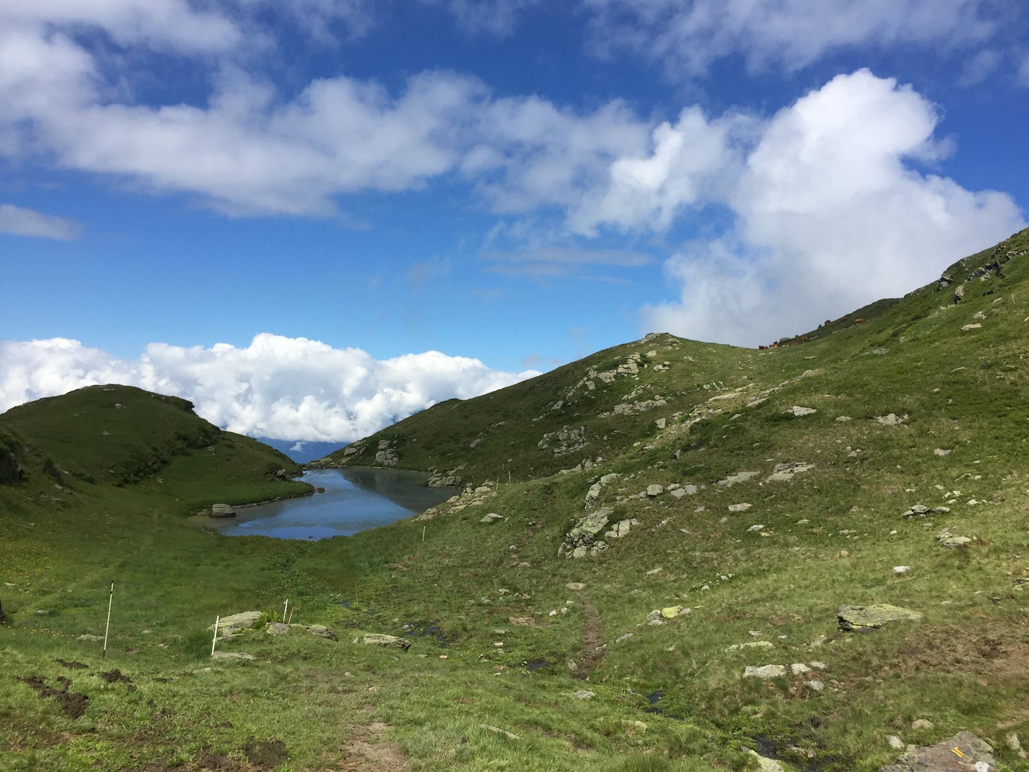
Saint Guérin lake (1,577m / 5,174 ft)
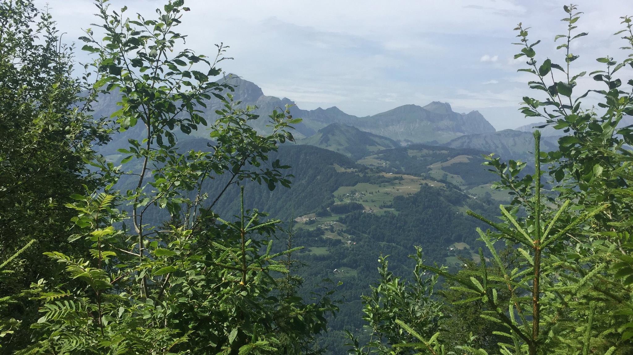
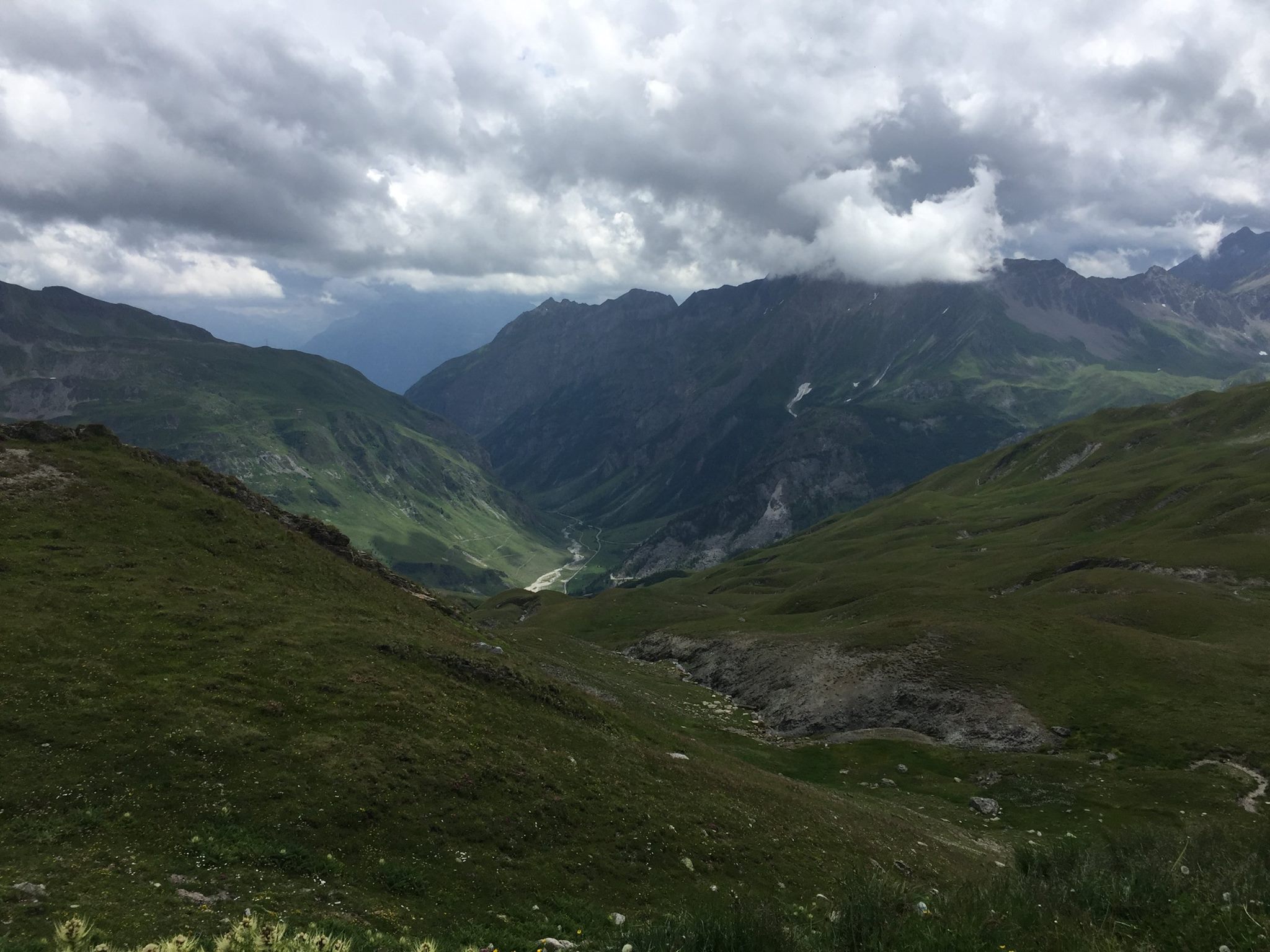
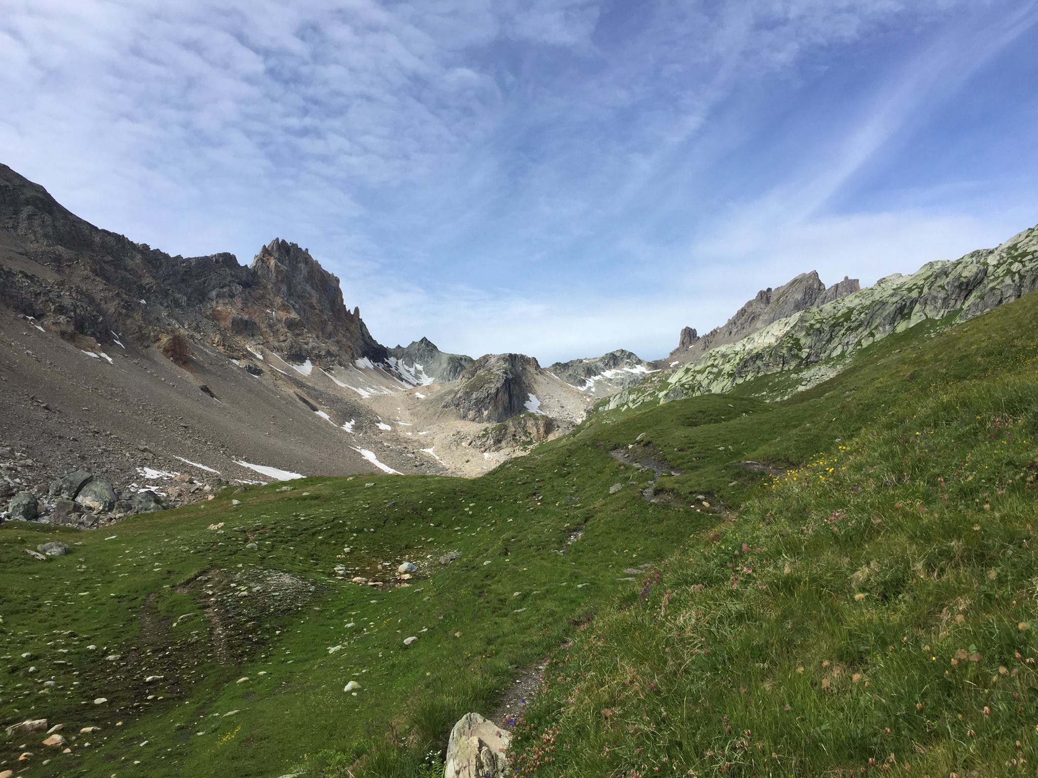
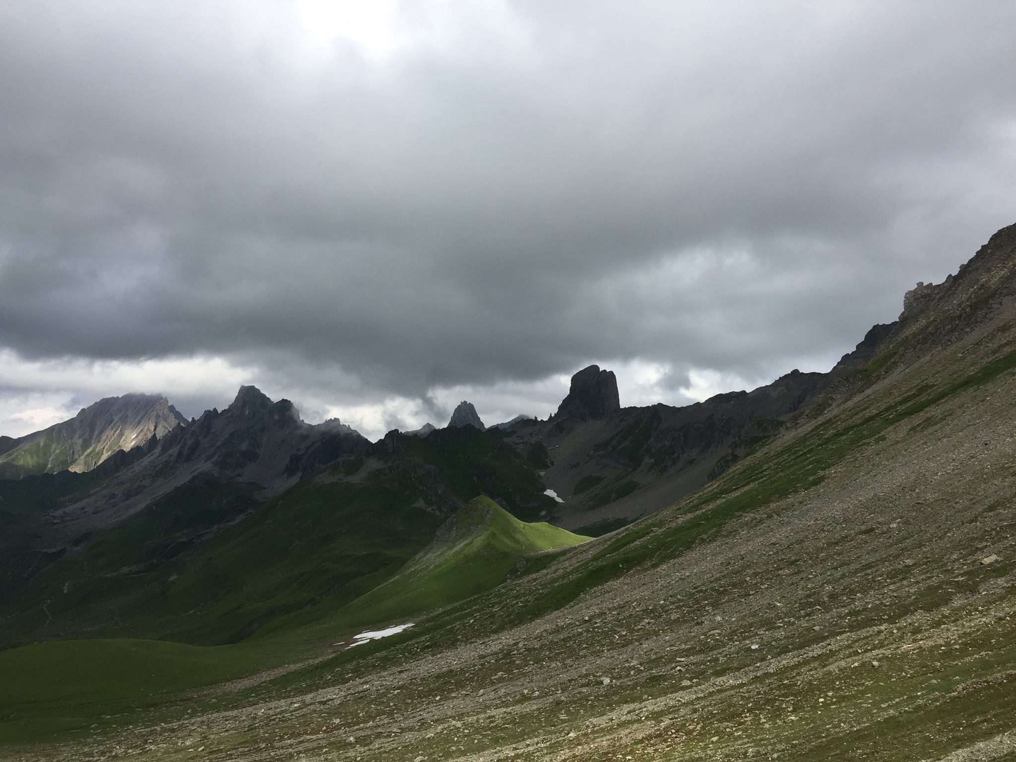
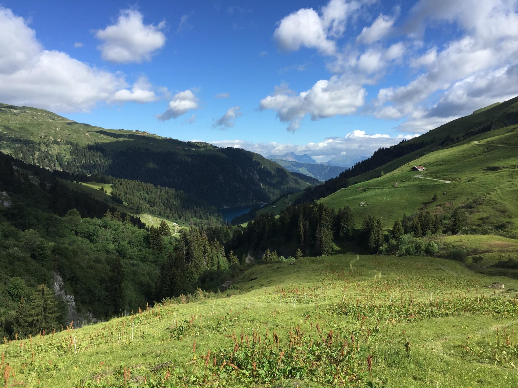
the Combe de la Neuva valley
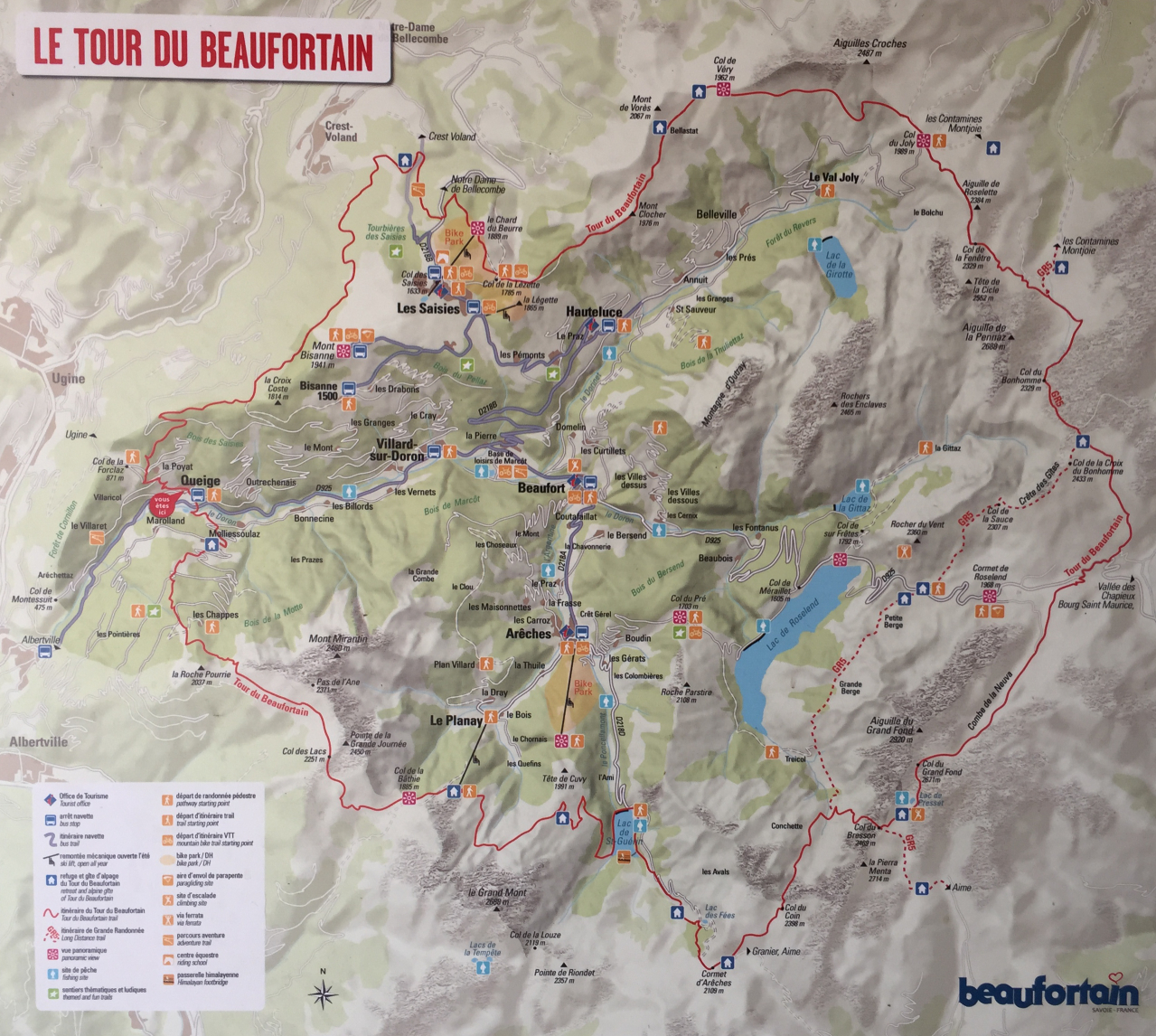
Overview:
Length: 98 Km (61 Miles)
Type: Round trip
Click here to download the trail’s .gpx
Season: End of June to Mid October.
Total Ascend: 5,344 meters (17,533 feet)
Total Descent: 5,344 meters (17,533 feet)
Trailhead accessibility: Easy (Bus / Taxi / Car)
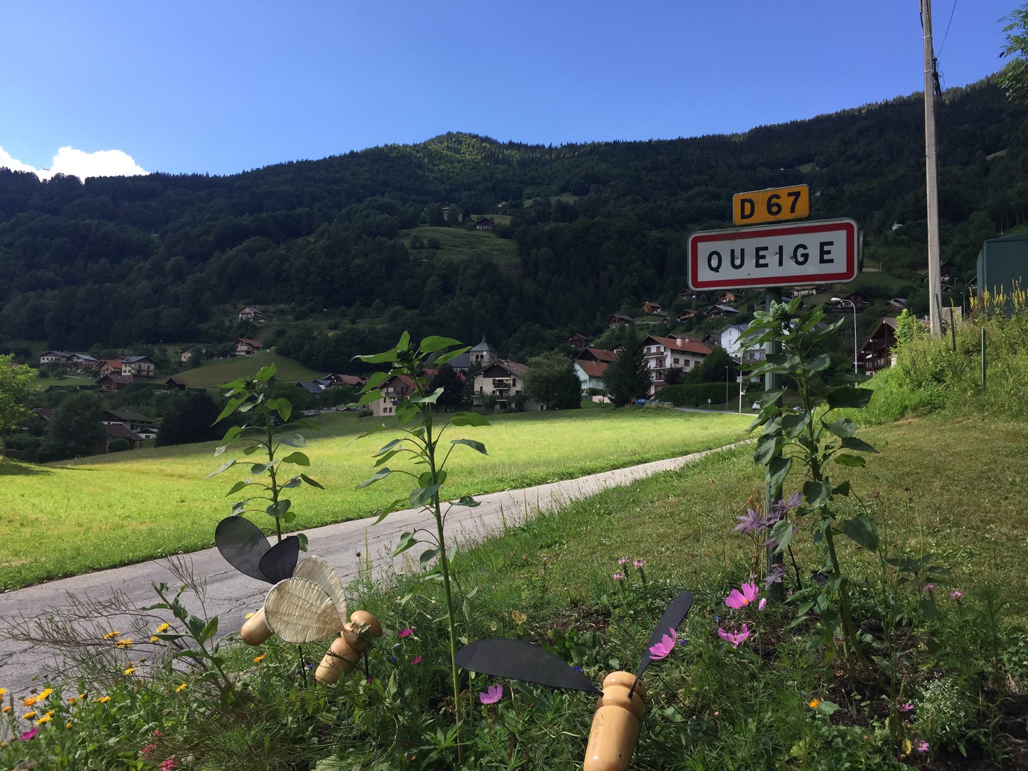
Start / End point name and location: Next to Church Saint Agathe, Queige
Typically done in: 6 days (clockwise)
Why do I say it’s nearly perfect?
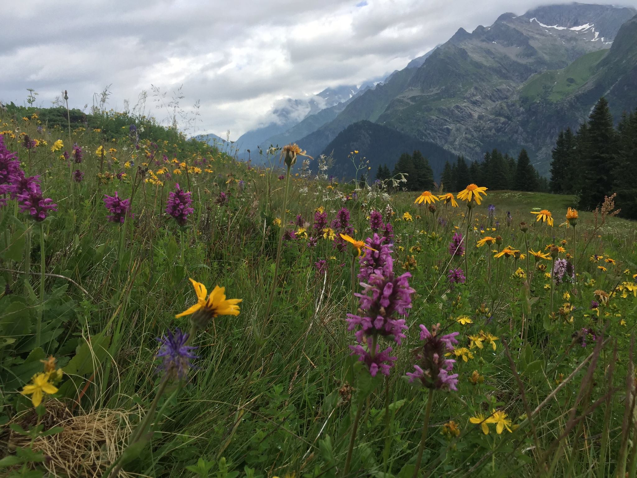
- The views are absolutely stunning. This hike has a mutual day with the famous TMB so you get to see the Mont Blanc “popping” every now and then It’s similar scenery to the beautiful TMB but contrarily to it –
- The trail is EMPTY (most of the time) i.e – even on high season (July – August) you’ll most likely not encounter more than very few people. I think the main reason is that nearly only French people (not to say local French people) know of it or even heard of it. This makes it the perfect alternative to the extremely busy TMB where you might find yourself having to wait in line to reach places like Col de la Croix du Bonhomme.
- As I’ve said – it has TONS of variants and access points making it very easy to plan according to the time you have. Also, however isolated and “free” you feel most of the trail – you’re never too far from an exit point that could easily connect you to Albertville which is an important hub with lots of commerce and a train station.
- About that train station… If you’re not familiar with how trains work in France all you have to know is that it takes 3h51min to get from the heart of Paris to Albertville in a very smooth and comfy train with one short change on the way. On weekdays, prices are fairly low and can get even lower in some hours of the day and on certain trains. This means you could easily leave early in the morning (first train leaves at 06:46) and be on the trailhead at around 11AM on the same day. Considering the fact that in summertime sun sets in the Alps at around 21:30 – this allows for around 10 hours of solid hiking. Enough to get you safely to your first sleeping point on the trail.
- This trail has a huge variety of sleeping options – from some of the best and most stunning refuges in the French Alps (like the Refuge du Presset) all the way to not less amazing wild bivouac spots. And before you ask – yes, you can freely camp in most areas along the trail provided that you pitch your tent no earlier than 19:00 and fold said tent no later than 07:00 the next day; not camping in the same spot more than one night and of course – leaving no trace of your presence.
- It’s a relatively easy hike or it could be as easy or as hard as you want it to be because of all the possible variants. The “Official” Tour du Beaufortain is 98Km (61 miles) with a total ascent of 5,344 meters (17,533 feet) and a total descent of pretty much the same. Its highest point is at 2,671m (8,763 feet) – the Col du Grand Fond which is higher than the highest point at the TMB (the Col de la Croix du Bonhomme – 2,408m / 7,900 feet That you will be conquering on the Tour du Beaufortain also!).
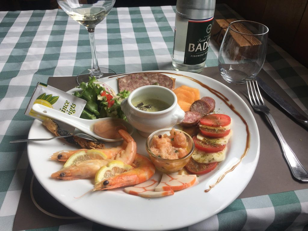
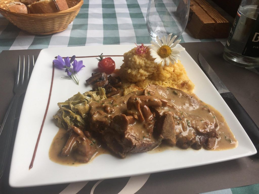
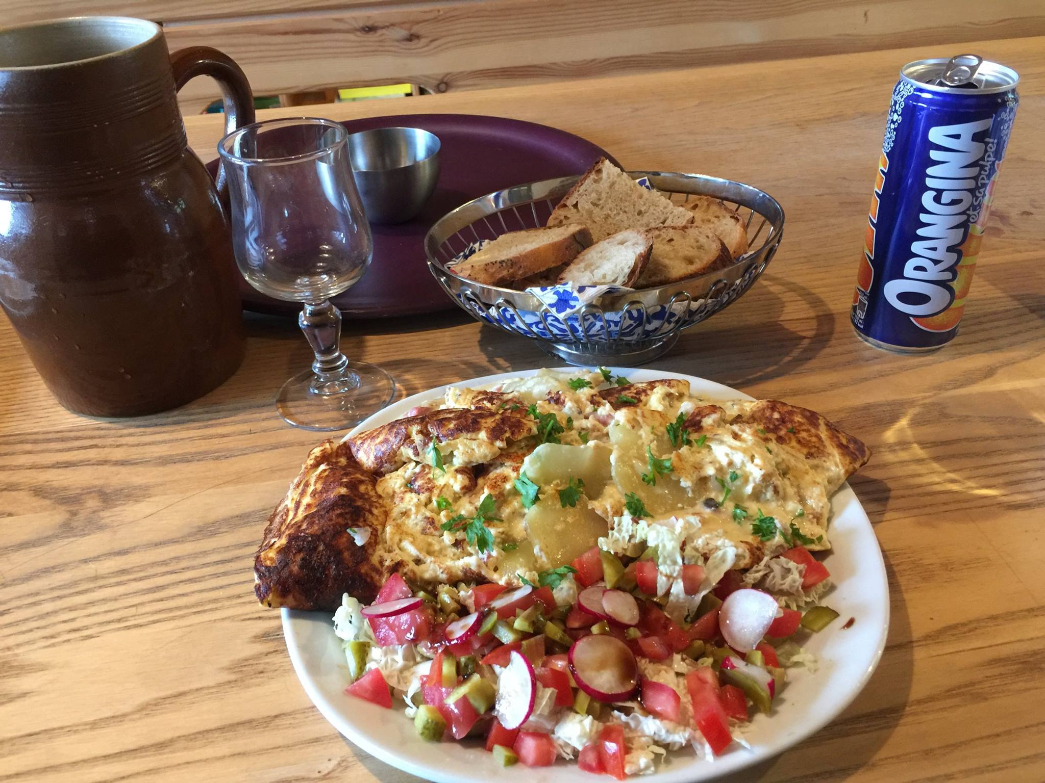
- You can find great food, drinks and company on the way. Other than good yet simple meals in refuges, you could literally have one or several cold beers nearly every day on the trail. How about that?! (Just remember to drink responsibly…). Most refuges are held and / or run by local families – allowing you to meet some genuine French people from the region (called Savoyards) and if you’re curious and kind enough you’ll most definitely have a great time both with them and the few other hikers that will stay there.
So here’s a little description of how it was for me to do this trail. I hope you find it helpful and let me know in the comments if you have any questions or if you’ve done it and have some new info. I’ve also included a (very) detailed hiking gear list for your convenience.
Day 1 –
From Queige to (slightly beyond) Refuge de Lachat
Any taxi driver found right at the exit of Albertville station will do. Choose one and ask him/her to take you to the Village Church of Queige. It’ll take about 10 minutes and will cost about 20 Euros. There’s also a bus service there (Bus L21 to “Arêches Place Capitaine Bulle” on your right when you exit the train station) But its frequency varies. If you’re taking a taxi make sure you get the driver’s phone number (they usually have cards) so you could call him to come pick you up and bring you back to Albertville at the end of your adventure.
Facing the church’s tower (the façade where the clock is) just go along the road on your left. Pass a small stream and you’ll see the trailhead (Alt. 590m / 1936 ft.) . You need to follow the yellow and red stripes all along this trail. It’s very well way marked in most places.
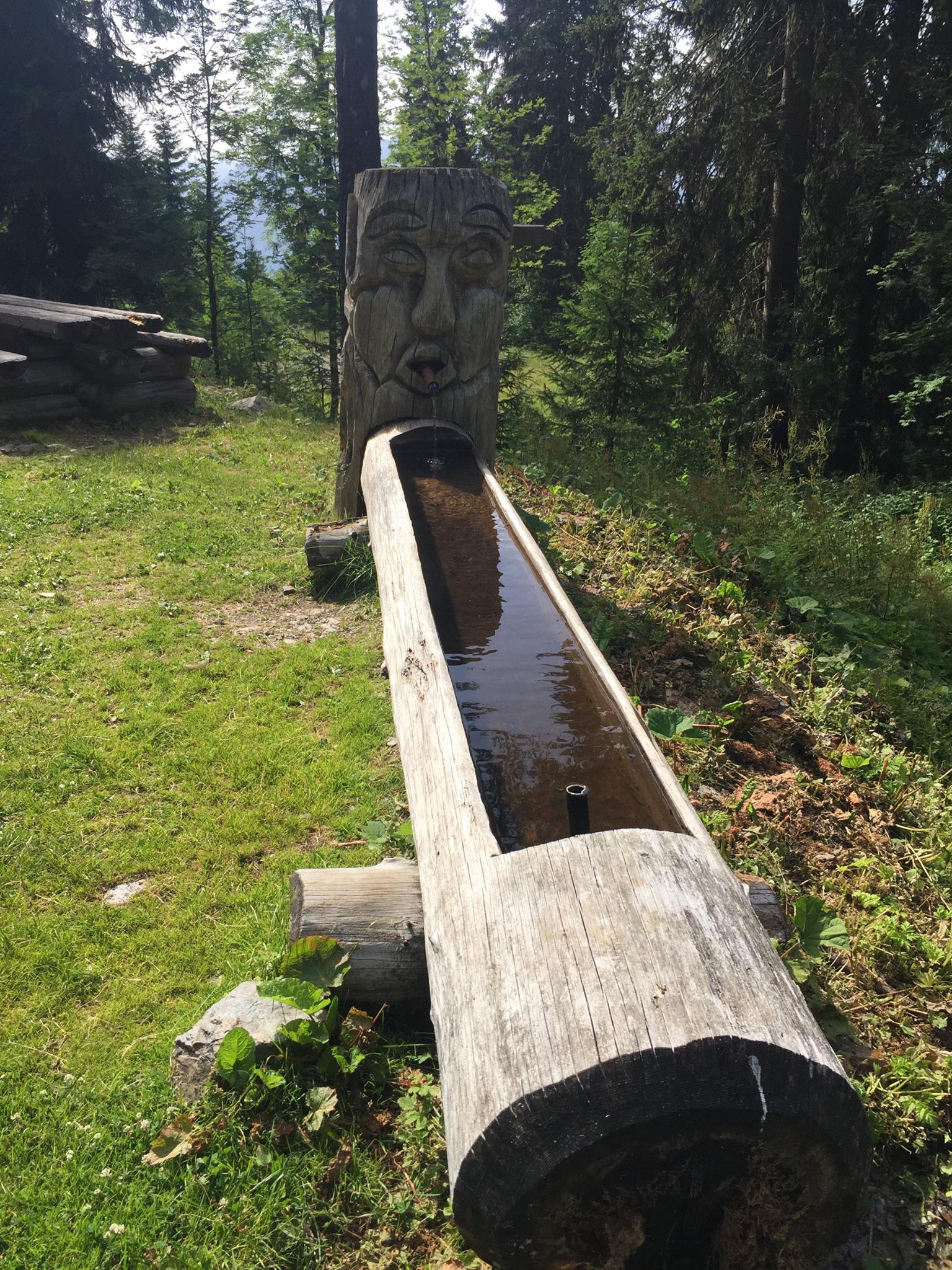
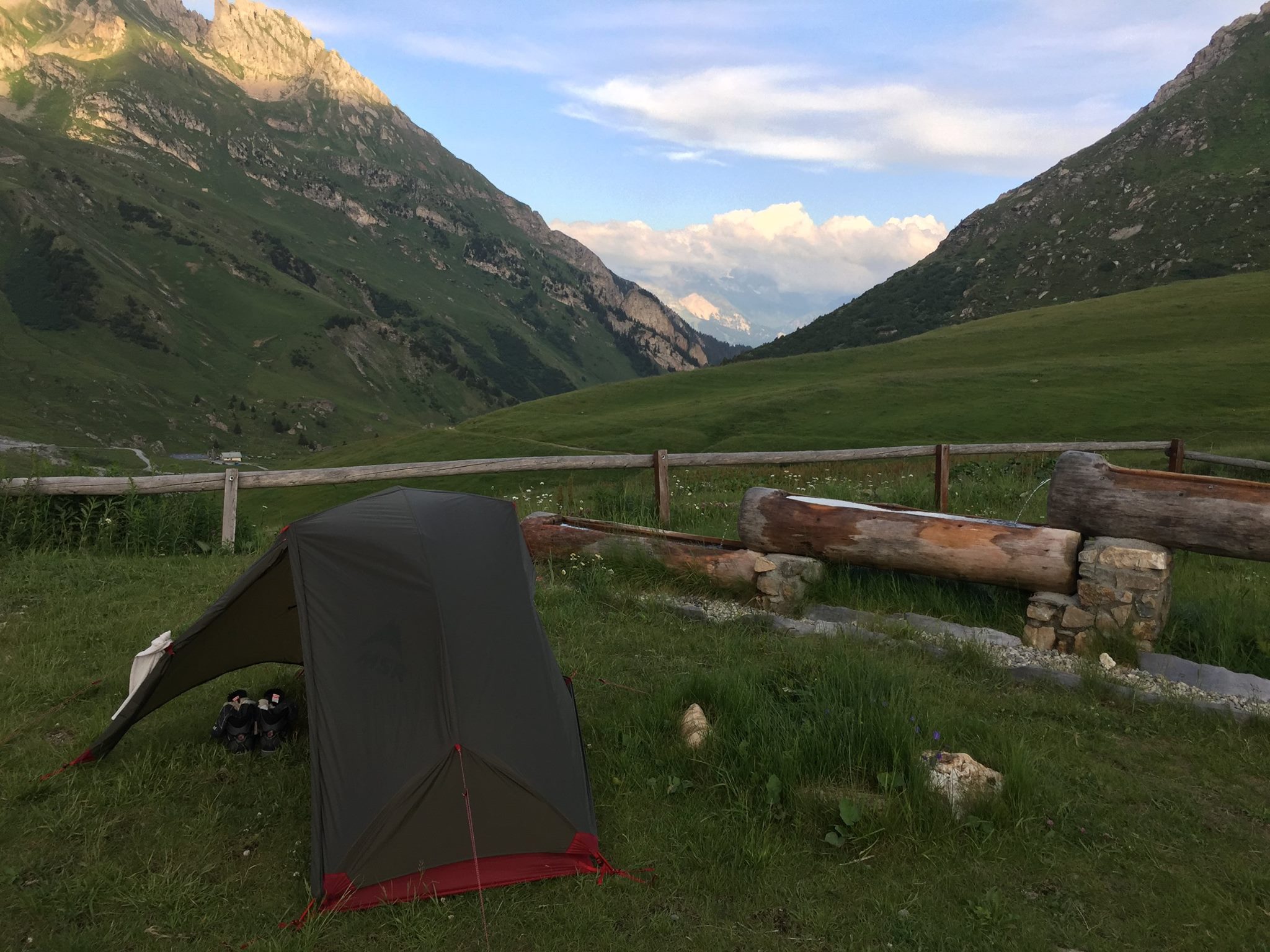
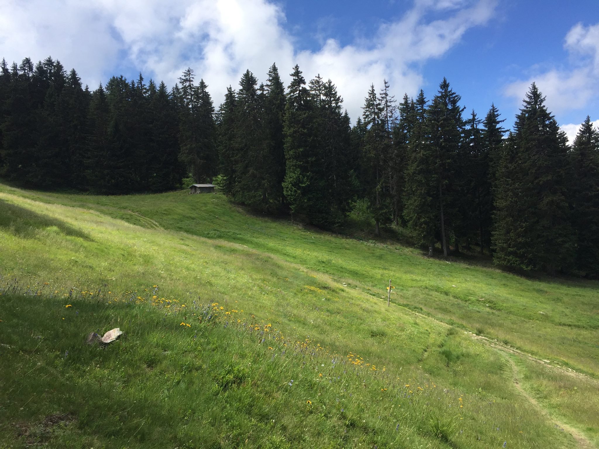
The trail starts a bit flat but goes up quite steeply criss-crossing small roads. At the end of your ascent after about 3h20 you’ll reach Sous Varzéron (Alt. 1,480m / 4,856 ft) – a small chalet with some drinking water next to it. (Fig 1 & 2) At the end of harsh summers (September) water from the fountain might be just a trickle. If you started your day late, this could be a good sleeping point.
Continue along the trail and after about 1h20 minutes you’ll reach La Palette Chalet (Alt. 1,716m / 5,630 ft) This is also a good camping spot that has drinking water nearby. This is where you’ll get your first glimpse of the Mont Blanc.
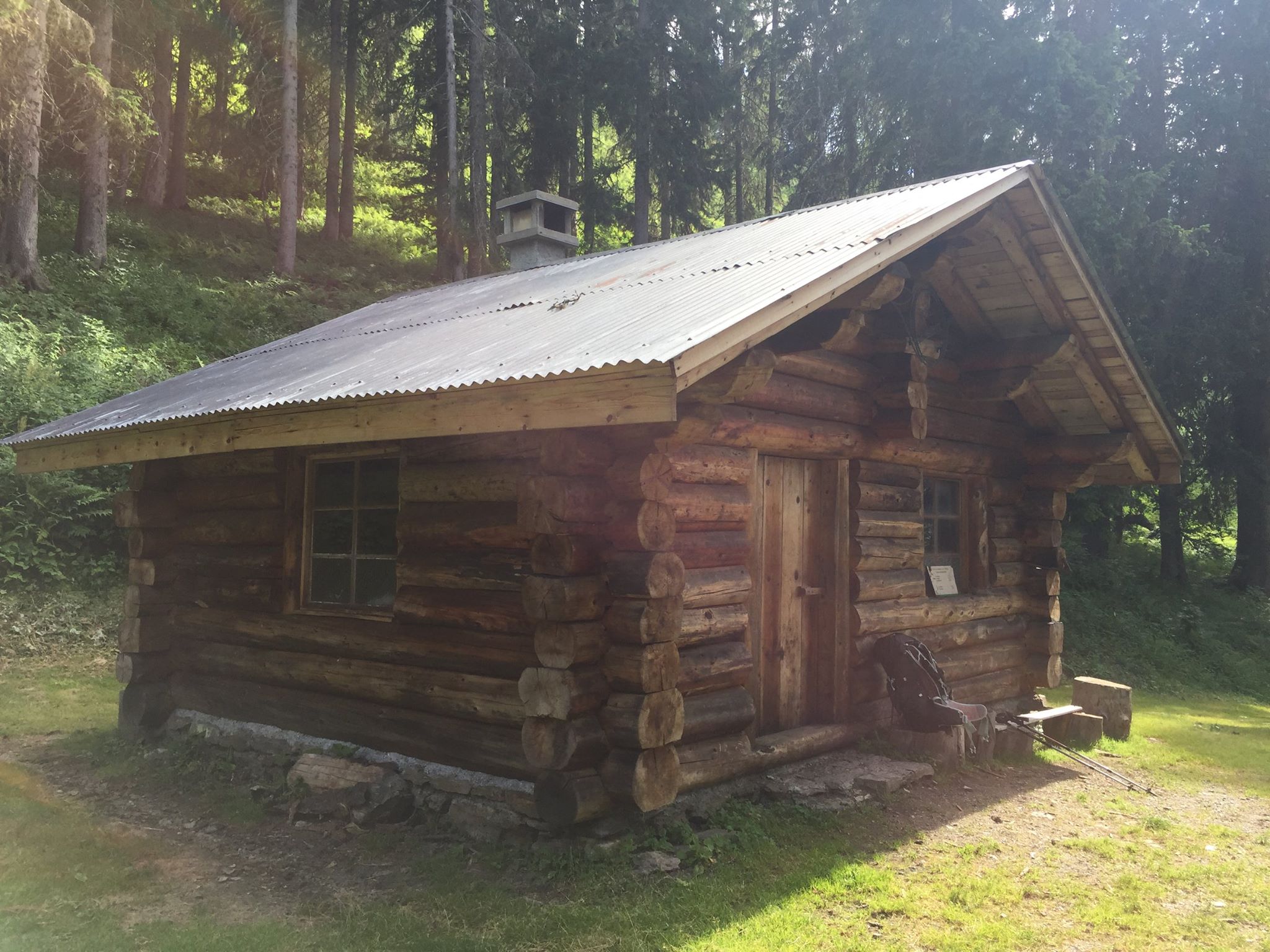
From La Palette, descend slightly along the trail, you’re only 2 hours away from Refuge de Lachat(1,555 m / 5,102 ft.) Contrarily to Varzéron and La Palette, this refuge is manned during the hiking season so you can get a warm meal and a bunk bed in a communal dormitory (55€ per person 6 pers. per room or 65€ per person in a room for 2-4 people). It is best to reserve ahead If you don’t want to eat or sleep there you could just as well stop for a cold beer / soft drink and some snacks.
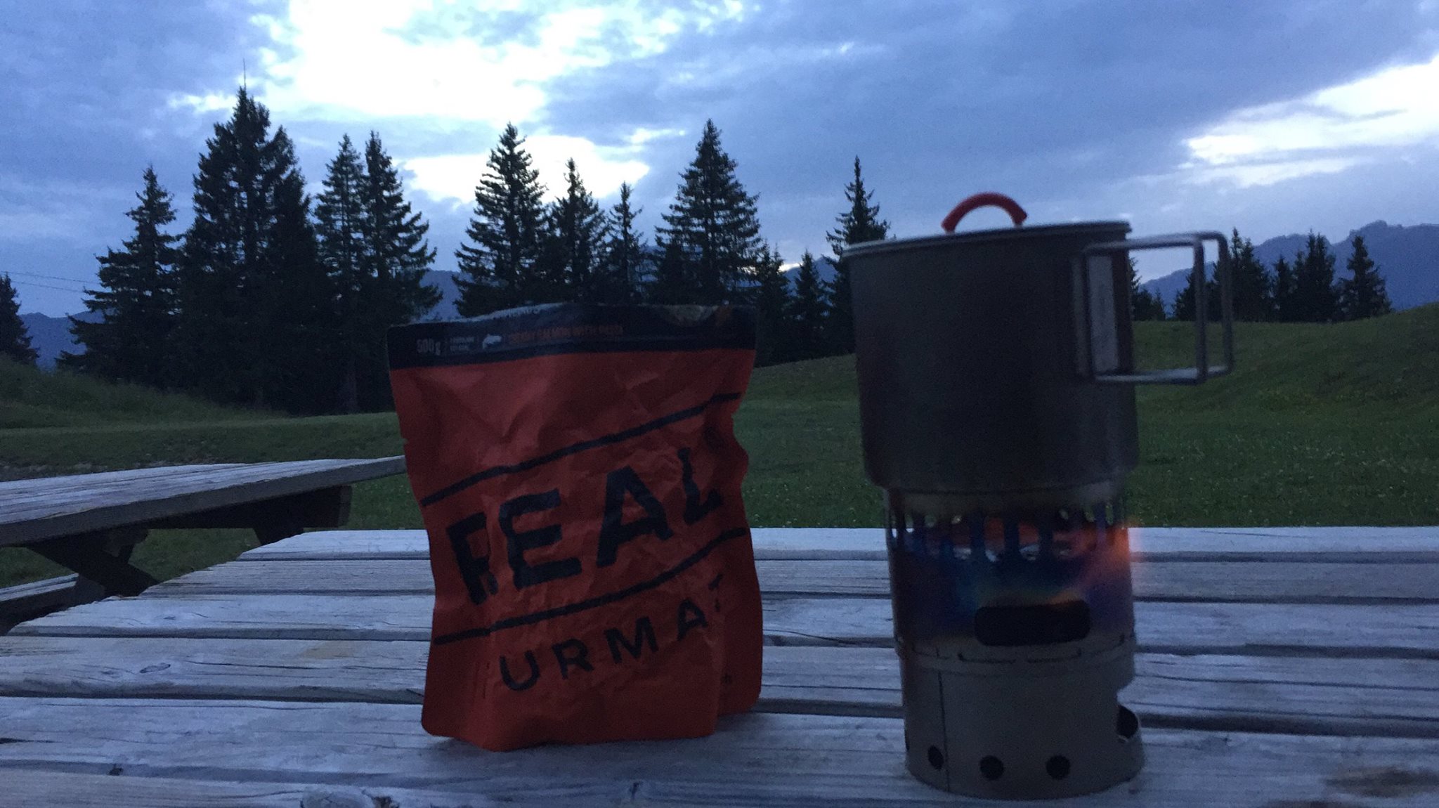
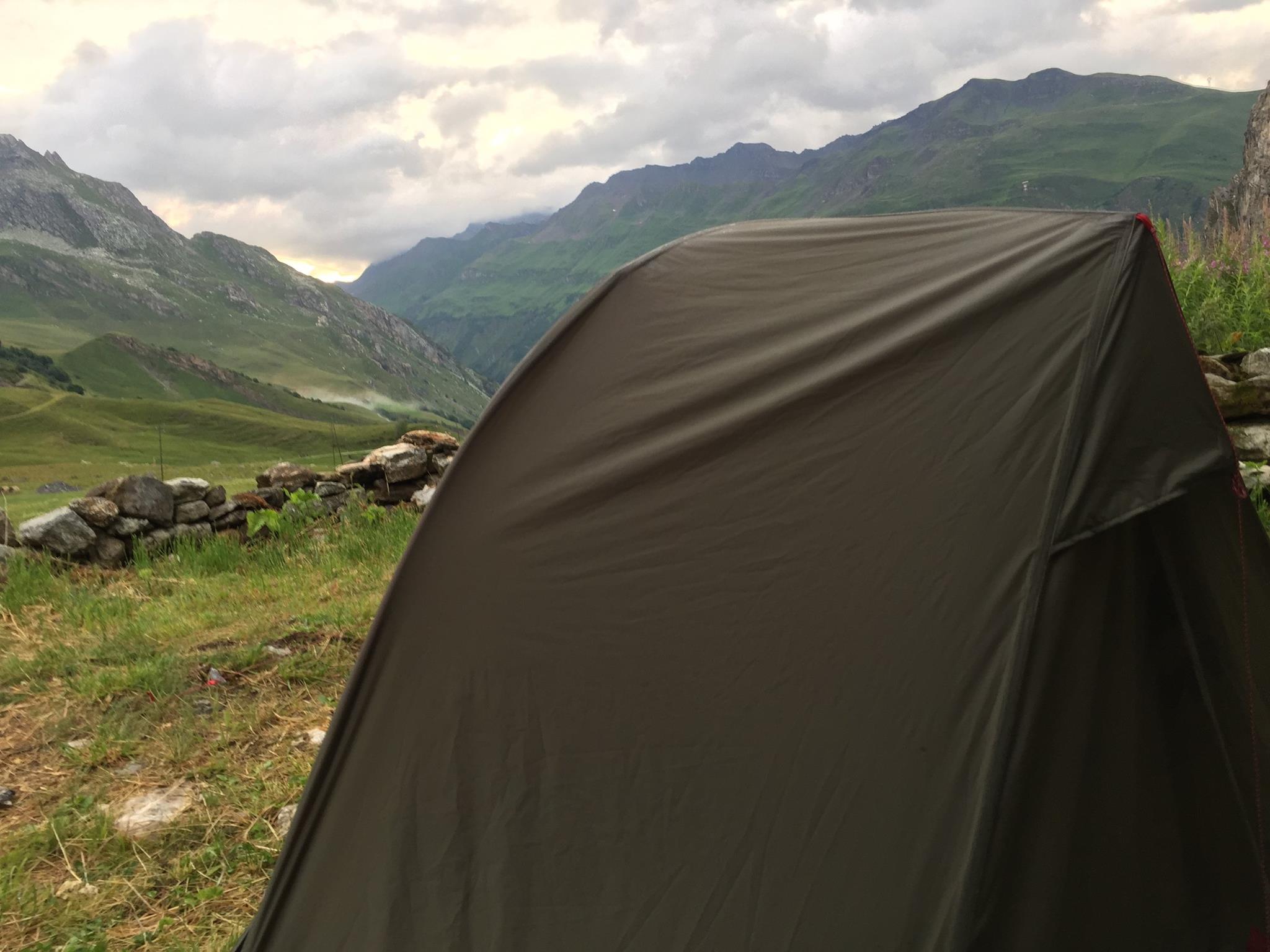
On the day of my arrival the whole refuge was booked for an event so I continued further to a small artificial pond at the heart of a nice picnic area with splendid views over the Mont Blanc just 400m (1/4 mile) ahead. There are loads of picnic benches there and plenty of flat grass to plant your tent (for free). I wasn’t planning to sleep at the refuge anyway so this spot really suited me. It was time too inaugurate my brand new Evernew alcohol stove and I had a nice Real Turmat Creamy Salmon with Pasta (see my gear list below for details) as the light was ebbing at 21:30. (See pic #5)

Day 2 –
From Lachat lake to Refuge de la Roselette
The night was very quiet except for some random owl cries. I slept like a baby and woke up hungrier than I thought I would be. I guess it was thanks to all of that fresh fresh air and yesterday’s climbing effort.
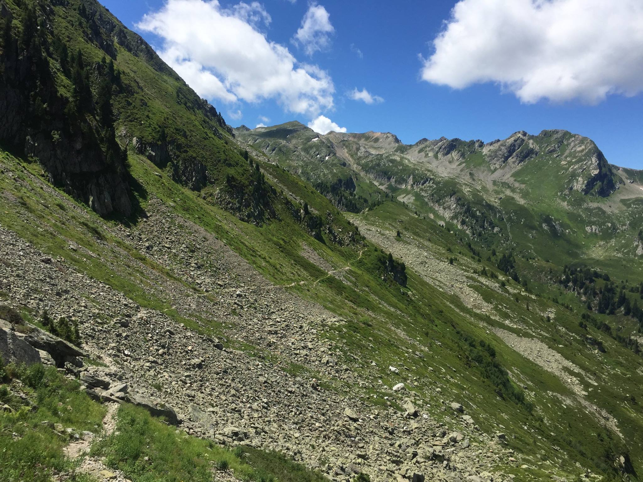
An hour walking south on a very clear trail in an alpine forest setting will get you to a crossing at the D218 B-road. Look for “Chard du Beurre” on the signs. It’ll take you about 1h15 to reach that summit (1,889 m / 6,196 ft) from there it took me 20 minutes to reach Col de la Lézette it was 11:20 AM but the restaurant there “Le Benetton” with its splendid vistas looked too tempting to just ignore so I’ve stopped there for an early sumptuous 3 course lunch! (Pics X – XX) After all, what the heck, I’m on vacation, right?
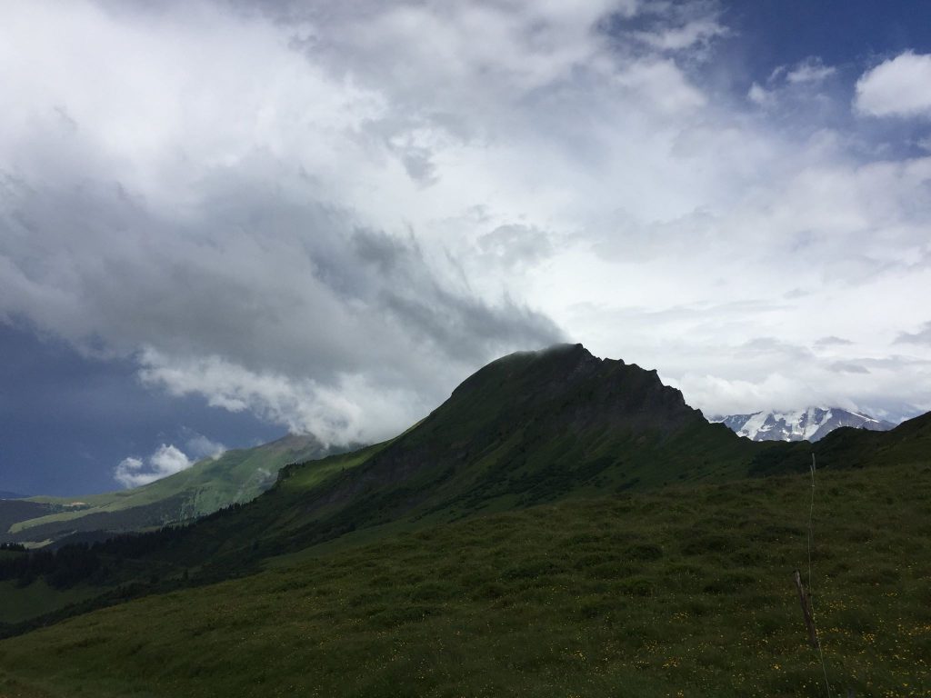
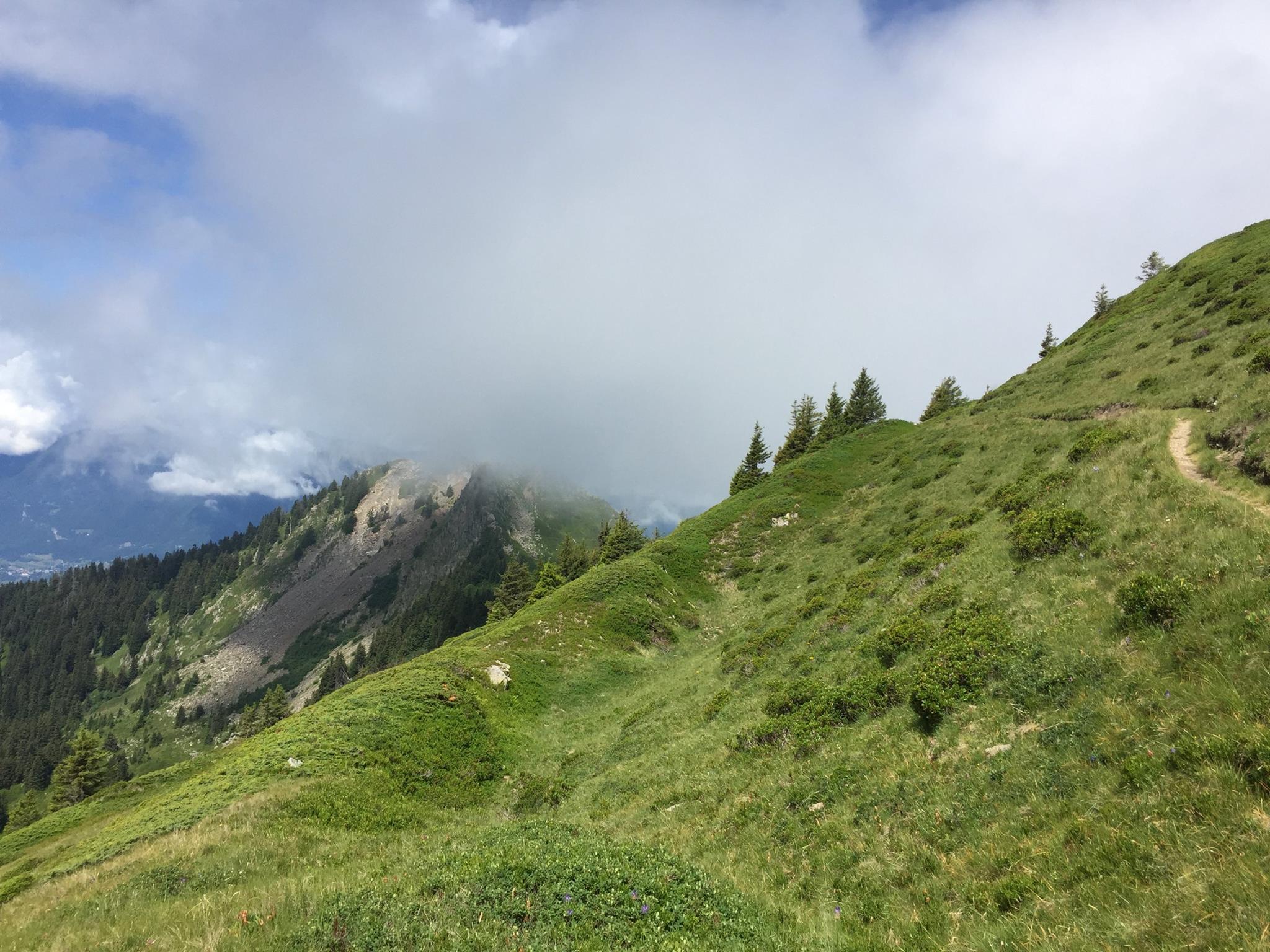
A bit heavy from the meal and the pinte of beer I sipped I headed eastwards and after about an hour I’ve reached Mont Clocher summit (1,976 m / 6,483 ft) Offering some splendid views but the sun was getting more and more obscured by clouds as I was walking towards Col de Véry. By 14h00 you could see the clouds just whooshing by and light rain started. Luckily for me there was a small chalet on the edge of the trail. I quickly put on my rain gear (see gear list below) as the weather changed drastically. A serious storm with thunder and lightning started but it disappeared nearly as fast as it came. 30 minutes later and it was all gone and the air actually became noticeably hotter. In the Alps, most swift storms occur in the afternoon / Evening. It’s a known phenomenon.
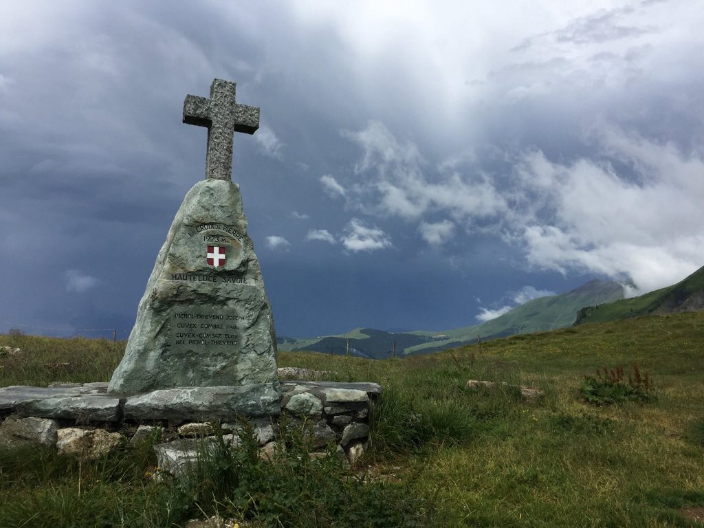
you’ll reach Col de Véry(Alt. 1,973m / 6,473 ft) within 1h10 of walking. There’s another refuge there, called Refuge de la Croix de Pierre – (“Refuge of the stone cross”) And lo and behold there’s actually a stone cross just nearby This is the northern most point of our trek.
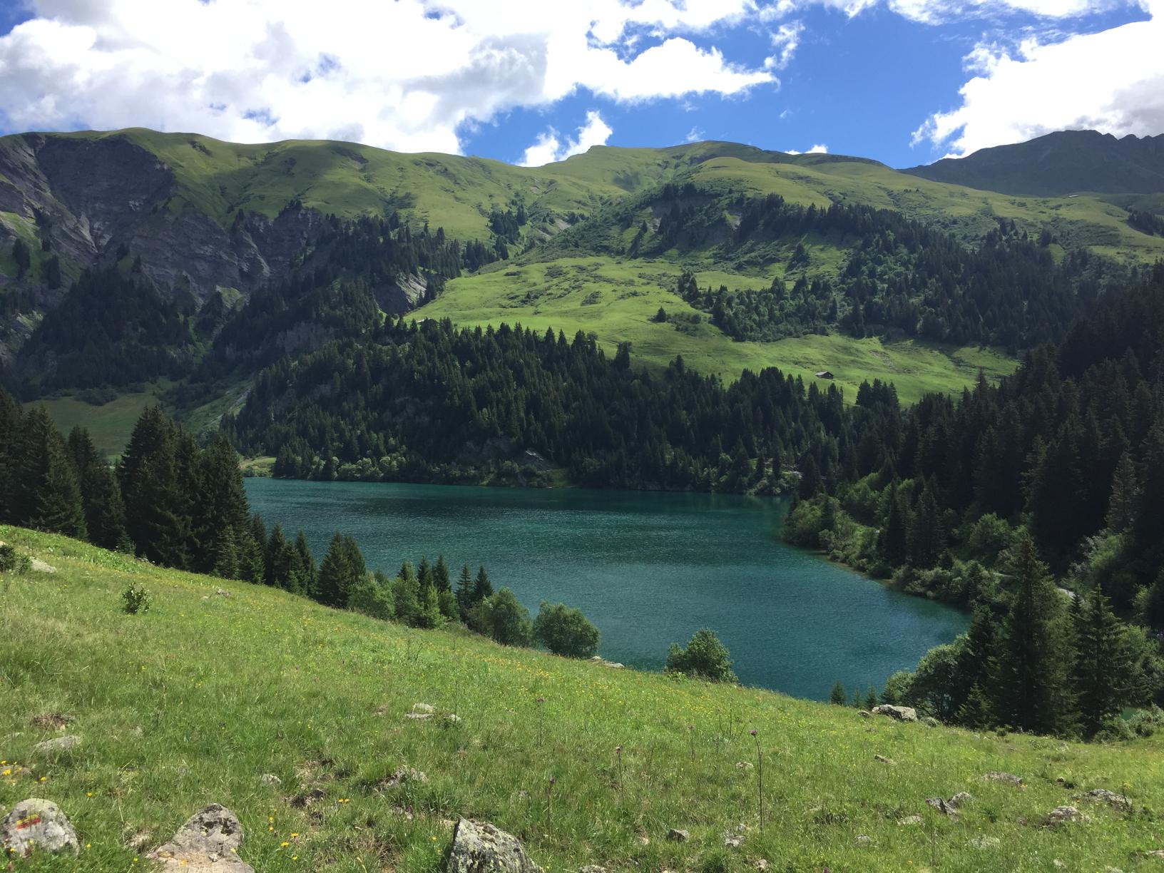
From that cross, continue southward about 2 hours until you’ll reach the Col du Joly (1,989m / 6,525 ft) from there it’s just about 15min till you reach a beautiful little lake offering yet another stunning view of Mont Blanc. This is the Lac de Roselette and just 15min ahead, slightly below – lies the Roselette Inn. It was still fairly early in the afternoon but the place was SO lovely and the family running it so welcoming – that I’ve decided to stay there overnight and pitch my tent in the small grassy yard with a privileged view at the ever-changing cloud scene over the summit of the Mont Blanc.
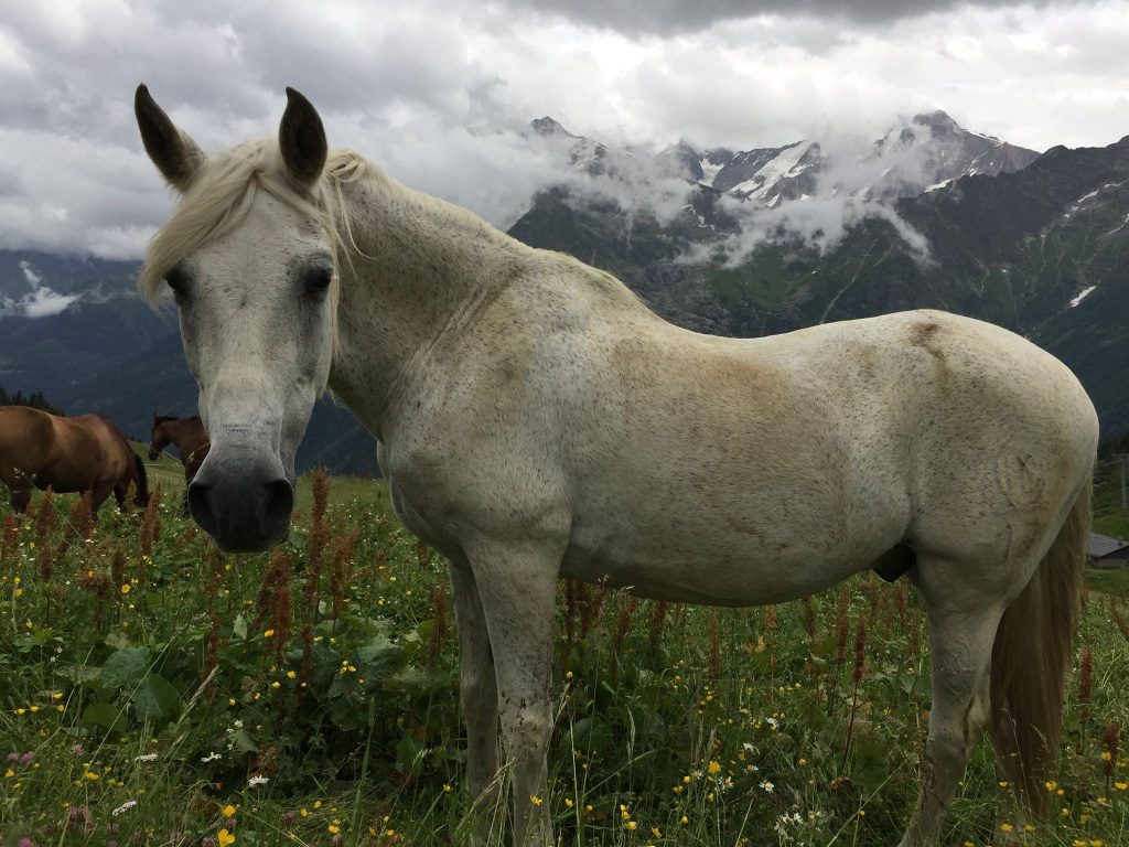
There was a bunch of Horse riders there that did a variant of the Tour du Beaufortain on horseback (and I met them at the next night as well. After a few beers at the inn everyone were singing and telling jokes including the hosts who told a cheeky joke about the difference between the Haute (“High”) Savoie and Savoie (Two alpine regions the Haute Savoie having higher altitude) it goes like this:
– “Why do the people from Savoie have long ears?
– “Because when they are little, their mothers grab them by the top of their ears [demonstrating] and show them the Haute Savoie saying “Look how beautiful it is up there!!”
It’s not THAT funny but we all laughed our tired drunken a**es off.
The inn offers several accommodation options – not only dormitory (sleeps 18) and bivouac (like I did) but also 2 “Roulottes” – which is basically a wooden gipsy-wagon (sleeps 3 and 2) as well as a Tipi (5 places) and a “Glamping” tent (4 places) you can see all options and book here.
I went to sleep after yet another delicious hearty meal. I had for neighbours all 8 horses of the riders. The friendliest of them all was a white horse called “Tokyo”. I Slept like a log.

Day 3 –
From La Roselette to the small chalet at La Fauge
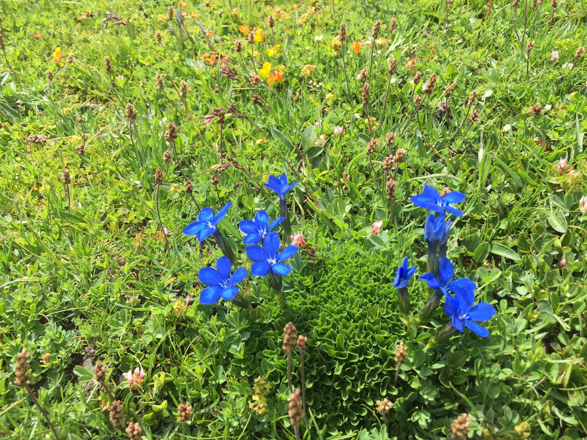
The morning of the third day was quite chilly. I didn’t bother with the continental breakfast served at the Inn. Wearing my mid layer and waterproof I just sat outside having a Café au lait in a Bol (the French way…) gazing at the Mont Blanc. I Said goodbye to everyone and headed south-eastward going somewhat downward in a beautiful path going through a stunning multicolour flour bed for about 1h45 until I’ve reached the Chalet de Balme(Alt. 1,706 m / 5,597 ft.). This is where the Tour du Beaufortain joins for a while with the TMB – The famous Tour du Mont Blanc. The ambiance on the trail changed completely. From being quiet and on my own I was suddenly surrounded by dozens on hikers from all over the world. Most of them though, seemed to be Korean and none of them seemed to speak English, they were moving about in groups.
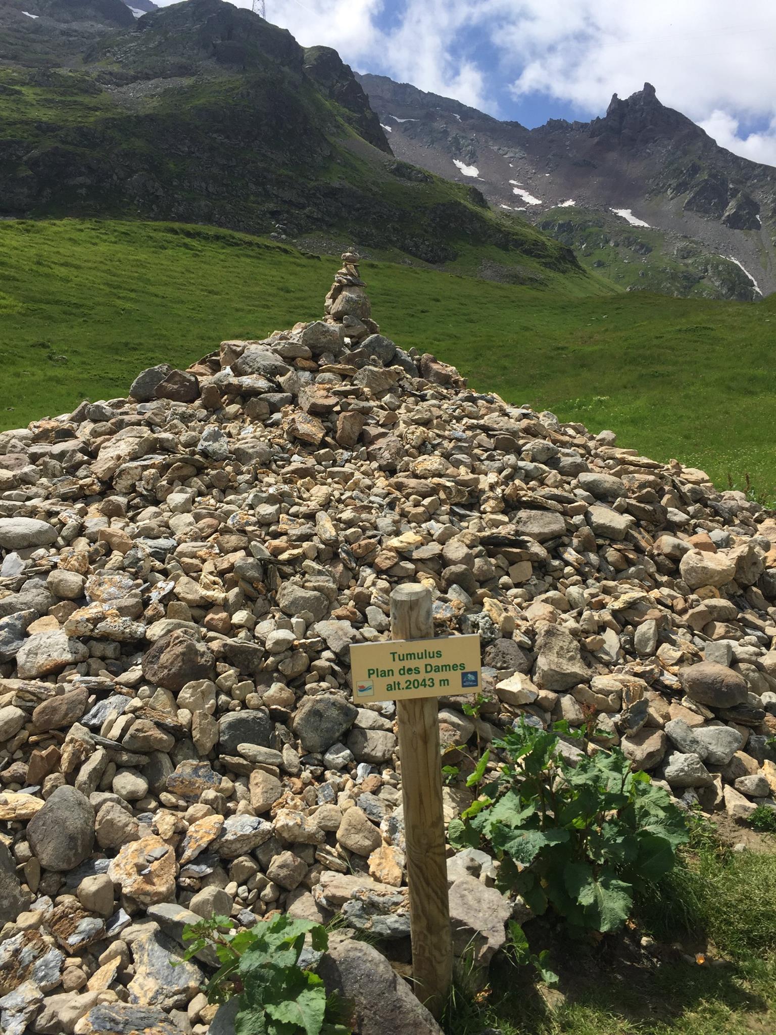
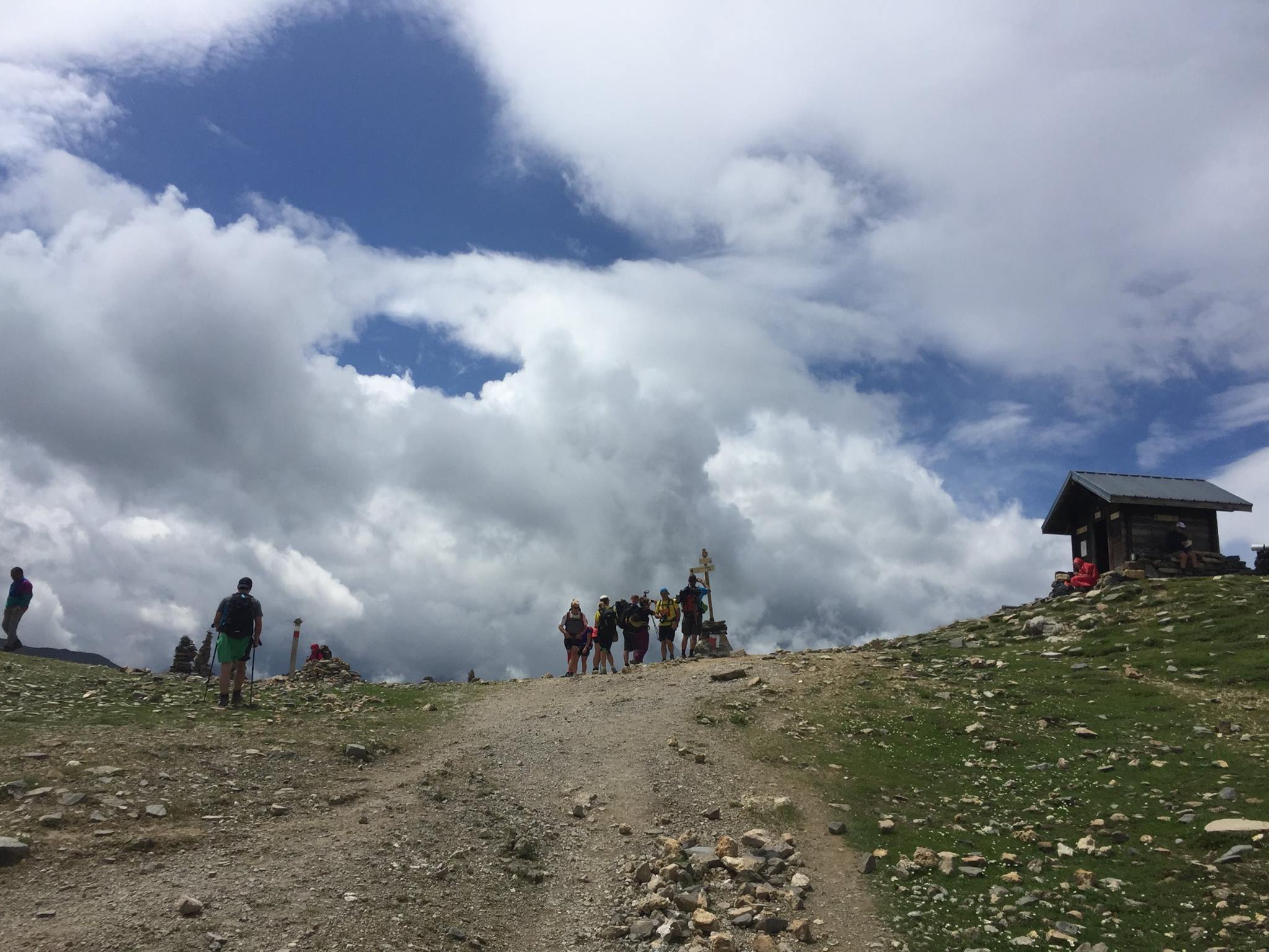
There’s some kind of a huge junction of trails at this point. Other than TMB and our trail there’s the splendid GR5 (I highly recommend this thru hike!) and some variants. Don’t worry though, you won’t get lost there are very clear signs everywhere. You’re headed to the Col du Bonhomme(2,329 m / 7,641 ft) – After about 340m ascent you’ll reach a huge tumulus called “Plan des Dames”. According to a local legend it marks the spot where an English Lady and her servant are buried after they were killed in a horrible storm. It is customary to add a stone to the tumulus in their memory… It should take you no more than 1h40 to reach the Col du Bonhomme – unless of course, you’ll have to “stand in line” waiting for all of the loud overpacked and slow TMBers that are ahead of you. The climb is somewhat steep at parts but all in all not too bad. The Mountain pass itself (“col” in French) – is quite windy and has a mini (unmanned) refuge that smells really bad. On a good day this place offers some really stunning panoramas over the the valleys and mountains surrounding you. Unfortunately there’s no way for you to take a picture without catching someone wearing some flashy coloured jacket in it…
From the busy and windy col, continue upward south-east a bit to the Highest point on the TMB(2,380 m / 7,808 ft) – Tomorrow you’ll go to an even higher point not less stunning but way quieter. From there it’s a pretty straight forward decent towards the Refuge du Col de la Croix du Bonhomme(Alt. 2,433 / 7,982 ft). It should take you the better part of an hour to get there.
The refuge itself also has amazing vistas (hard not to in this area) In front of it there’s an orientation table that’ll help you recognise the summits you see ahead of you.
This refuge is an important landmark of the TMB. It’s quite gigantic (Sleeps 131 persons in its dormitory) It’s very loud, very crowded, has tons of annoying flies for some unclear reason but it’s also a great place to sit at a huge table with a cold pint of beer and engage in conversation with complete strangers if that’s your thing… I didn’t taste the food there but on the way down from it I saw a guy carrying a huge gas can and about 7 egg cartons with 40 eggs each. I guess an omelette was on the menu that day… I was so stunned by him carrying all that stuff I forgot to take a picture. He told me he was staying all summer at the refuge and he goes up and down 2-3 times a day with supplies. He had long blond dreadlocks a huge smile and the thing that was the most stunning about him was that he was bare footed!! He said he just preferred it that way…
From the refuge, head down to a trail junction called “Les Murs” – It’s quite important you don’t just go down the valley (this would seem quite the obvious option) but follow the markings and take a strong left (Eastwards) first to get on the proper trail (you’ll be going towards a the high voltage electric line). If you follow the .gpx file I’ve attached here – you’ll be fine. This is particularly important in the beginning of the season where there might still be some snow in the valley and you might get tempted to follow other trekker’s footsteps. Don’t. Follow only the red and yellow markings and your .gpx.
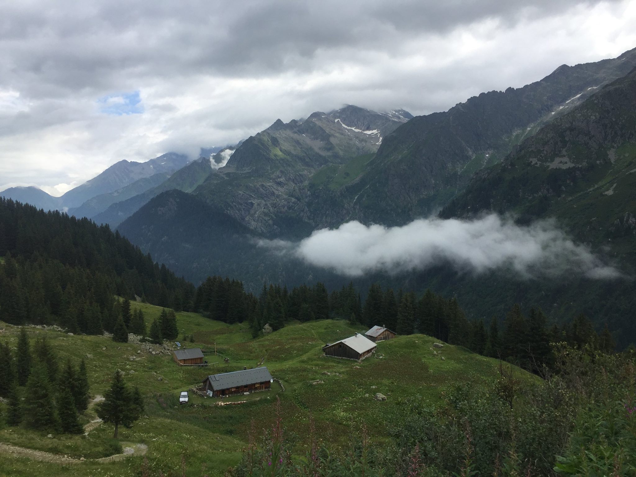
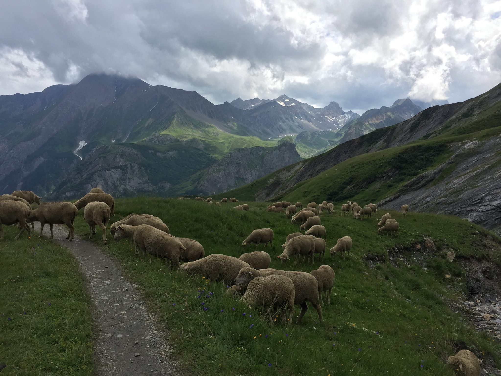
It’ll take you a little less than 2 hours to reach Les Murs(Alt. 1,760 m / 5,774 ft) on the way, right before Les Murs you’ll pass by a place called “Chalets de la Raja” – don’t be fooled by the name, these are (beautifully built) farm buildings and there’s no accommodation there just cows and sheep. Les Murs are just a bunch of semi abandoned farm houses as well. From there you could go (very steeply down for 35 minutes) to yet another awful-ish TMB-crowded place called “Les Chapieux”. It’s not really on our trail so don’t bother unless you want to call it the day at this point and sleep and eat there. It’s basically a huge chalet – restaurant with a small grocery shop and a parking. I ate there once and was quite underwhelmed by the food and annoyed by the huge crowd and noise.
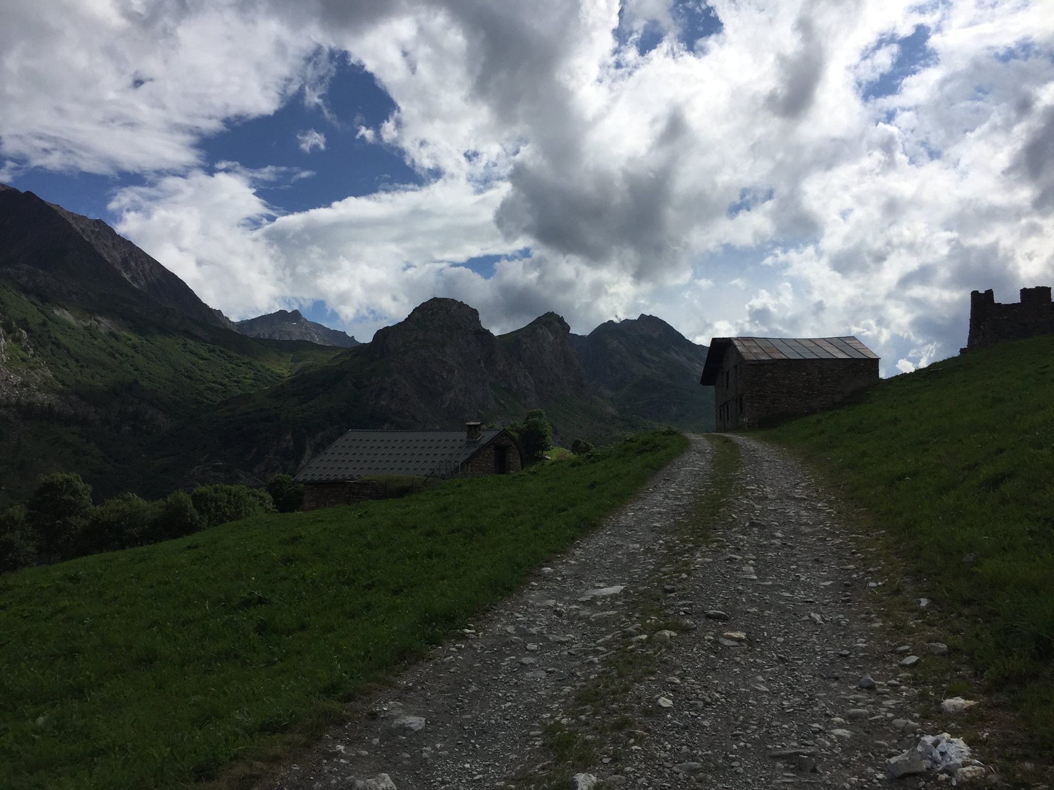
Les Murs is where our romance with the TMB ends (thank god…) just follow the wide path for about 15min until you reach the D902 road. You’ll need to continue on that road (not much traffic but be careful all together, some poor visibility at places) – for about 10 minutes – you’ll see a junction with some chalets down on your left. Theses are called “La Fauge” – get towards them and turn right towards a further small chalet.
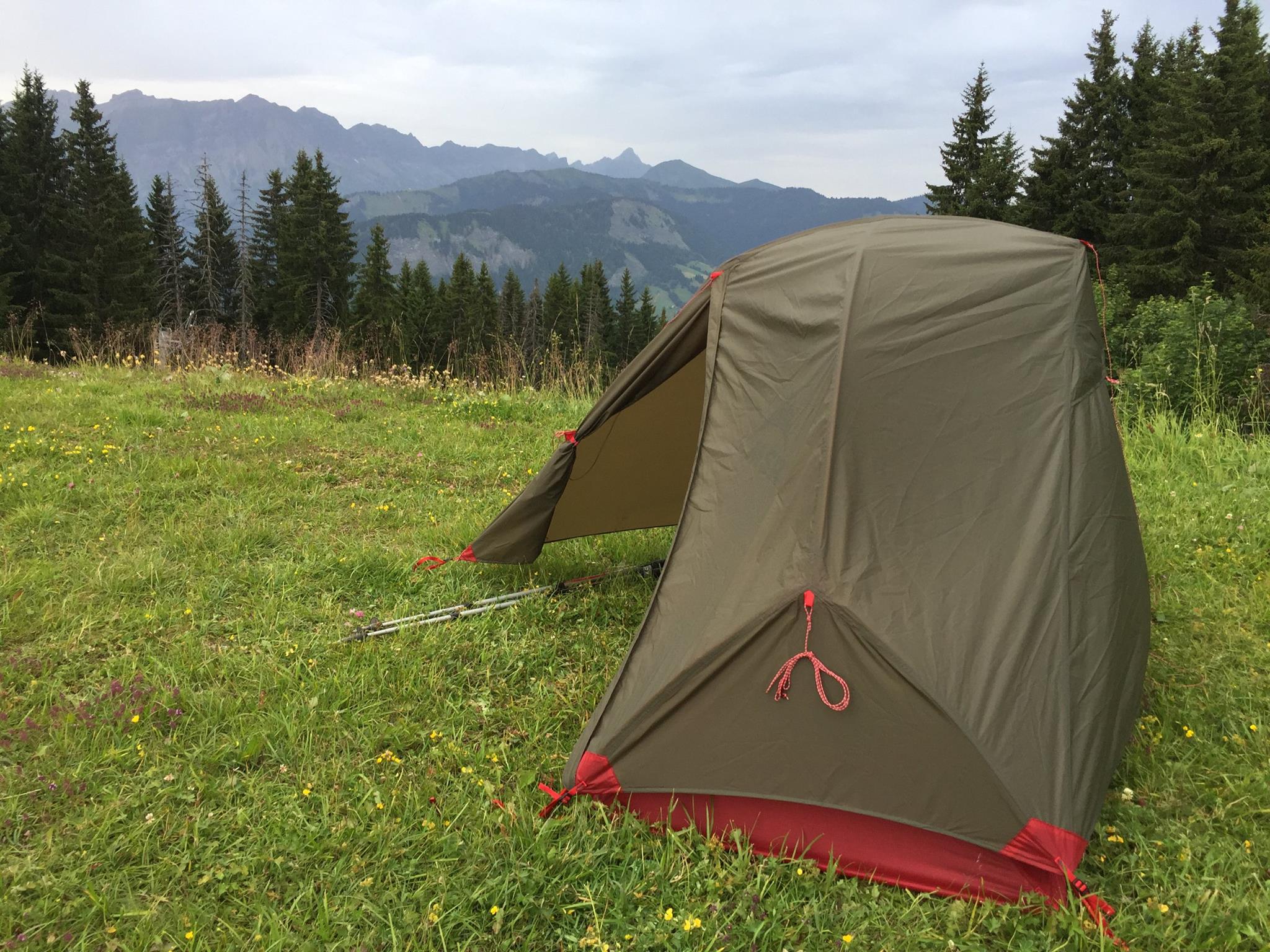
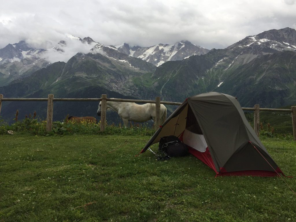
A year earlier I passed through this chalet and it was in ruins but to my surprise, this time it was refurbished and fitted with a new roof. About 20 somewhat starteled Koreans were sitting round 2 picnic tables in it’s small court. One of them dashed inside and a Frenchman popped from what seemed to be a small and dank kitchen. He looked quite surprised to see me there but as soon as he realised I was French as well he was all gleeful and friendly. He said that this place was renovated by the owner and now serves as an extra refuge for tourists doing the TMB. He said none of the Koreans were speaking any French and suggested I’d stay the night (bivouacking; as all the beds in the small dormitory were occupied ) and after he finishes preparing dinner he’ll come over for a chat and a cold beer. It was 18h00 and by the look of the skies it was quite obvious a huge storm was coming. I knew the valley ahead could become quite dangerous in case of a storm so I accepted his suggestion and quickly pitched my Hubba NX tent. (See gear list below) Only a few minutes later the first drops started falling and within 15 minutes it was pouring with rain hail and lightning in fury. Just like the previous storm from yesterday – It came as quickly as it went and the Frenchman appears as promised all smiles and beers. We’ve built a small fire and chatted until it was pitch black. Then we both hit our respective pads.
It is not likely that you could sleep next to that chalet during the hiking season unless you get explicit permission from the owners so your options in this area are as follows:
- Either get down that steep 35 minutes decent I’ve mentioned earlier and sleep at Les Chapieux – I’m not a big fan of this place.
- Either continue further on the side of the D902 without taking the left at the sight of La Fauge chalets – You’ll reach within an hour the Refuge du Plan de la Lai – a very popular stop right on the road that has accommodation and an OK restaurant but is also a bit noisy and crowded.
- If you don’t like that option too much either you can cross the road and get on the path to the “Gite de Plan de Mya” just a few minutes away. It’s much quieter and you can pitch your tent there or sleep in the dormitory. I find that place nicer, cheaper, quieter (and with better food)
- If you have enough daylight ahead of you and the weather isn’t menacing – you could venture past the water station at the valley called “Combe de la Neuva” that’s described on day 4.
- If you know you wouldn’t make it past the water station in the valley already from the Refuge du Croix du Col du Bonhomme (allow 4h30) – you can take the GR5 markings down from the Refuge and straight (2h35) to the Gite de Plan de Mya.
down to Les Murs
Day 4 –
From La Fauge to Refuge de la Coire
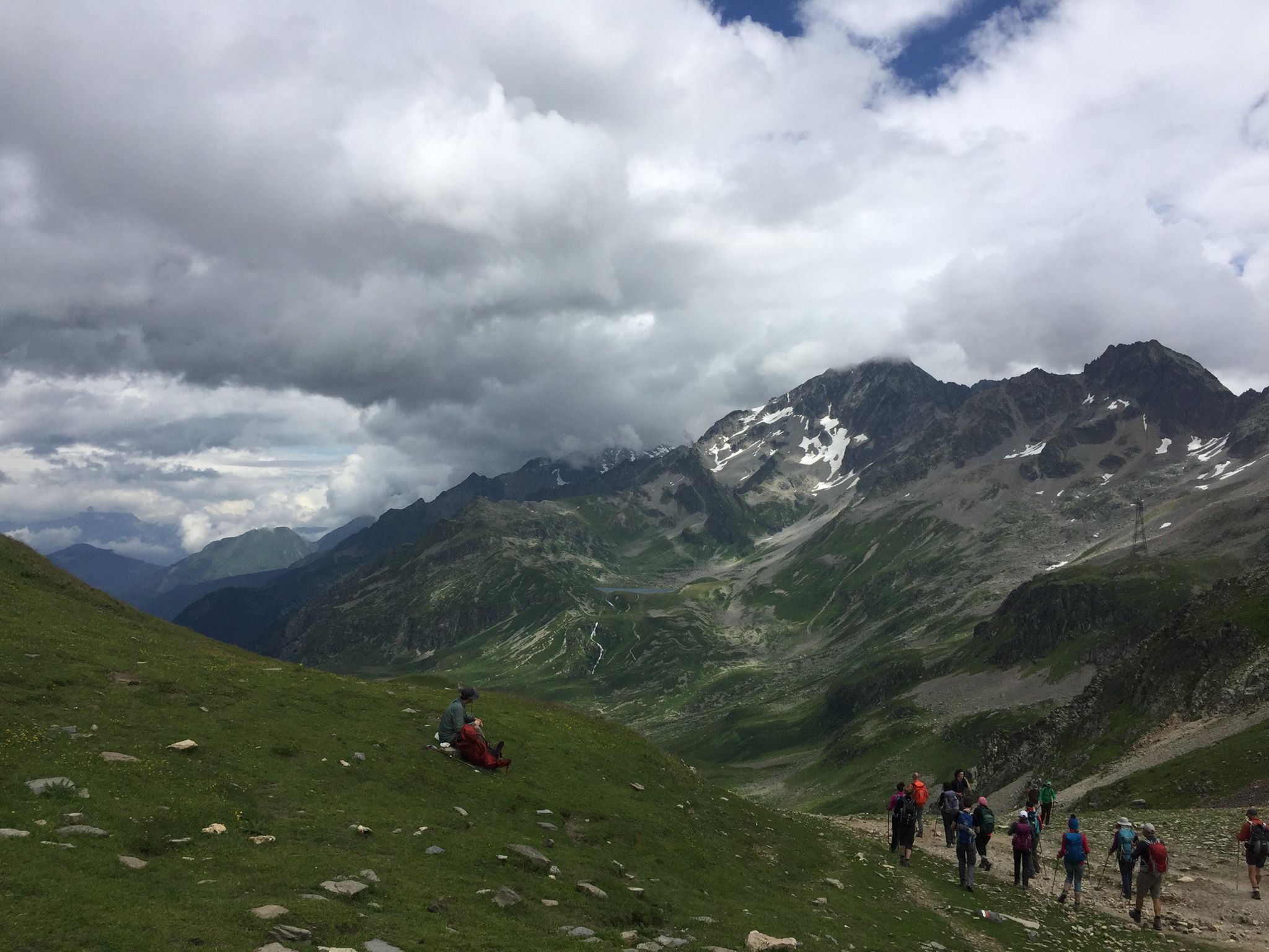
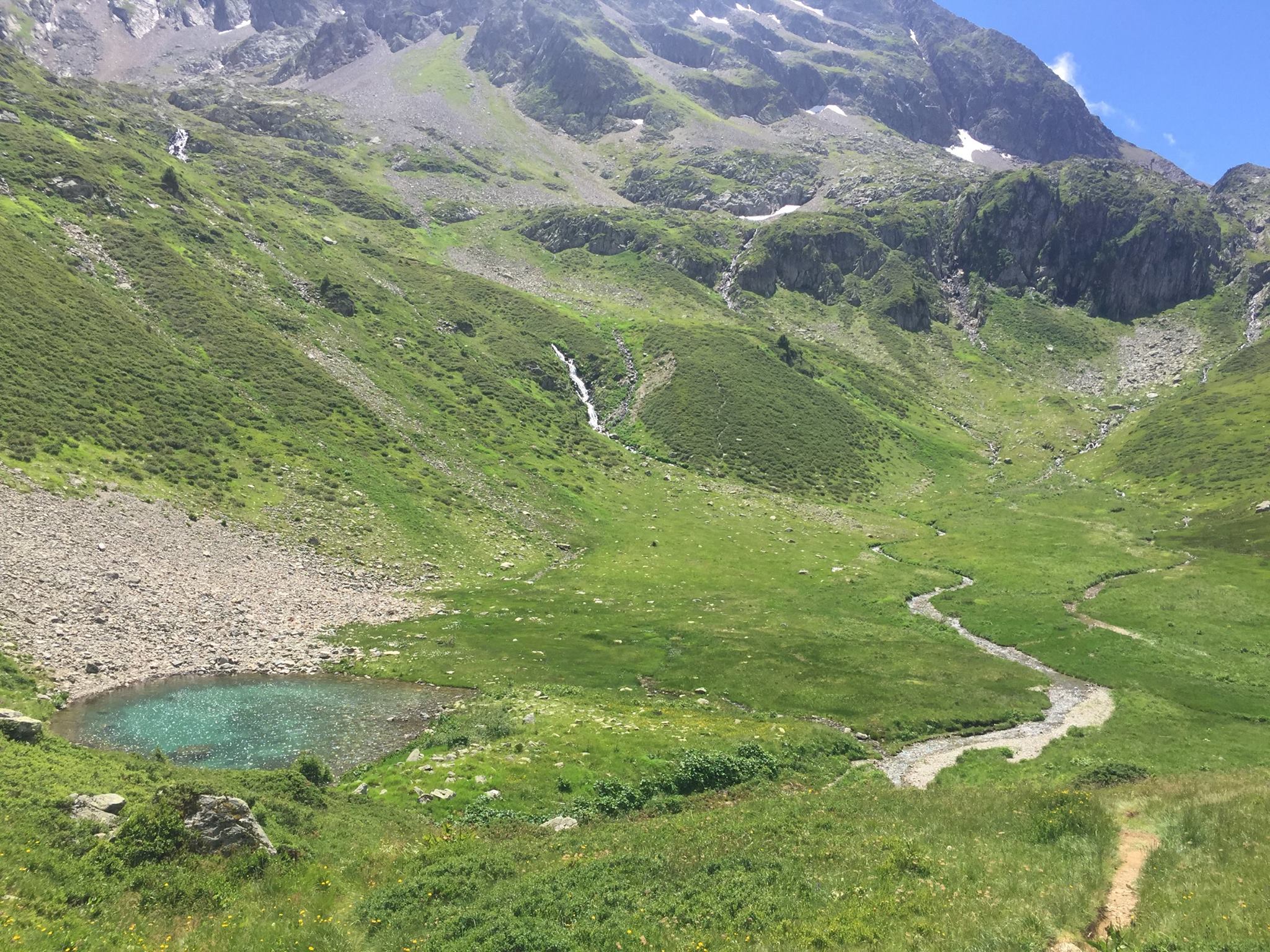
Woke up fairly early as I knew I had a long day ahead of me. I packed up my things and set on my way. It took me no less than 400m of walking to realise I forgot my trekking poles back at the chalet. The Koreans who were still there looked bemused and one of them handed me my poles. I then turned back and entered the Combe de la Neuva valley. I’ve been here before, when I did a short variant of the Tour du Beaufortain. It’s one of my favourite places in the region. It’s a bit difficult to explain why. It’s very calm and peaceful and very few people if any pass there. Most of the time the only thing you would here is your own footsteps echoing from the high mountain walls that are intimately surrounding you. I secretly call this valley “Valley of the Shadow of Death” because of warnings that I’ve heard about it in case of storms from locals. There’s a (somewhat peaceful) stream that runs through it. In case of storm, the river is in spate which means that the valley gets partially flooded. In fact, as I was advancing, I met up with a poor soul in his late 60’s that was sitting nearly completely naked, mid way up the valley. He was completely drenched and all of his gear and tent were spread out around him, slowly drying in weak morning’s sun. I asked him what happened, although I already knew: He got to the Chalet an hour ahead of me and continued into the valley thinking he would find a nice bivouac spot by the stream. He obviously did, but it was inside the river’s bed and obviously he got flooded. He told me he nearly got swept away and had to spend the night completely wet and shivering on a huge boulder nearby. He had to use his emergency blanket…
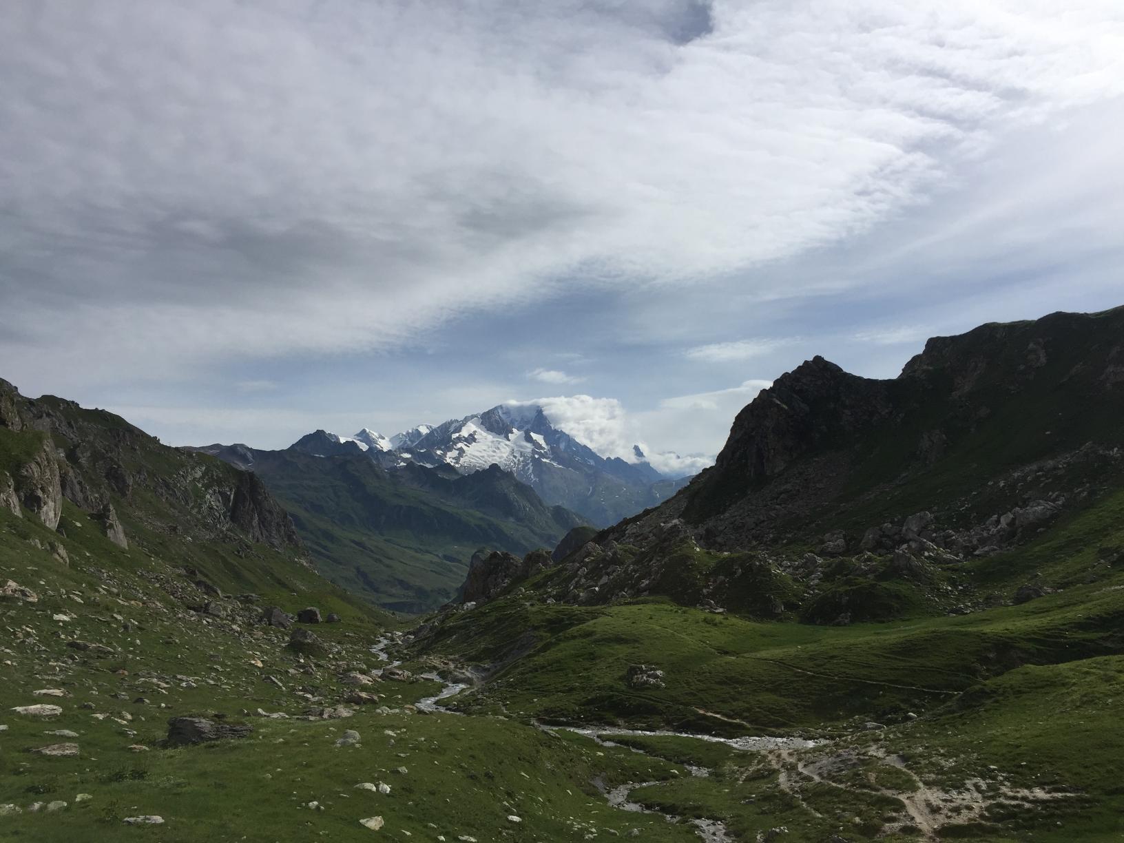
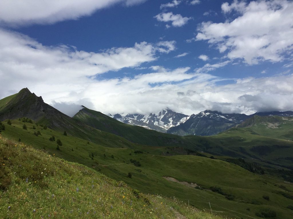
There are several nice and safe bivouac spots after you pass the water collecting facility about 20 minutes walk from the chalet at the valley’s entrance but make sure you’re nowhere near the stream’s bed or you’ll end up like the soaked soul I met on the way. In my opinion it is actually best to go beyond the mountain pass called “Col du Grand Fond”, which is also the highest point on this trek (and offers crazy views all around at 2,671 m / 8,435 ft) All in all, from Les Murs (mentioned yesterday) to the col you should allow 3h30 of walking in a normal pace. The last 500 meters of ascent to the col are somewhat steep and expect to find some snow patches if you’re there before August.
From the col you could clearly spot the Refuge de Presset down below. It’ll only take you 20 minutes to reach one of the most beautiful refuges in the French Alps. I stopped there for a nice brunch of Omelette Savoyarde with Beaufort cheese and a pint of cider. A real treat!
The refuge is not too crowded but very popular because of the top notch facilities it has (real individual beds) it sleeps only 30 in 5 6 bed rooms so you’d better book it in advance. Next to it there’s plenty of place for bivouac just don’t be tempted to plant your tent right on the shore of the small lake as it tends to flood as well when there’s a storm.
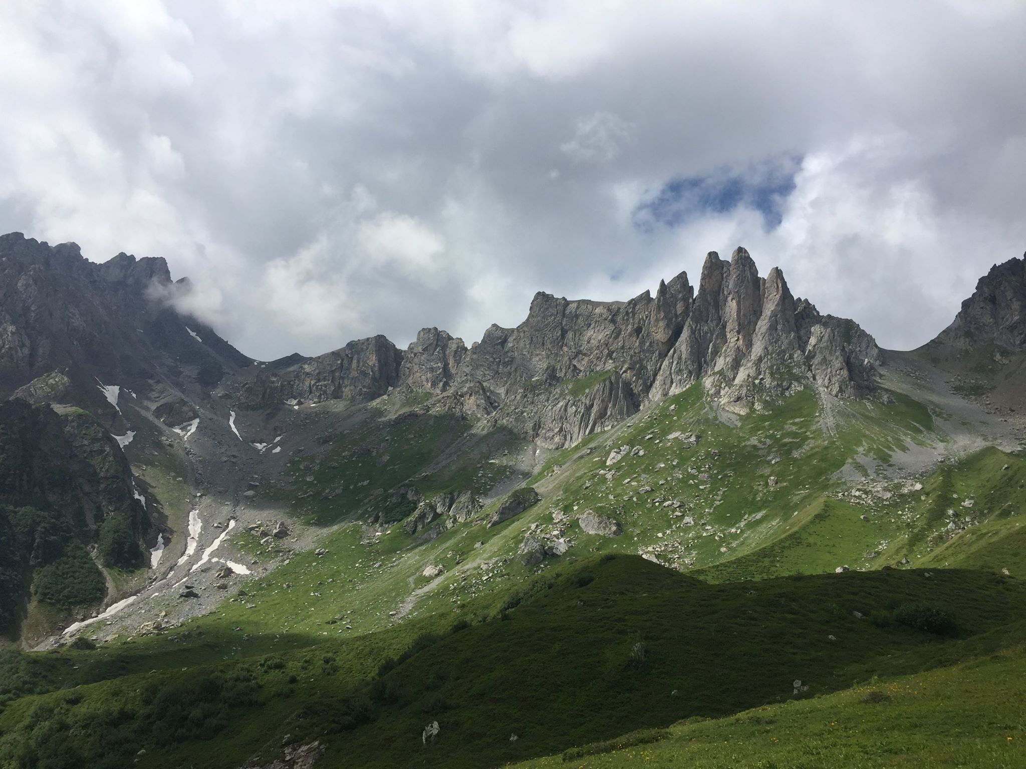
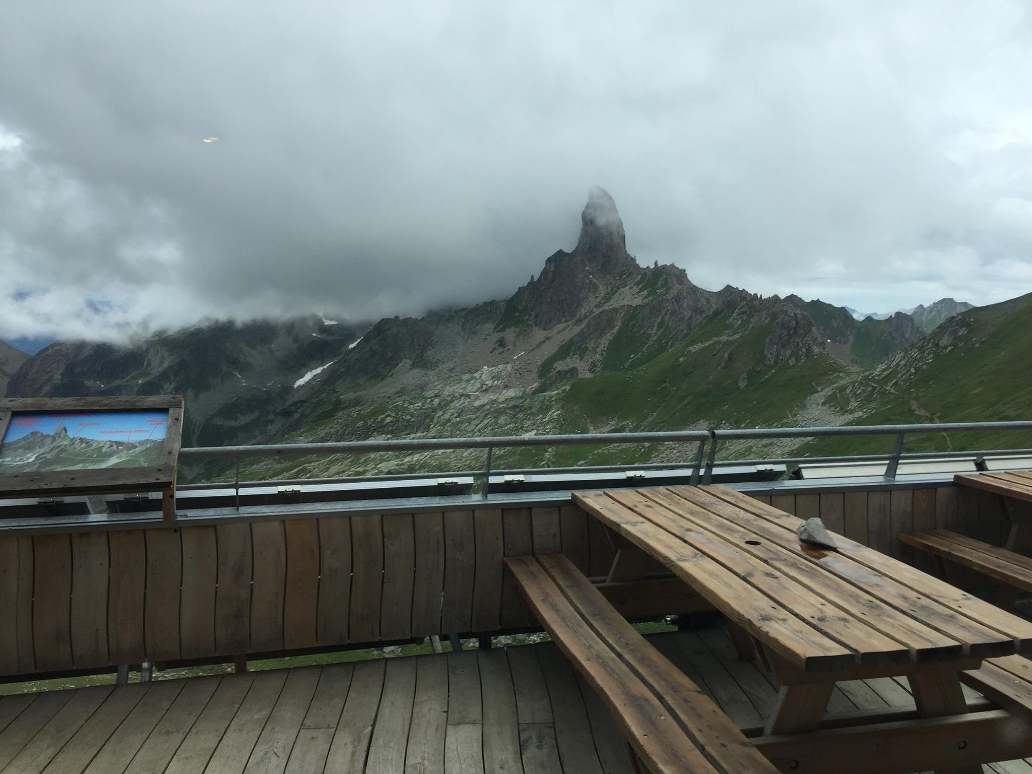
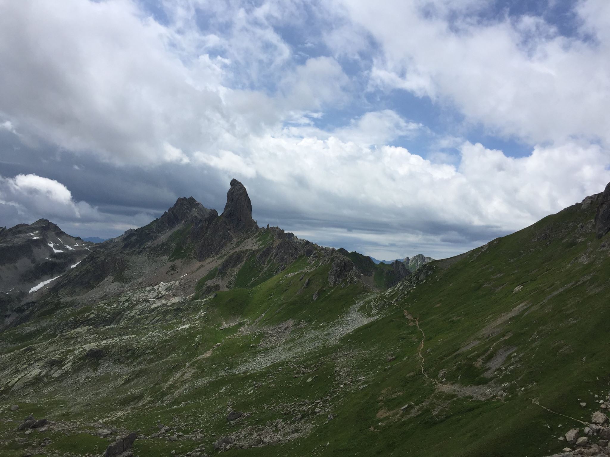
The Pierra Manta, seen from everywhere around the Refuge is a well known rock climbing challenge. It’s right next to the Col du Bresson that you’ll reach within 20 minutes from the refuge. This spot(Alt. 2,469 m / 8,100 ft) is yet another paths crossing where the GR5 meets our trail. Make sure you stay with the red-yellow marking and not straying to a different path.
You’ll probably encounter some sweaty climbers on the way up towards the Pierra Manta while you descend towards the ruins of the old refuge of Presset(Alt. 2,000 m / 6,561 ft) at the Roseland valley. It should take you a bit more than an hour normally.
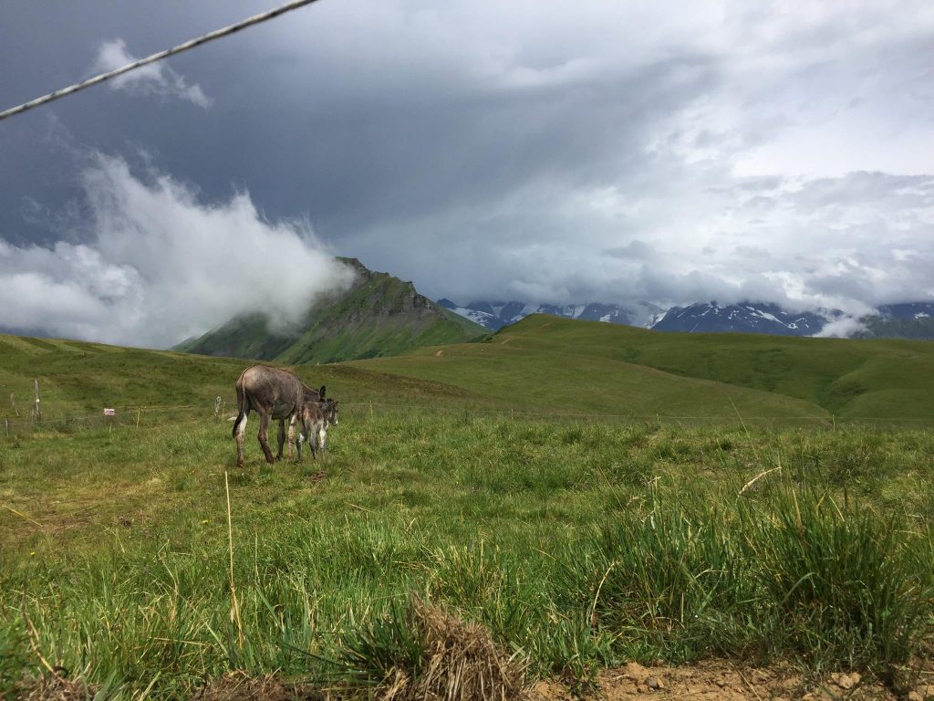
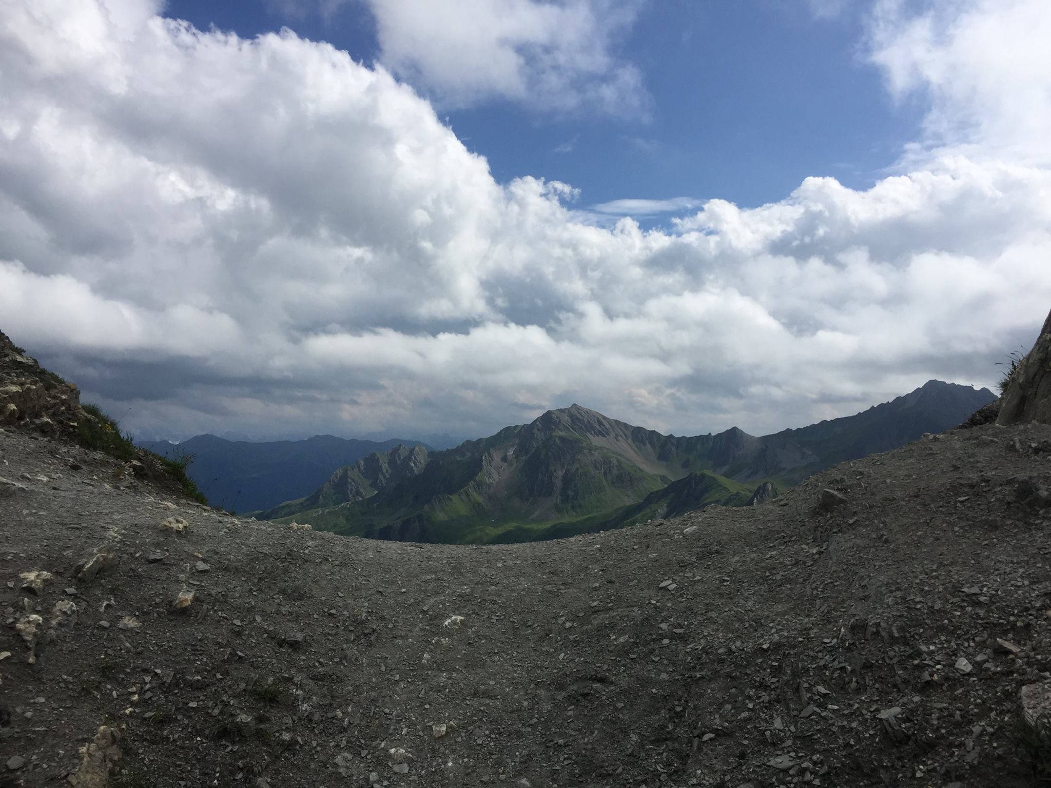
From there you’ll go fairly south towards the Col du Coin it’s a decent ascent to 2,398 m / 7,867 ft that’ll take you about 1h35. If you’re lucky you’ll spot some loud members of the big colony of marmots. The views from the mountain pass, how surprising, are to die for.
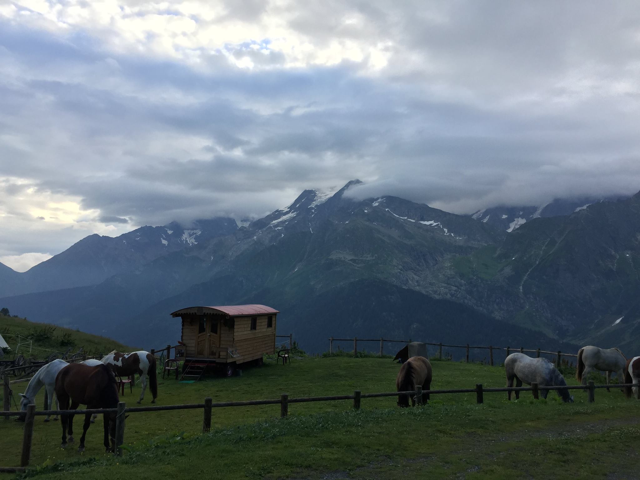
From the col you’ll gradually descend South-Westerly for about an hour till you reach the Refuge de la Coire(Alt. 2,059m / 6,755 ft). The people running it are lovely and welcoming. When I got there, the horse riders from 2 days ago were already there and good old Tokyo was happily grazing in the field next to the refuge. I pitched my tent next to the curious water fountain they have there. Took a piping hot shower and ate a very yummy meal in company of old trail friends. 2 pints and I was ready for bed.

Day 5 –
From Refuge de la Coire to Refuge des Arolles
Yet another fresh morning. This time I’m not staying for breakfast at the refuge. My spirits are high and I’m eager to hit the trail. By now I’ve already got my “trail legs” and even though I’m wearing heavy hiking boots (And this hike was the last time I made that mistake…) – I feel very light and motivated.
It takes only 15 minutes on a wide 4×4 dirt road to climb to Cormet d’Arêches (2,109m / 6,919 ft) And this is the southern most point of the trek! From here you’ll be going steadily North-West all the way back to our starting point Queige.
15 minutes further, after connecting back with the path you’ll be descending to a beautiful little pond at 1,896 m / 6,220 ft called Lac des Fées (“fairy lake”) There’s a bit for road and a parking spot where a German family were having breakfast next to their RV looking very happy (and why wouldn’t day…) There was a sheep herder descending with her flock shouting very loudly the two German kids were hopping gleefully at the sight, running towards them.
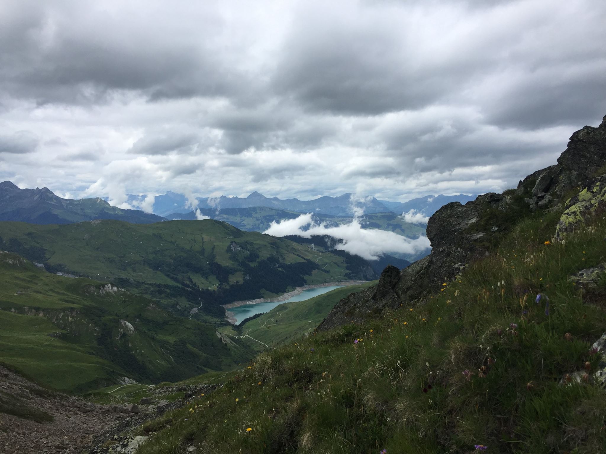
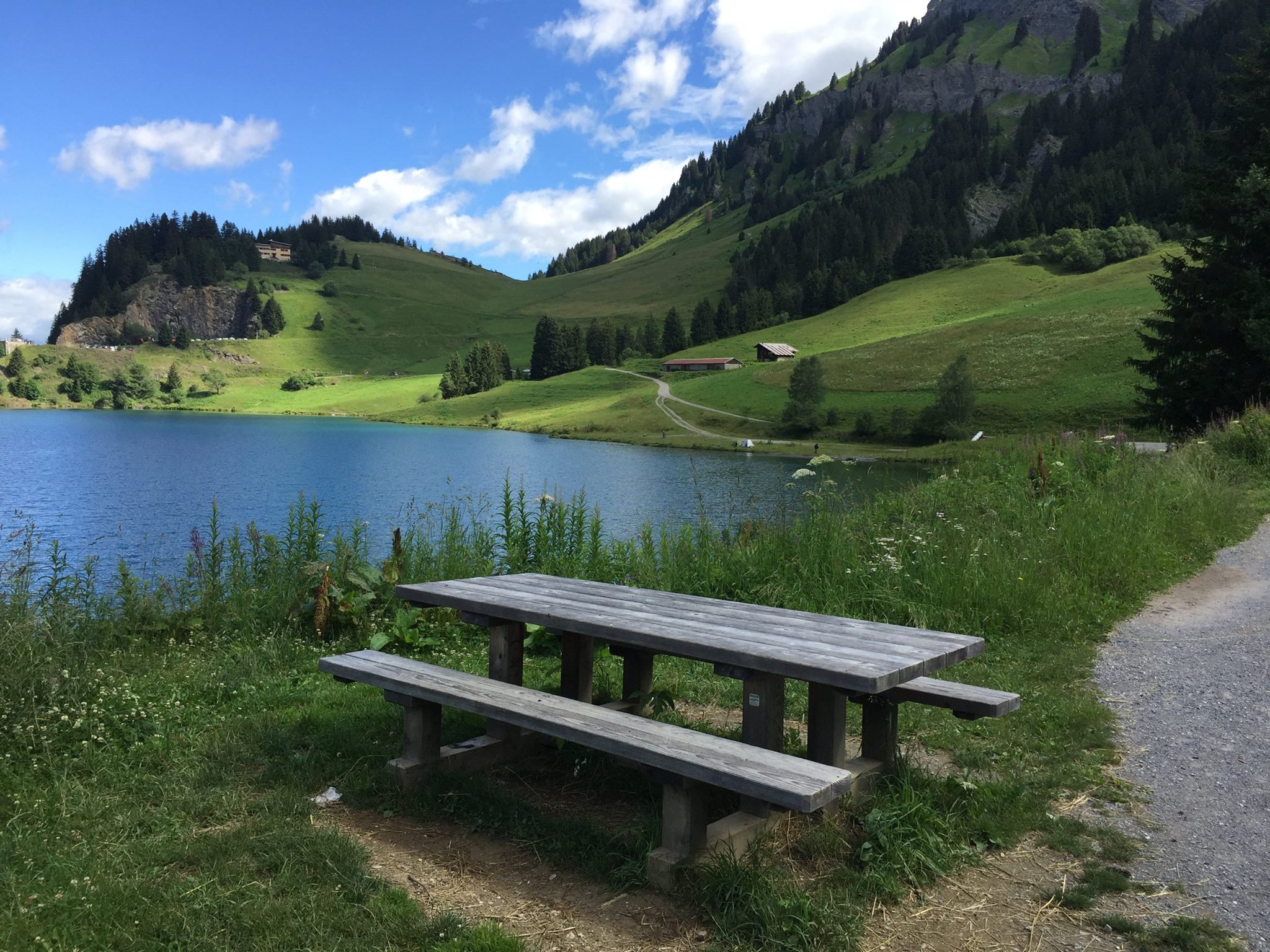
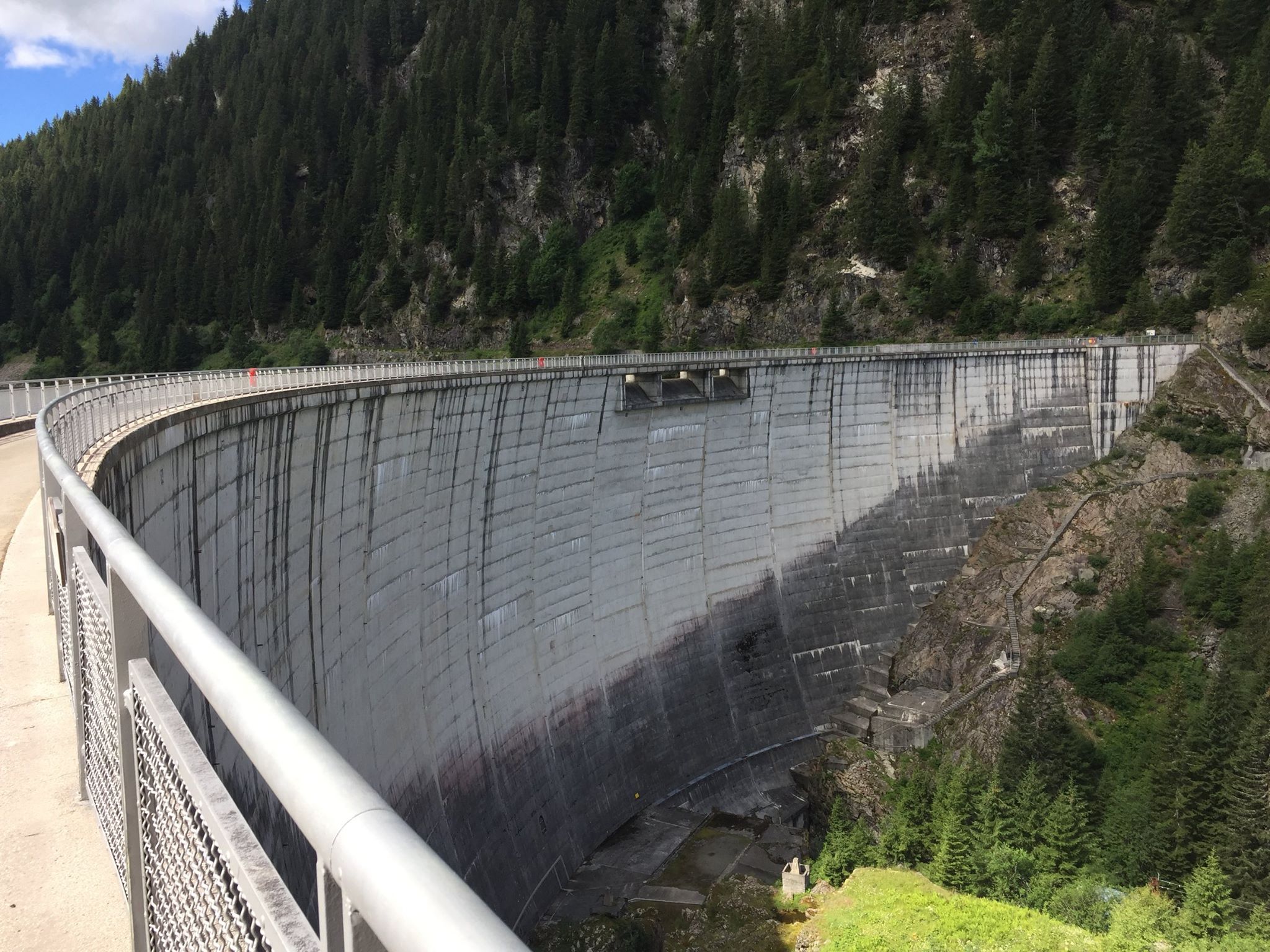
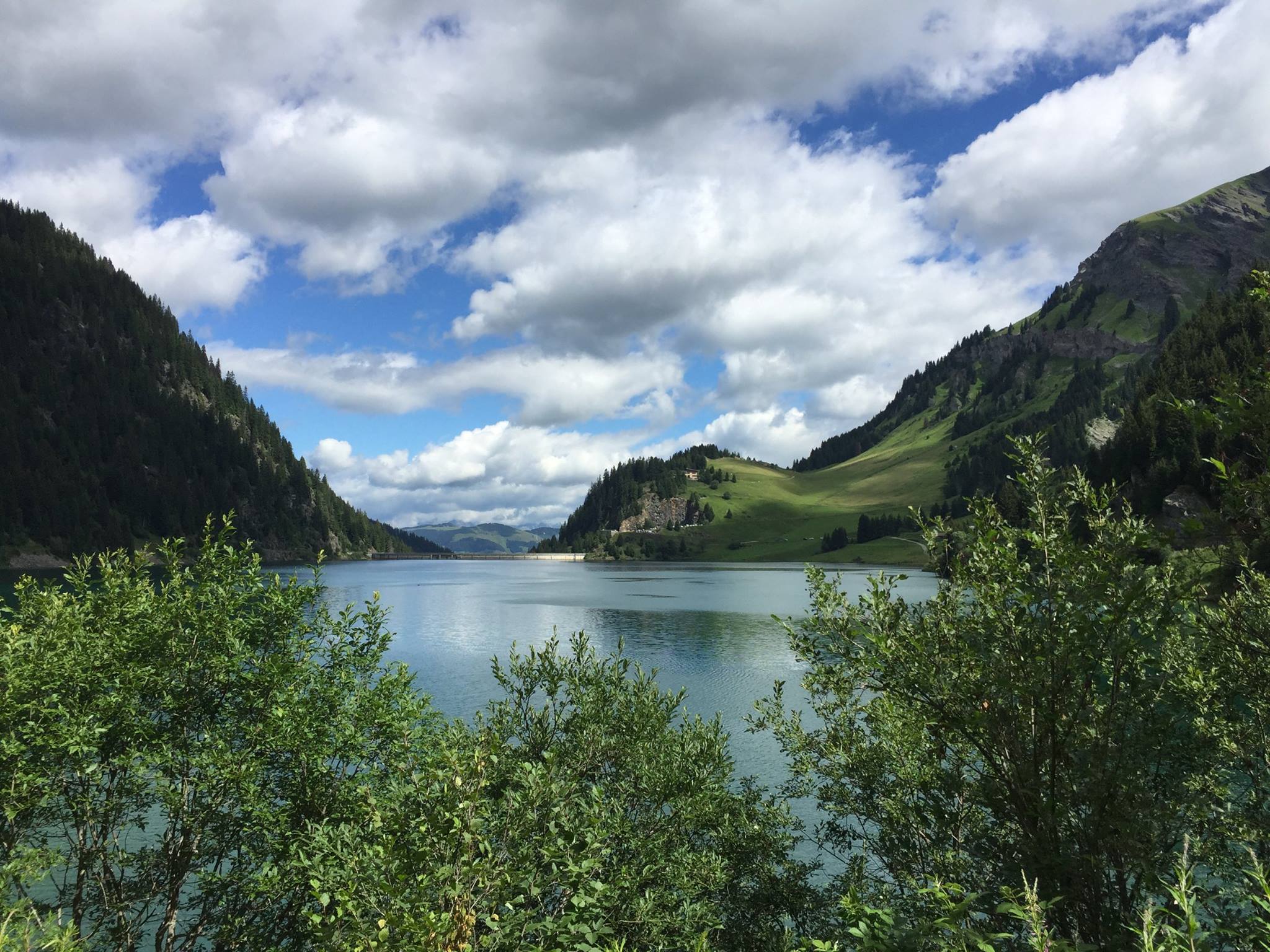
It’ll take you a bit less than an hour on a gentle slope getting on and off the b-road until you’ll reach a much bigger lake: The Saint Guérin lake(1,577m / 5,174 ft) . This seems like a popular outing spot for locals (rightfully so, as the views are stunning and there’s an easy stroll around it and some beautiful picnic areas right at the shores. At the northern end of the lake there’s an impressive dam. I took the time to walk all the way there just out of curiosity being an architect and all. There are panels (in French) along the way that explain how hydroelectric power is produced.
Cross the Himalayan bridge and continue on it’s southern shore till you reach the forest trail. From there it’s a 300m / 984 ft ascent until you reach a good vantage point over the lake. You’ll probably get your camera out on that spot.
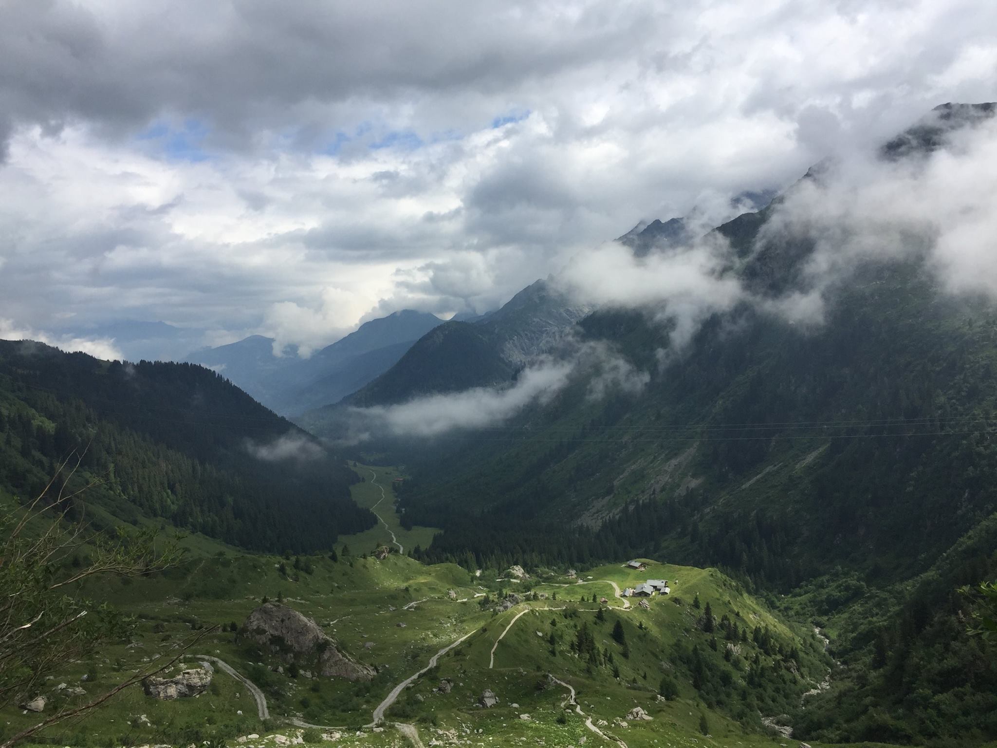
All in all, it takes about 2 hours to walk from the lake to the Refuge de l’Alpage(2,000 m / 6,561 ft) further up. This refuge has burned down in 2016 and has been rebuilt completely in 2017 it offers all the usual things (bivouac, dormitory, bar and meals) including the mandatory stunning views over the endless alpine mountain chain. What it does not offer is cellular reception, but if you climb a far enough on the ridge to its West you’ll get some.
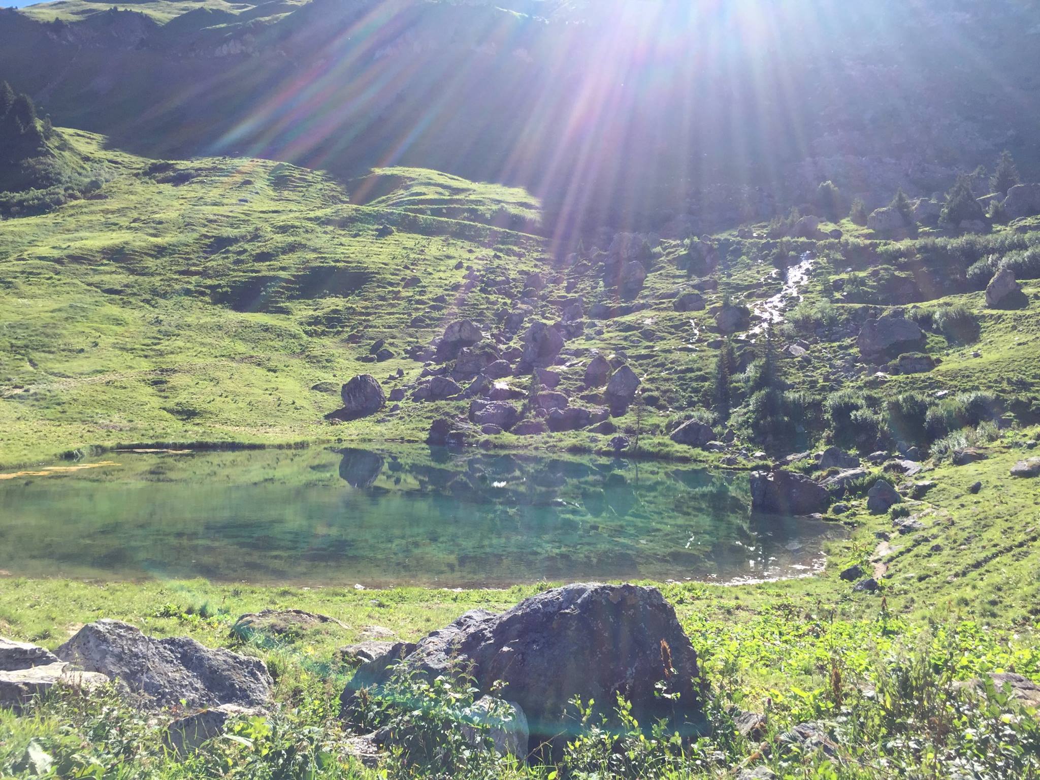
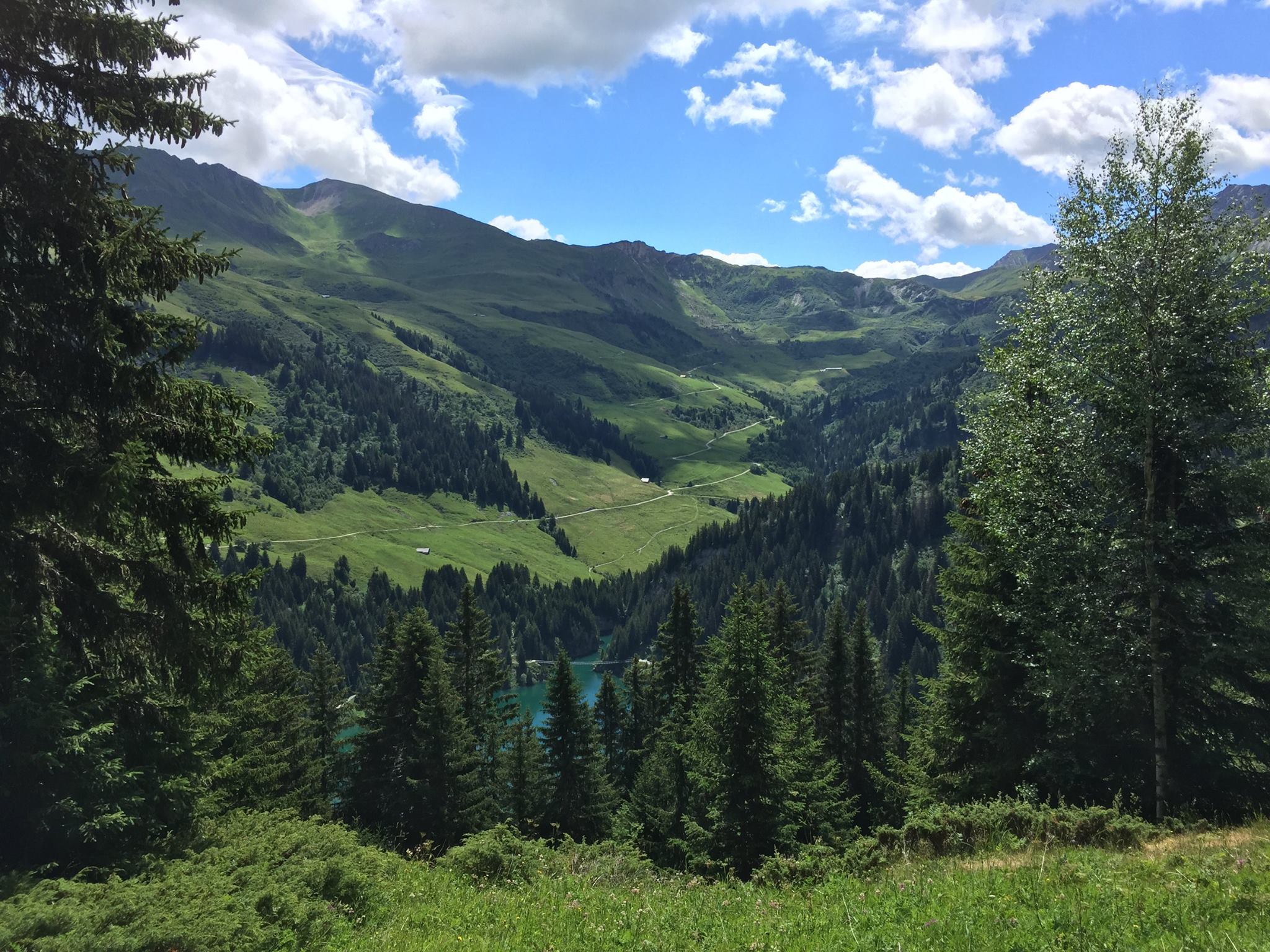
It was still too early in the day so I’ve continued further north, then west then North-West for 2h15 all the way to the Refuge des Arolles. The way to this refuge was quite pleasant. The weather was perfect. The path changed from B-road to a very thin and somewhat exposed track then it reached a beautiful little valley with a small pond called Lac Tournant – I strongly suggest you stop and dip or maybe just have a snack there (Weather permitting) There’s something very calming and peaceful in that little valley. Further on the way to the refuge, the landscape changes quite a lot and looks a bit like the mountains in China you’ll be walking along a beautiful little stream for quite a while. I really enjoyed that part.
I’ve arrived at the Refuge des Arolles(1,900 m / 6,233 ft) fairly early (Around 16h30) I could still go for 2-3 hours but I was tempted by two tall Dutch guys that I’ve met on the way to join them for a drink on the Refuge’s amazing deck overlooking the Grand Combe valley and the Mont Blanc. It wasn’t a single beer I can tell you… I’ve decided then to call it the day. Quite tipsy and very happy I sat down and had a lovely lasagna savoyarde (With Beaufort cheese of course!). I even decided on sleeping in the dormitory (with the few other trekkers that stayed the night) Not at all in my habit.

Les Quefins village
Day 6 –
From Refuge des Arolles back to Queige
However lovely the food the previous day was, I did not enjoy my sleep in the dormitory. I dislike dormitories very much. They always feel a bit like a concentration camp dormitories to me. I don’t like the idea of getting cramped next to total strangers, some of which have interesting hygiene habits if they have said habits at all. The place was over heated and as soon as the lights were off some people started snoring and some other people started complaining about the snoring then pretty much everyone started farting their lasagna savoyarde onto their liners. At this point I started seriously considering getting out and pitching my tent angrily but then I heard the rain and it finally soothed me into sleeping.
In the morning I had breakfast on the deck pretty much on sunrise. It was some awesome breakfast with the sun slowly piercing through a thick canopy of morning clouds with last night’s smell of rain still in the air. Majestic.
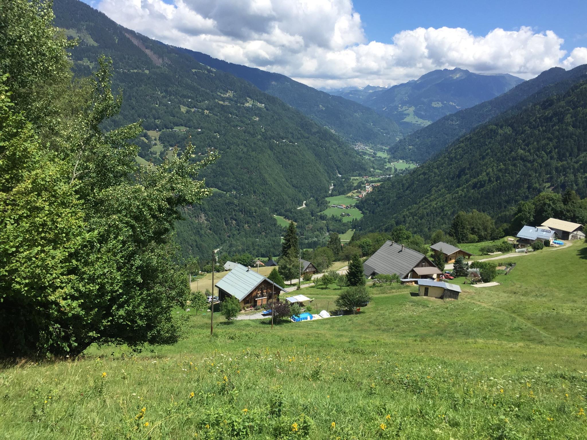
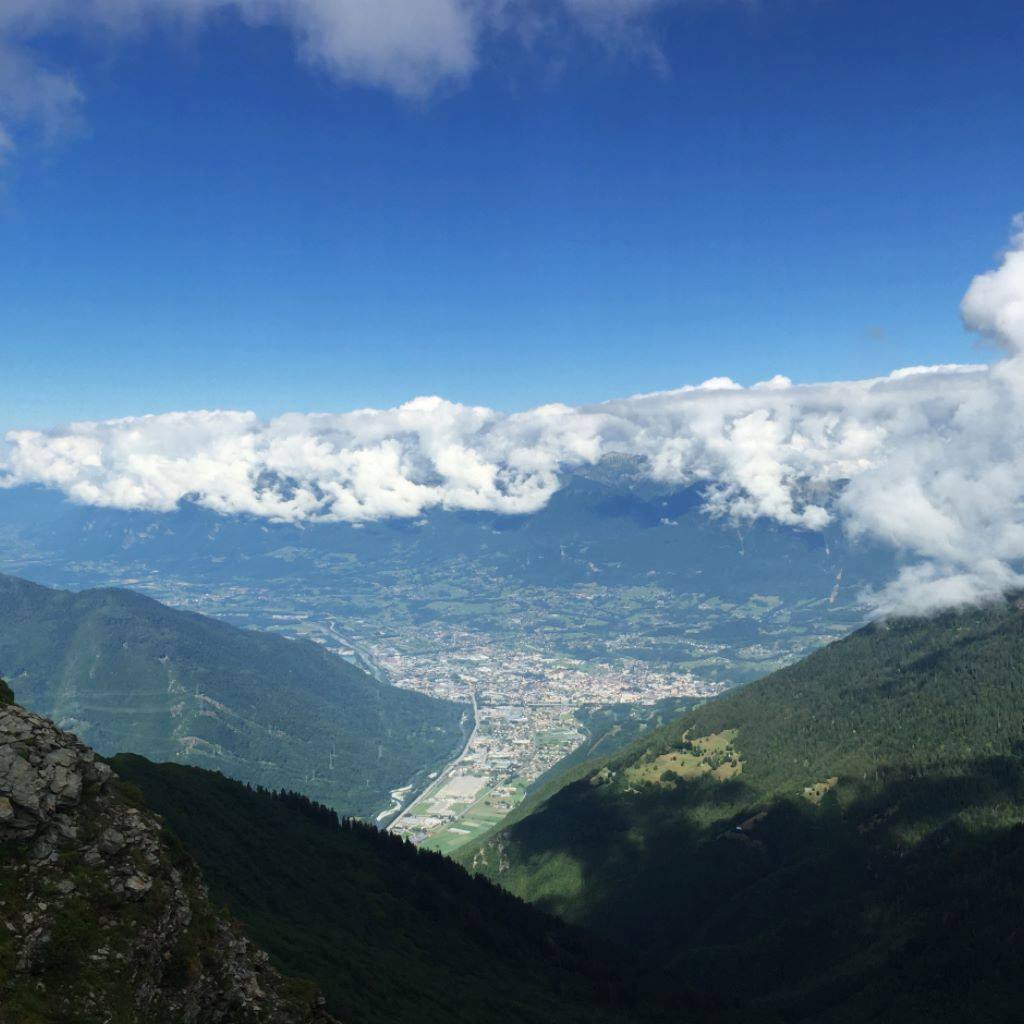
From the refuge it’ll take you about 2 hours to reach the Col des Lacs Mountain pass(2,250m / 7,382 ft) This was your very last ascend on the trek. From now on it’s going steadily down all the way to Queige(590m / 1936 ft.) This place has a breathtaking view of Albertville and it’s valley. As you go further down the town will peep at you time and again.
After this mountain pass be careful if you’re doing this trek in the beginning of the season as the first descent is a bit steep and there might be some snow patches. Then the path gets less steep and just swarms about trough tight low vegetation. The mountains in here again have this slightly “Chinese” look to them.
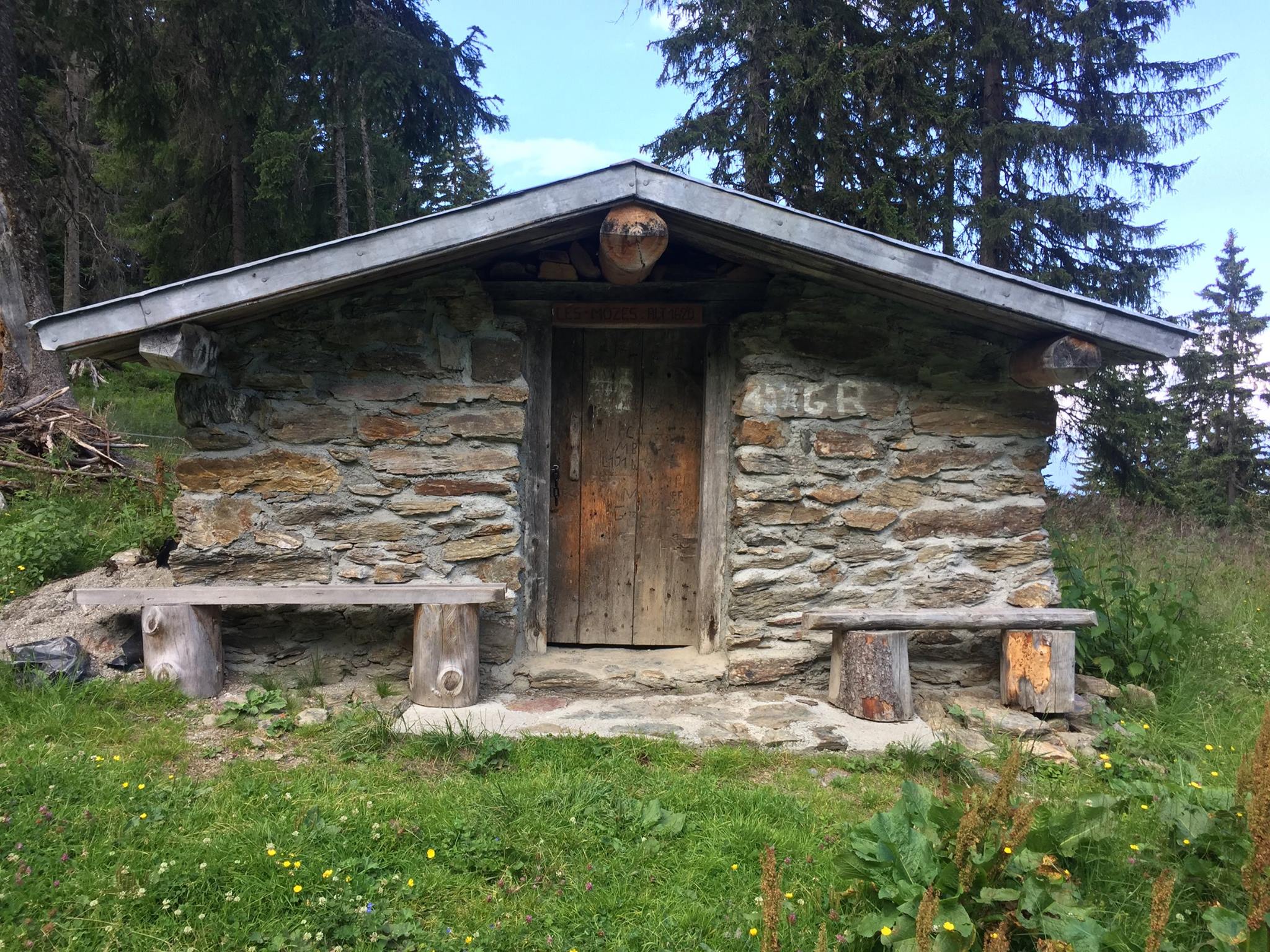
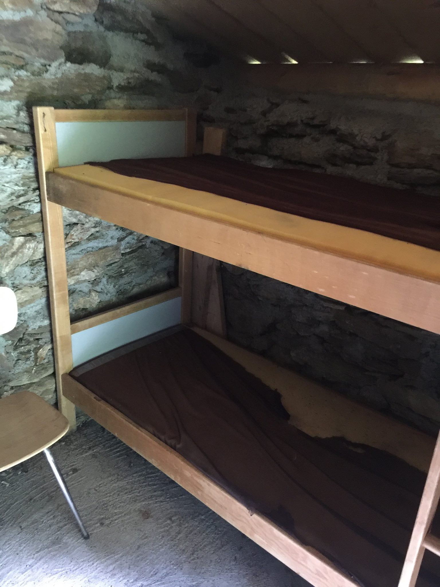
You’ll reach La Roche Pourrie (“the rotten boulder”) mountain pass (2,050 m / 6,726 ft) within 1h20 and then again there’s a steep descent for about 200m / 656ft and from then on the slope is quite constant. You’ll notice next to the path a very small chalet called Chalet des Mozes (1,620 m / 5,315 ft). It’s a (rather cute…) rudimentary refuge that can sleep 2 and is unmanned. If you’re doing the trek counter-clockwise this could be a good place to stay after your arduous 1,000 m / 3,281 ft ascent.
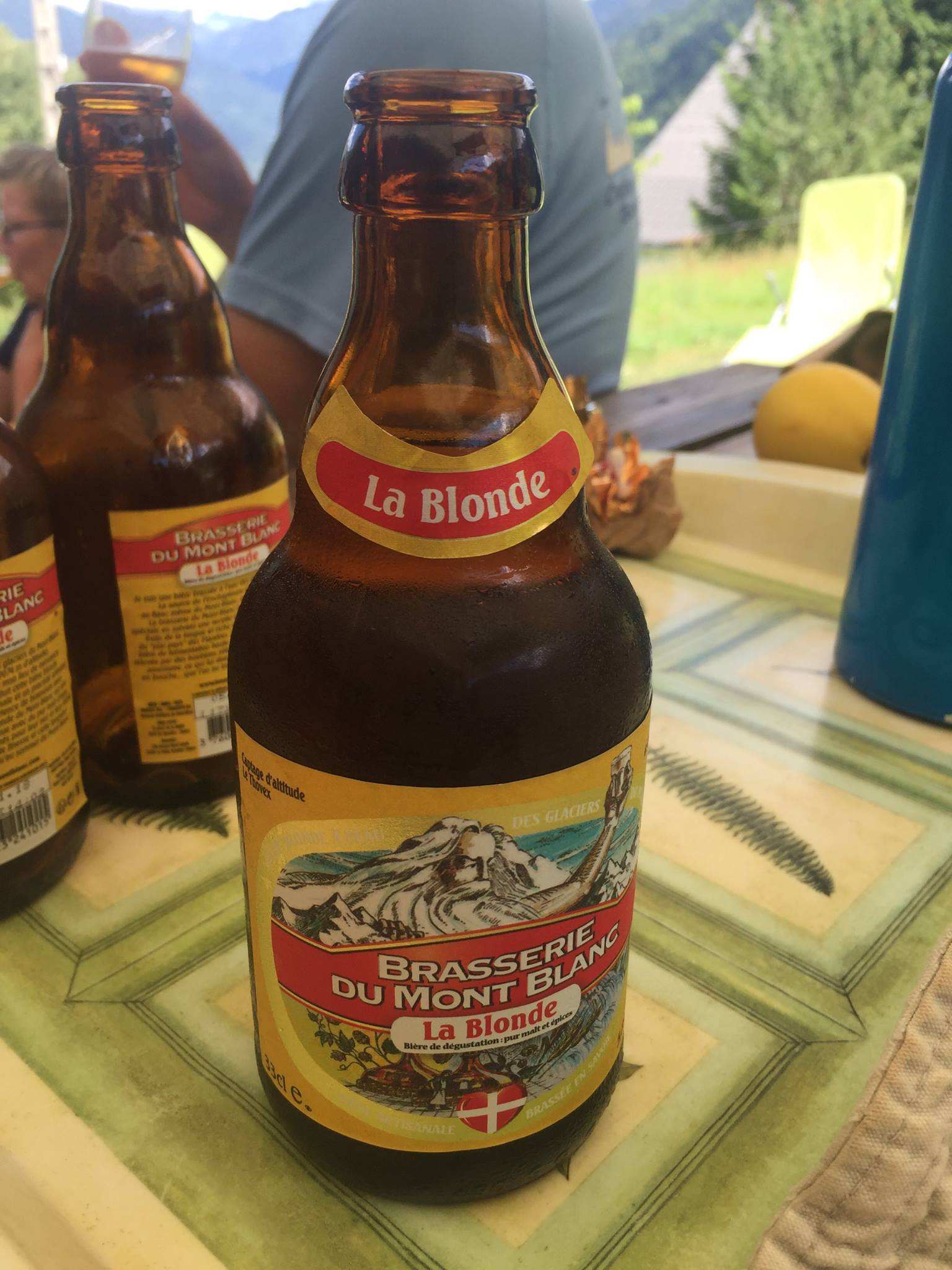
Your next stop is the Gîte d’tape de Molliessoulaz(980 m / 3,215 ft). It was a hot summer day and as you descend you increasingly feel the heat (the rule of thumb is that you gain / lose 1°C (1.8 °F) every 100m (328 ft)) So I stopped there for a while after descending non stop from La Roche Pourrie for 2h10 and just had a lovely chat with the owner under a parasol while I was downing no less than 4 (!) Ice cold La Blonde bottles. Some other very joyous trekkers were there as well (it was 14h00) some going up some down.
From there you’ll pass through quite a few private gardens – You have the right of way by law, so don’t worry if it seems the trail goes through private property. I startled at least 2 families at lunch it was somewhat amusing. For me at least.
An hour later I was back at Queige(590m / 1936 ft.) and quite starved. To my great joy, A pizza truck was still at operation at the village’s square called “Pizza Höt” (What??) It was an excellent triumph pizza. It has been a great ending to my trek. The taxi that brought me there came right as I finished the last slice and 15 minutes later I was back at Albertville station.
Chalet des Mozes – 1,620m