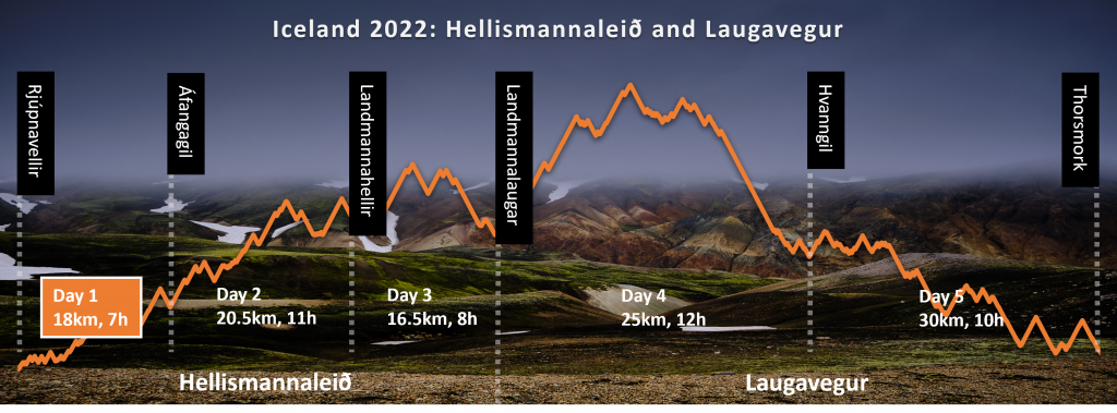
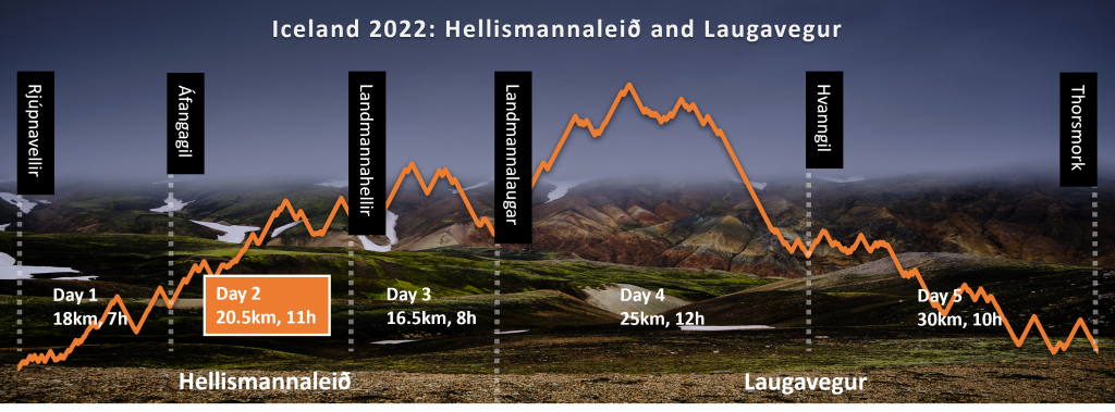
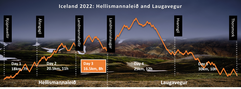
In July, 2022, I trekked across two Icelandic trails – Hellismannaleið and Laugavegur. Each of them is 55k, long, totaling a 110km. This is the story of the first trail, Hellismannaleið.
Overview
Length: 55 km
Season: Mid July to Mid September.
Trailhead accessibility: Easy (Bus / Taxi / Car)
Start point name and location: Rjúpnavellir
End point name and location: Landmannalaugar
Typically done in: 3 days
Day 0: Landing in Iceland
I landed in Keflavik airport around 19:00, and caught a bus to downtown Reykjavik. Immediately after arriving to Reykjavik at 21:00, I started to run around, in order to purchase the things I was missing for the trail: beef jerky, a lighter, and fuel for my gas stove.
Beef jerky and a lighter was relatively easy to find, but looking for a gas canister was a nightmare. Three hours, 5 different supermarkets – and no gas canister. All of the gas stations were closed. Apparently, it is very hard to find anything open in Reykjavik after 19:00.
I returned to the guesthouse with heavy heart, hoping that I will find a gas canister in the gas station, called Hekla N1, that the bus will stop on my way to Rjúpnavellir.
Day 1: Good Karma
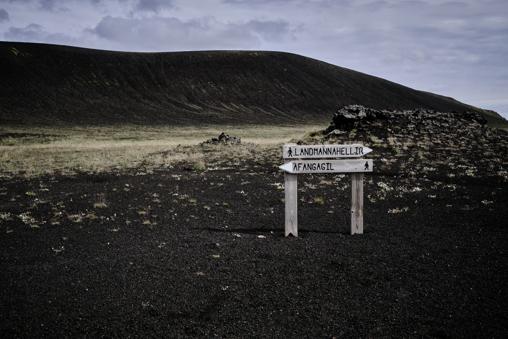
Rjúpnavellir → Áfangagil, 7 hours, 18km, other hikers count: 0
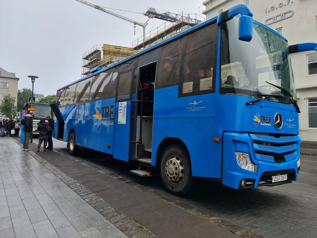
Around 8:00 in the morning, and I am on a 4×4 bus, operated by trex.is company, waiting for me near the city hall. I asked the driver to drop me at Rjúpnavellir. The driver was a funny fella, cheering people about going to Landamannalaugar, and then pointed me out: “He is not going to Landmannalaugar with us! We are dropping him in the middle of nowhere!” Within a few hours, I realized he was right…
trex.is bus
After driving for two and a half hours, we stopped at Hekla N1 fuel station. I ran to the gas store, and to my horror found out that there are no small gas canisters of the type I needed. The only canisters that they did have were tall and slim, way too heavy, and won’t fit my stove head. I strolled back to the bus, and the driver told me that there are no other stops until Rjúpnavellir.
Things like this can ruin your adventure – if you have the wrong mindset. I could easily lose my spirit, panic or start it with the wrong foot. But, when things come to push, you need to improvise. It was possible to cold-soak the freeze-dried food I brought, so no hot water required. It will take around 30 minutes, instead of 10. Not fun, not terrible.
We arrived to Rjúpnavellir at 10:30. The bus driver opened the door, and immediately after stepping down I was attacked by a huge swarm of flies. They didn’t sting, but they were EVERYTHERE, trying to get into eyes, ears, mouth, nose – everythere! Harmless, but very annoying. I immediately put on the mosquito net, and the flies didn’t bother me anymore.
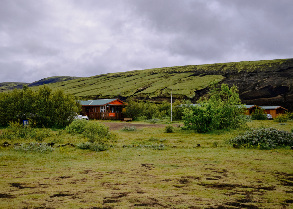
Rjúpnavellir
The bus drove away, and I walked into a room with “Information” sign on it. It was empty, but the owner of the place immediately came, and I asked whether he had gas canister. He showed me a few, quite large gas canisters, but then got a 200 gr completely new Jetboil canister from the backroom, and said that a hiker left it there a few days ago, because he didn’t need it, and I can have it free of charge. Even before setting my foot on the trail, the luck goddess smiled at me. Thank you, anonymous hiker!
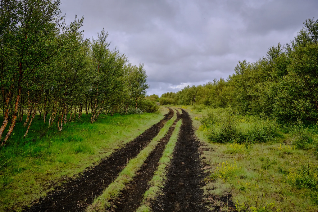
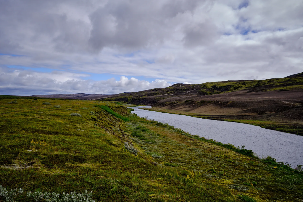
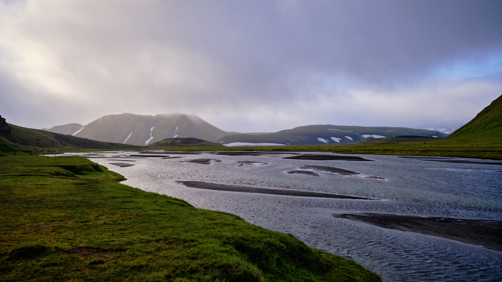
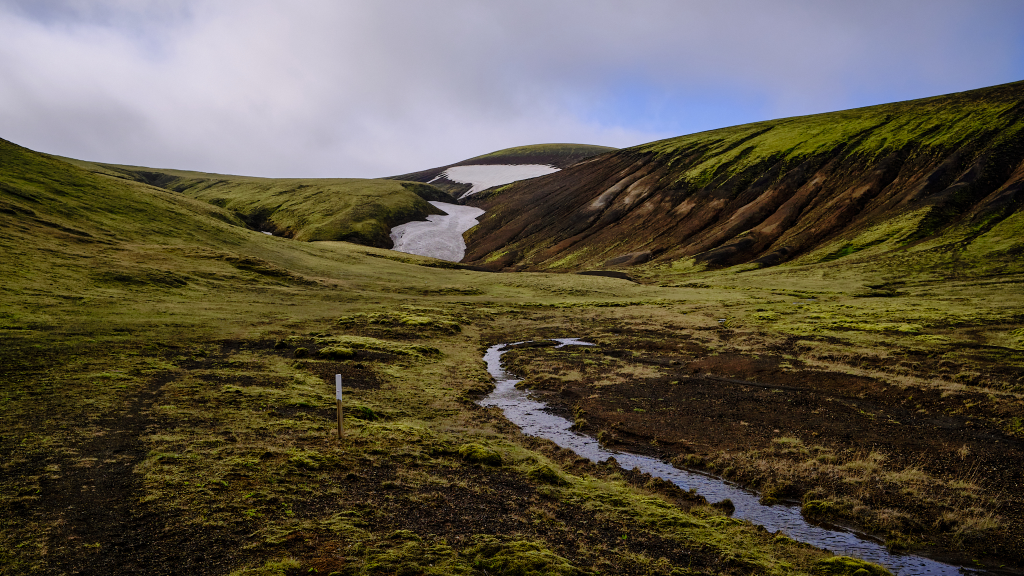
I started to walk between the birch trees. The trees are very short, not more that 3-4 meters. The trail is winding across the Ytri-Rangá river for about 3 km, until it reaches a large bridge. As soon as I crossed the bridge, the trail almost disappeared, but the navigation was very simple – wooden stakes with their top colored white. The trail is marked remarkable well – for the 55km of the trail, there was only one time I missed a stake, and it was only for 3 minutes. Even when I didn’t see the next stake, I just kept walking in the same direction, and in less than a minute saw the next stake.
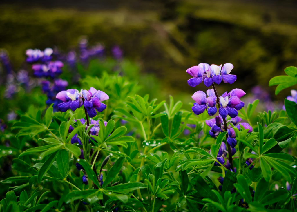
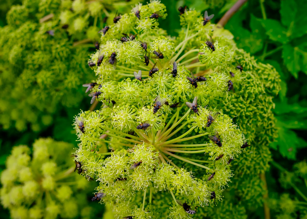
Trail head. These are the last trees I saw, until Thorsmork.Ytri-Rangá riverThe bridge across Ytri-RangáLupine – a foreign flower, brought to strengthen the ground. They are everywhere!Angelica with the annoying-but-harmless flies on top of it
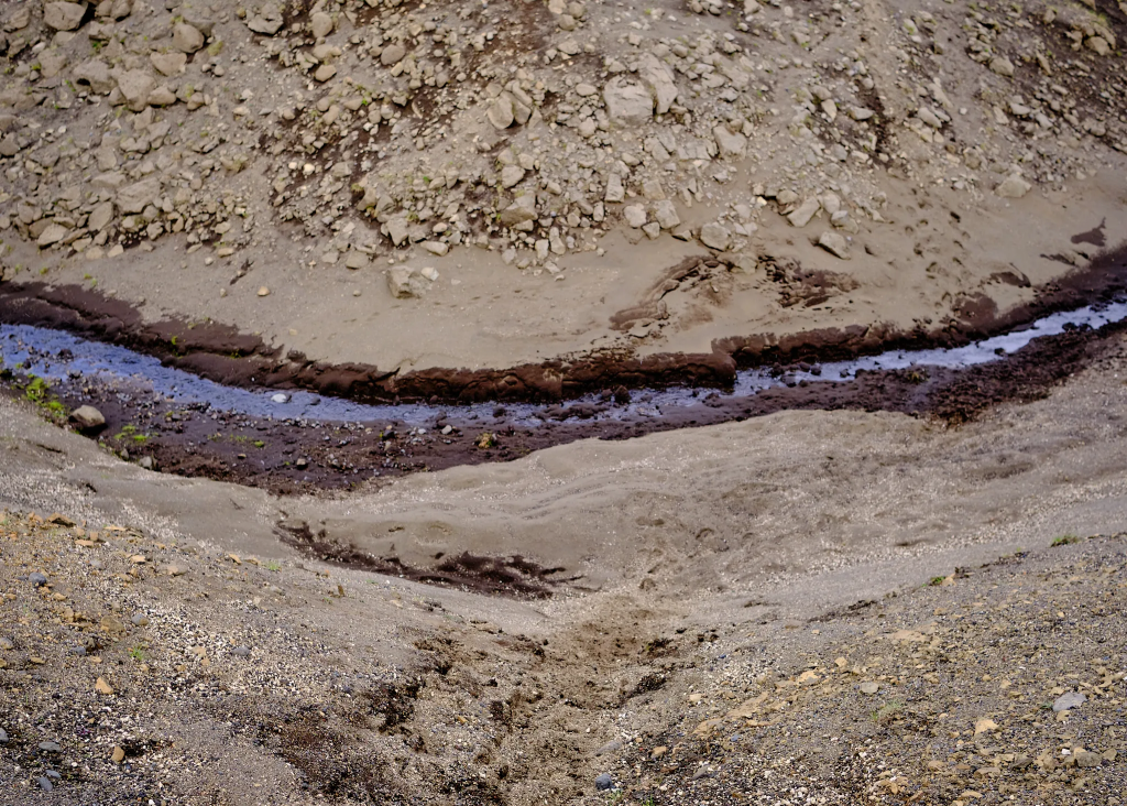
About a kilometer after the bridge, I came across the first stream I had to cross. I didn’t bother to take of my trail runners – and just went through it. The cool water, coming from the melting snow, were surprisingly enjoyable. I filled in my bottle, and learnt that the water was also delicious!
The water in Iceland is clean, and when drinking from most of the streams, rivers and creaks – does not require any filtration. During the whole trek, I drank directly from the rivers and streams, and it was the best water I drank in my life.
Then it was ups and downs on the hills. I crossed several streams – part of them originate from the melting snow, some others just spring from the hillside.
A couple of words about crossing rivers and walking in the rain. There are two main approaches here:
The first one is focused on preventing the water from entering the shoe. Buy Gortex, buy waterproof socks, whenever you reach a river – remove the hiking shoes, switch to water shoes, cross the river, change back. If the hiking shoes are wet – bad luck. Just like they prevent from the water coming in, they also prevent the water from coming out, resulting in very poorly drying shoes, and very wet feet.
The second approach is just assuming wet feet – and if your feet are wet, you’d better wear shoes that try out quickly – AKA trail runners, which are not waterproof, but dry out very quickly, especially if you have Merino wool socks.
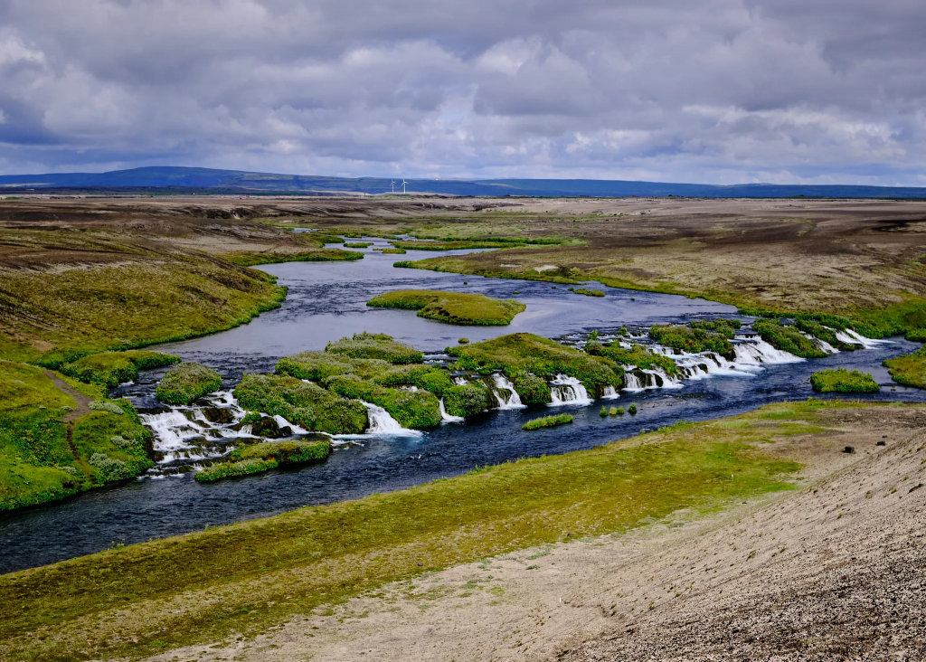
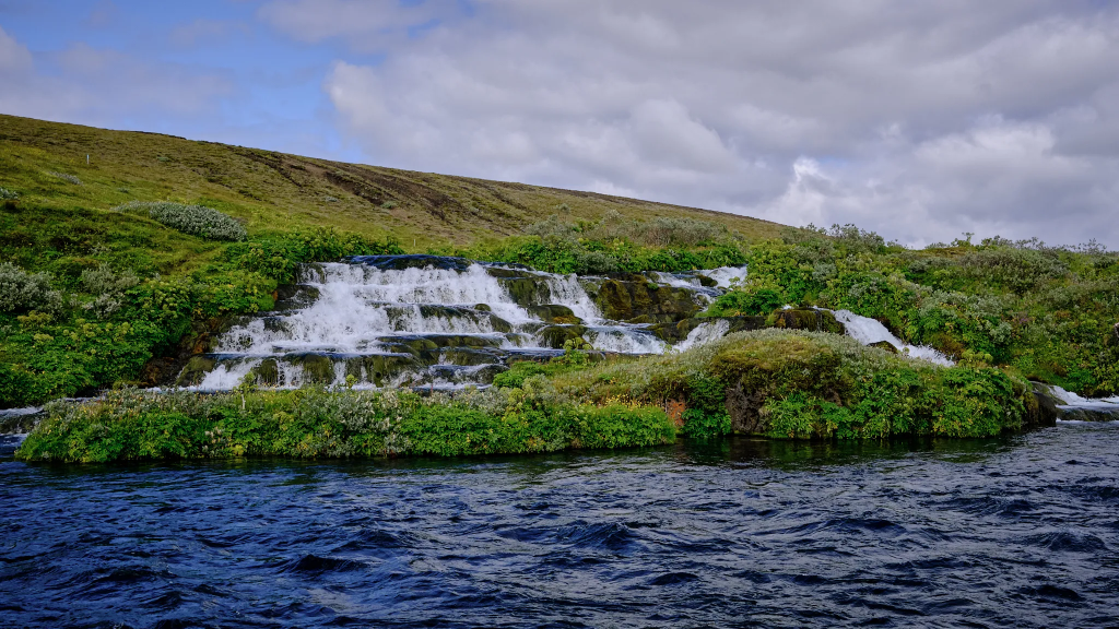
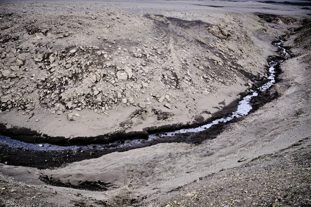
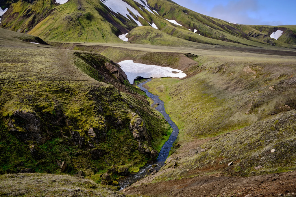
After yet another kilometer, I start to hear the sound of a waterfall. Rangárbotnar – very beautiful waterfall, not because it is tall, but because it is so wide. On the other bank, a few elderly tourists waved at me. Without a doubt, the view from my bank was so much better, because I got to see the whole waterfall. This is also the point where two Ytri-Rangá sources come together.
There were some annoying flies here as well, but much less than in Rjúpnavellir.
Rangárbotnar. Whoever is coming by car from the other side, missing the view.Rangárbotnar – a less known gem of the Icelandic nature.
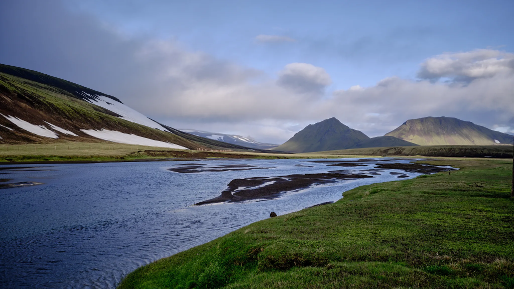
I walked on the river bank and then the path took me to the hills. Before climbing the hills, I refilled my water, knowing this is the last point I can do it – up until Afangagil camp, around 10 km from Rangárbotnar.
2.5 km later, I came to a monitoring station, under which I saw one of the two Ytri-Rangá sources. There was something powerful and mysterious, in the way that vast amounts of water came from beneath the rock.
One of the two Ytri-Rangá sources.
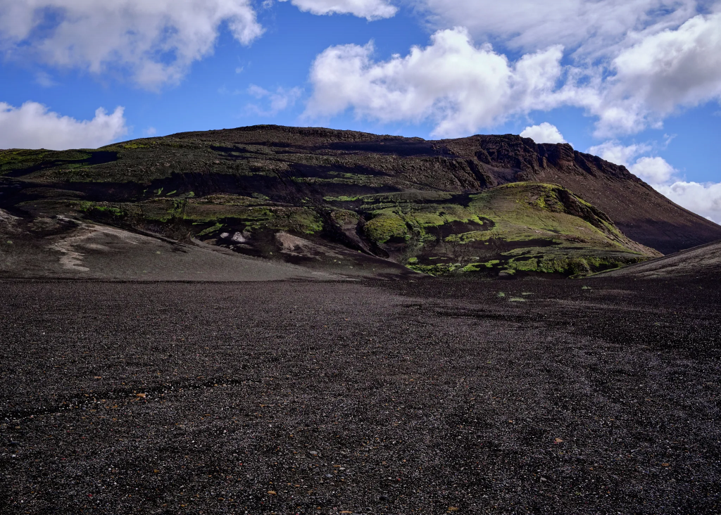
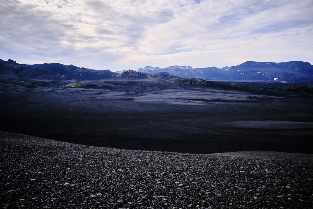
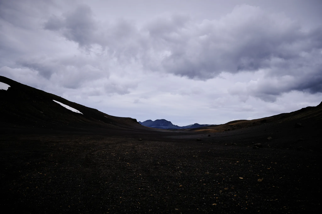
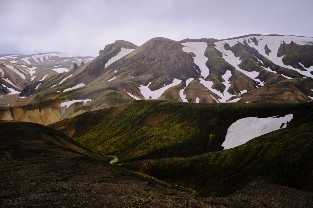
After a while, I encountered the first black carpet of the trail. Undoubtedly, this is a very impressing phenomena – 2.5km hike on a ground, mostly covered with black sand and white/black/red rocks – coming from the previous Hekla volcano eruptions. This is a breathtaking first experience, but most of the 2nd day is actually walking in such landscape.
Exos 58 backpack, a few kilometers after last seeing Ytri-Rangá.Black carpet and amazing weather.Icelandic moss, covering the rocks in a thick layer.Hekla volcano. The first two days are practically walking around it.
I slowly ascended in fields with low vegetation and a lot of animal tracks – mostly likely the arctic fox, but except for several sheep, I saw no other mammals.
Suddenly, without any previous hint, I arrived to a steep (around 45-55 degrees) descend, made of fine volcanic ash. On the other side, there was a similar ascend, and in the middle – almost non-existent stream. On my first step, the sand almost reached my ankle. It also made the descend easier.
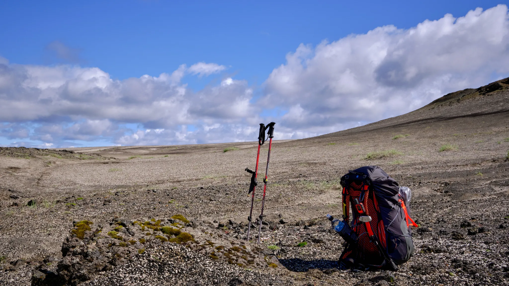
One of the things that really proved themselves during the trek, were the gaiters, very similar to Dirty Girl gaiters. They prevented sand and small stones entering my shoes, on countless occasions, and made the whole endeavor much more pleasant.
Getting closer to the end of the first day.A small stream in a deep descend.A small stream in a deep descend.A combination of a soft soil and small stones, made the area seem like it is a natural pavement.
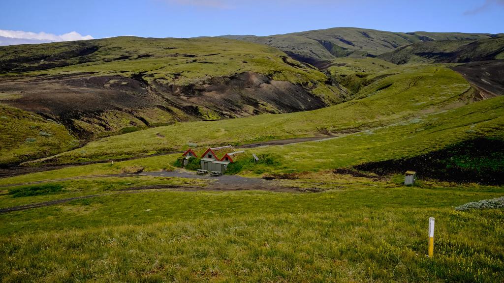
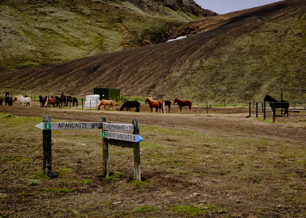
Finally, after completing the ascend, I saw a green valley with horses and sheep. I didn’t actually see the camp site, up until the last few hundred meters. No need to go towards the farm and its fence, but to continue with the poles with the white paint caps, until arriving to the camp.
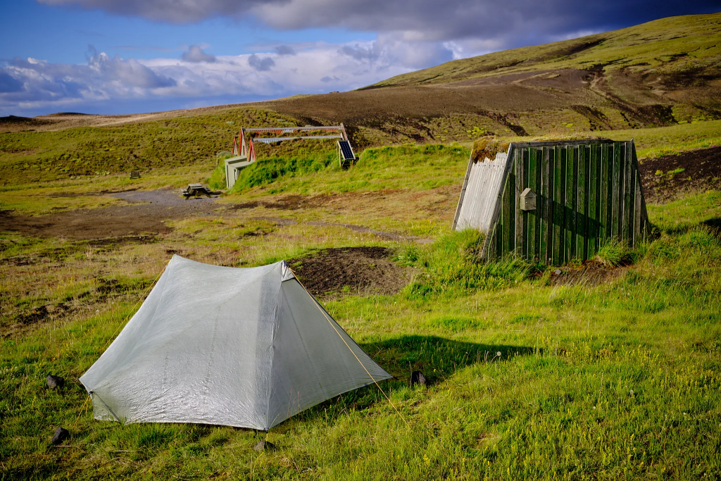
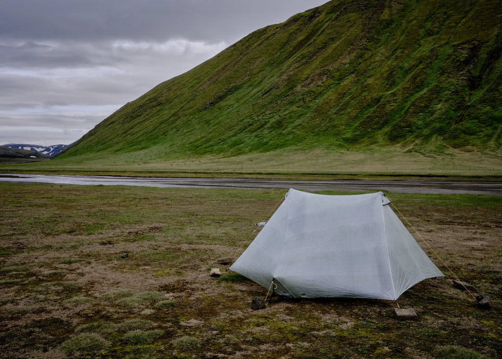
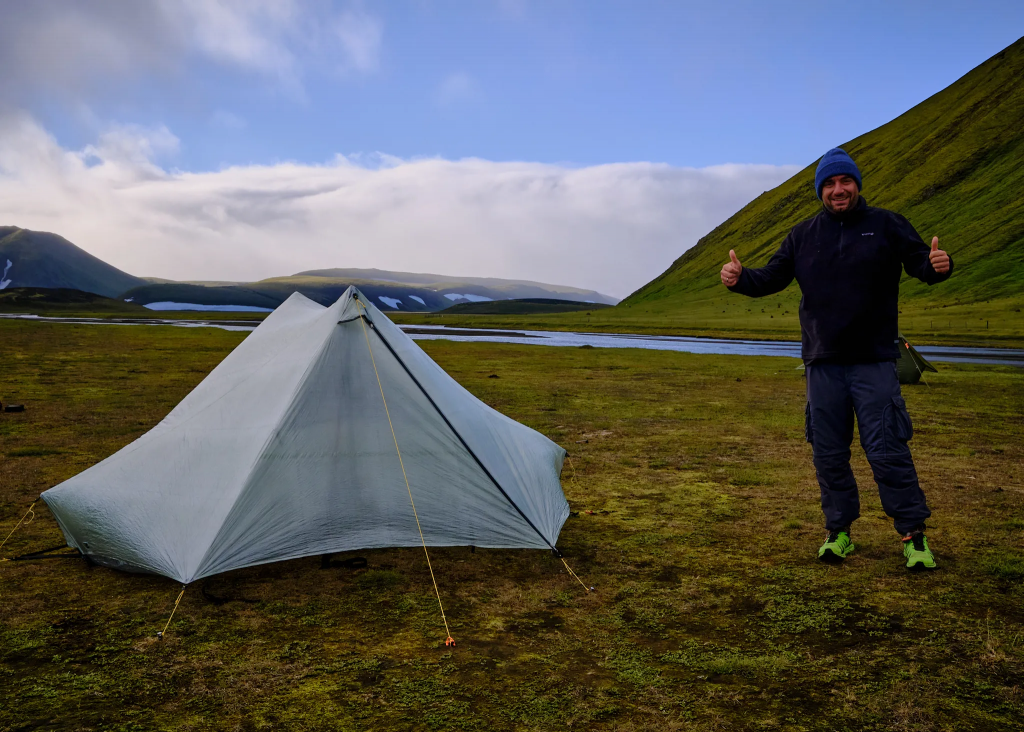
The farm is on the left.Afangagil campsite.My tent, with the toilet and sink in the background.First time with the Tarptent Stratospire Li II tent. Easy set up.
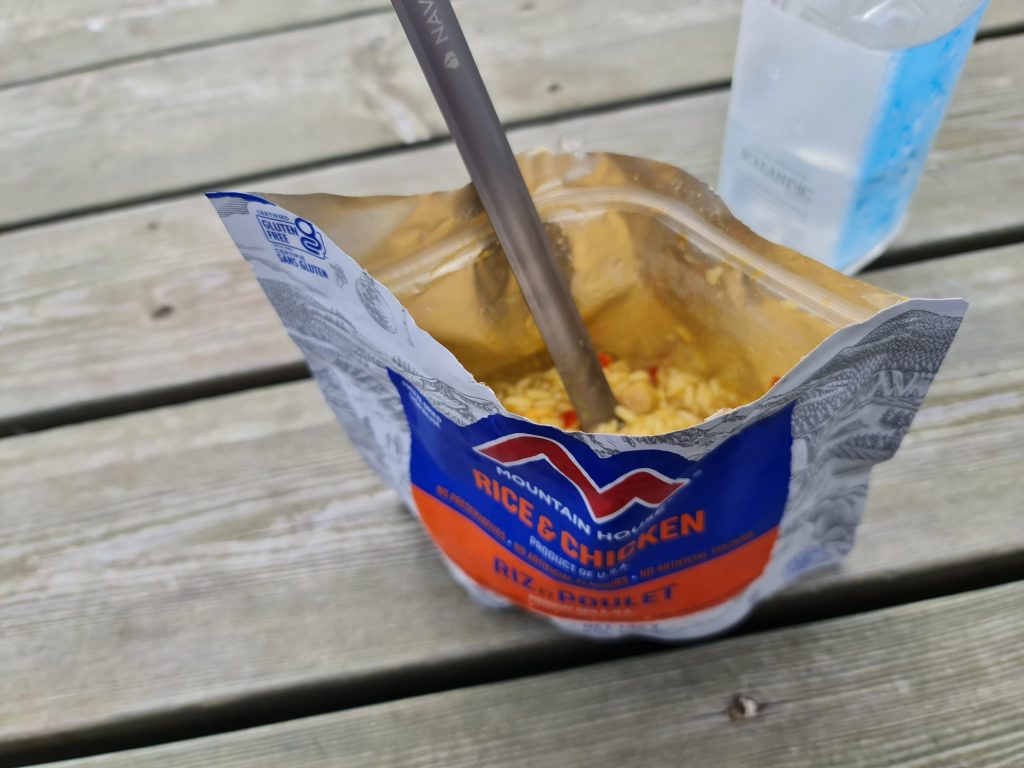
I setup my tent, and went to cook my first dinner. Mountain House Rice & Chicken had a great taste, and was a wonderful ending for the first day.
Sadly, one of the things I have learnt during the night, is the importance of setting up the tent on a completely horizontal ground. During the night the sleeping bag kept sliding over the mattress, the mattress kept sliding in the tent
Day 2: Black valleys, lakes and first river crossing
Áfangagil → Landmannahellir, 11 hours, 20.5km, other hikers count: 4
The sun doesn’t set in July in Iceland. Every time I woke up – there was light. If you need dark to get a good night sleep – you’d better get something to cover your eyes. There was no way to guess what time is it, without looking at the watch.
I woke up early. There was a total silence, morning stillness – to the point I almost heard tinnitus in my ears. The wind didn’t blow, the tent didn’t move, the birds didn’t chirp and the bugs didn’t hum. Absolute silence.
I packed my bag, paid Sonia, who lives nearby with her husband and manage the farm, and took on the road – which started with a 30 minute ascend.
Up we go.
When I reached the top, I was dumbfound by the sharp change. It was the first black valley of the day. Completely surreal – behind me, green valley, in front of me – black valley. Several kilometers of black rocks, black sand, and a single pole with a white cap. Quite a lot of times I had difficulty to see the next pole, because the valley is black and white, and the cap is white – so from the distance it’s hard to understand whether it is a stone, or a white cap. The path is clear, though, and even if not – continuing in a straight line gets you to the next pole.
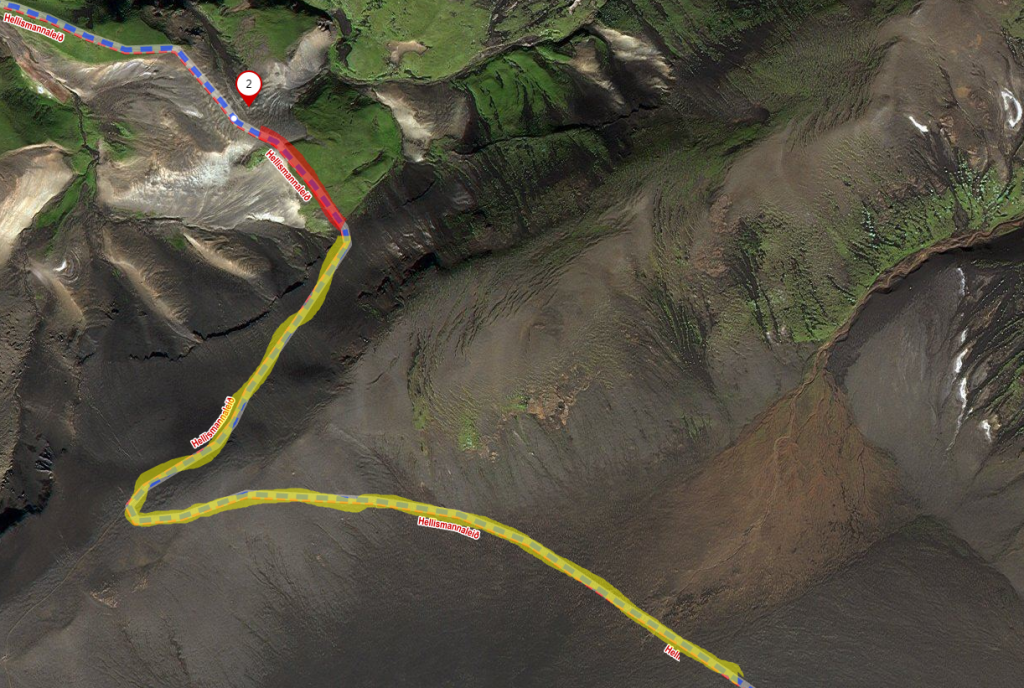
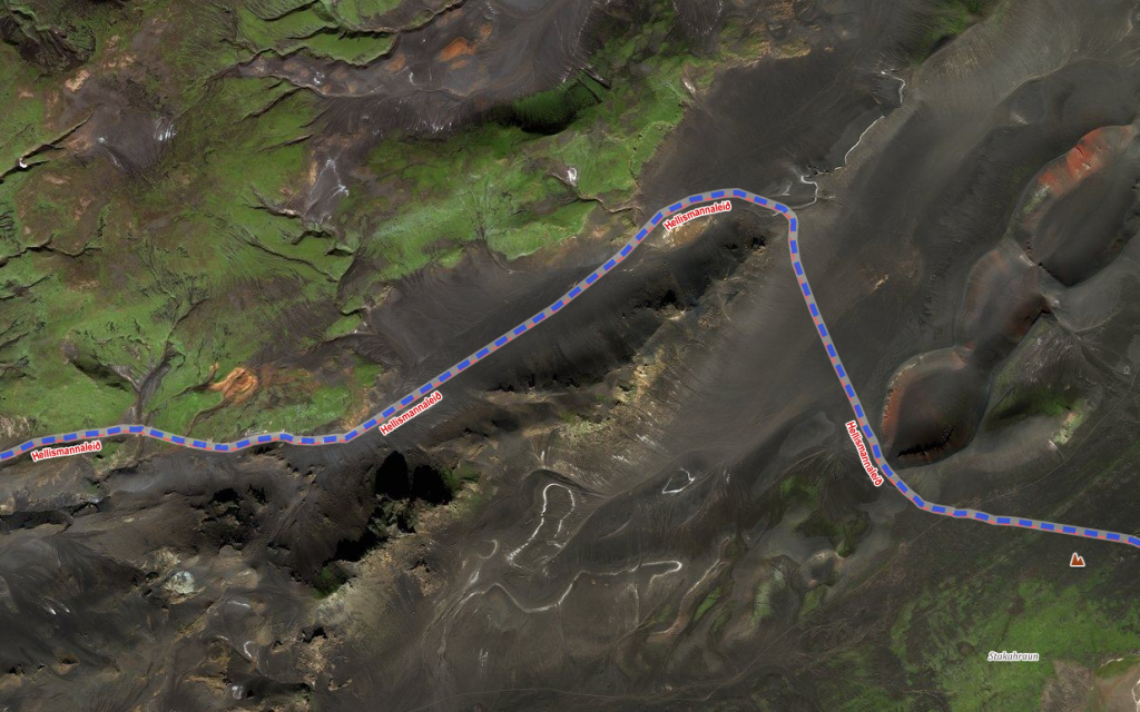
To understand the sharp change I experience, you may look at the following satellite image. The difference between the green ascend (marked in red) and the descend to the black valley (marked in yellow) is very sharp, and happens on the hill top.
Red: the ascend. Yellow: descend to the black valley, and the valley itself.
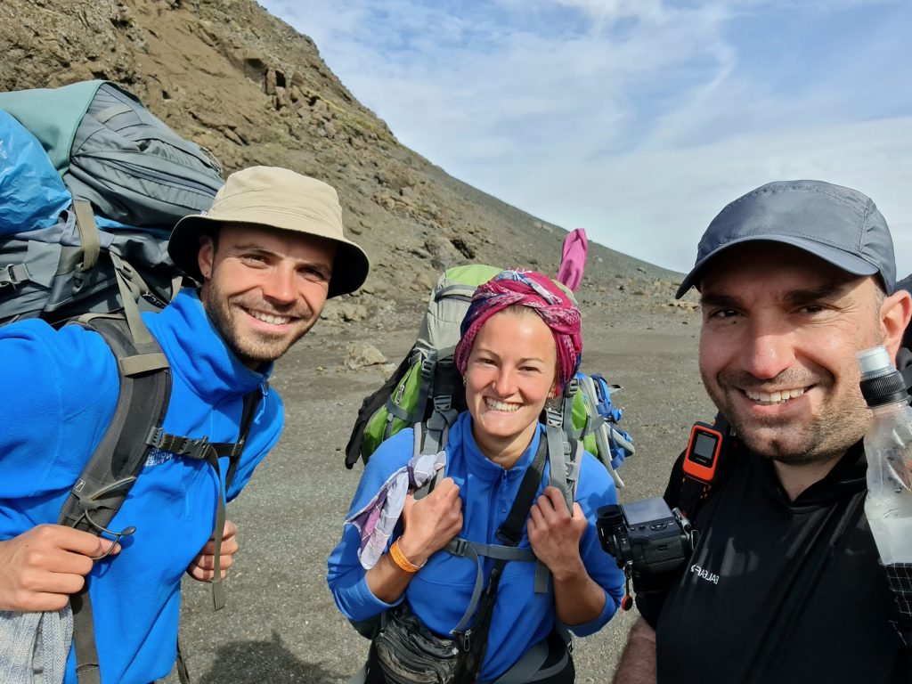
After about an hour, I got out of the black valley, into a canyon. I found a windless area, and ate breakfast – protein bar and some nuts. When I got out of the canyon, I entered another black valley, even longer than the first one. I couldn’t see where it ends. At some stage, I saw a white point moving in a distance. The distance was too great to understand what it was. At first I thought it is a white bus, or maybe a 4×4 car. Only about after another hour, I realized that I see a pair of hikers. These were the first hikers I saw since yesterday morning, a couple from Germany, who are doing a longer, 260km hike. I couldn’t help myself, and a selfie was made.
The German couple with the enormous backpacks.
I couldn’t ignore their enormous backpacks. They told me that the guy’s backpack weights around 25kg, and the girl’s around 20kg. They were very surprised about my relatively small backpack, which weighted only around 13kg, with a camera and food for 6 days.
I asked about the river ahead, and they told me it is only knee deep. I was relieved, since I read quite a lot about this river, and was worried about the crossing.
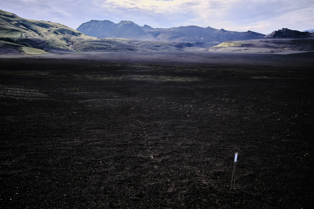
I continued through more and more black valleys – each one is more spectacular than the one before. In hindsight, looking at the map, I realized it is a huge territory, full of volcanic ash.
One of the most astonishing moments of the day was when I got on top of a range, and within a few steps I saw a deep black valley, which I had to cross. There is something very powerful in these valleys, and depressing. It was hard not to feel small, and imagine the catastrophe that covered this huge area with volcanic ash.
After I got out from the black valley, I started to see some green vegetation. Just like the black valleys suddenly appeared, they also suddenly disappeared. I started to see flowers and enormous rocks with a thick layer of moss on them.Holtasóley – Thief’s root
This flower is called Holtasóley, or a Thief’s root. An Icelandic folklore story tells that in order to become quickly rich, you need to still money from a poor widow’s house, while she is in the church, and then bury it under the roots of this flower. Soon after, the money you have buried will be doubled. Then again, thieves were usually hanged where these flowers were in abundance, so I wouldn’t count on this method to become rich.
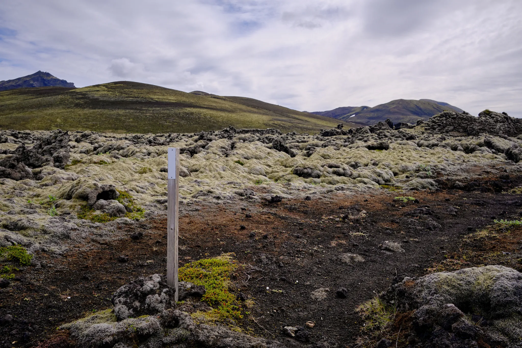
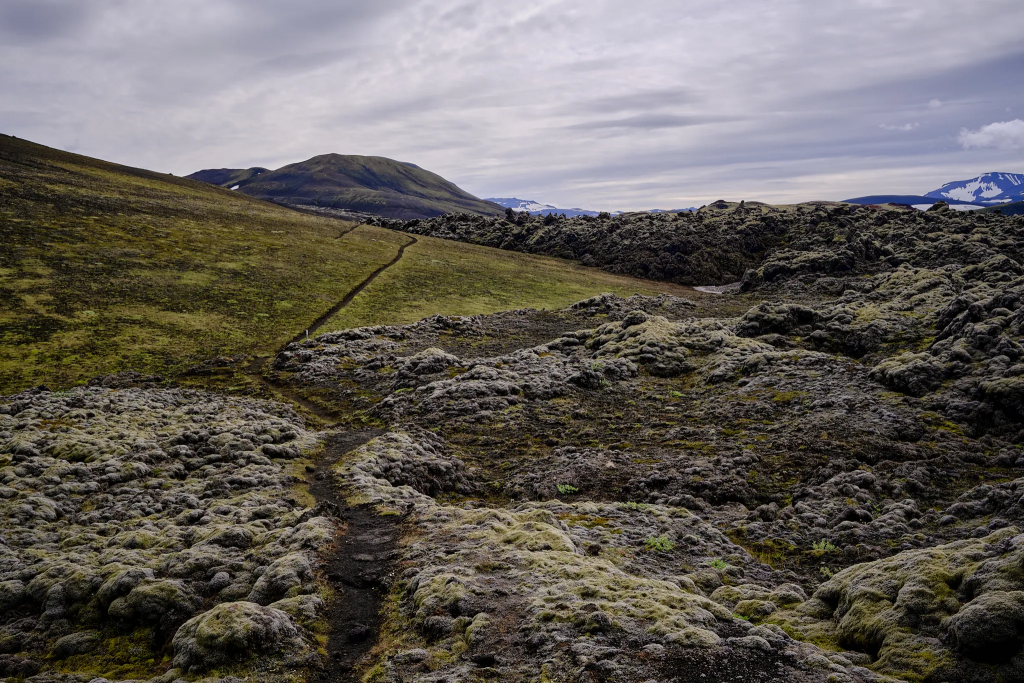
Black valleys were replaced by green fieldsStrictly for hikers
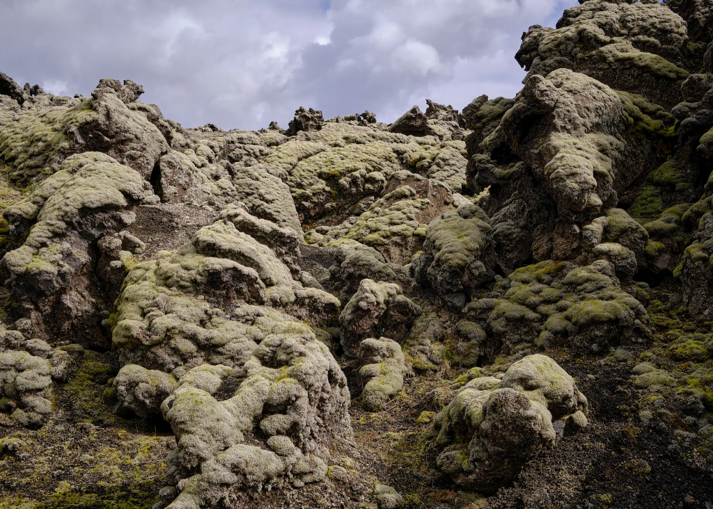
The trail continued through a large stone field, with a lot of moss covering the stones. I never thought moss could be so majestic, but this view of endless moss, with its unique Icelandic color, gave this part of the trail a magic feeling – as if the rocks are going to come to life, and sit down with me for a conversation.
The poles with the white cap that mark the trailA trail in the middle of a vast moss fieldIt seems that the rocks are about to come to life
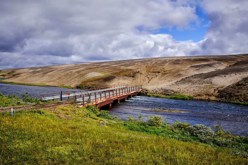
When I reached the Helliskvisl river, I sat down and ate lunch. I enjoyed the silence, but also hoped that someone will come along, so I won’t have to cross it on my own – it wasn’t clear how deep the water is.
After half an hour, I decided to cross the river without gaiters and socks. I found the widest part of the river (which is also the shallowest), and started to cross. The stream was very cold, and relatively fast. Within a few seconds, sand and small rocks quickly started to fill my shoes. I was worried that I will lose one of the shoes in the river – which would abruptly finish my adventure. I learnt a very important lesson there: no removing of socks and gaiters during river crossing. It’s better to have a wet shoe with a wet sock (which will dry out fast), than a dry sock without a shoe, in a middle of nowhere.
To my relief, the water reached only just above the knee. I crossed the river, full of adrenaline, squeezed the water from my shoes, and walked on. The first river crossing was marked as a big success.
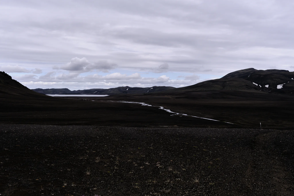
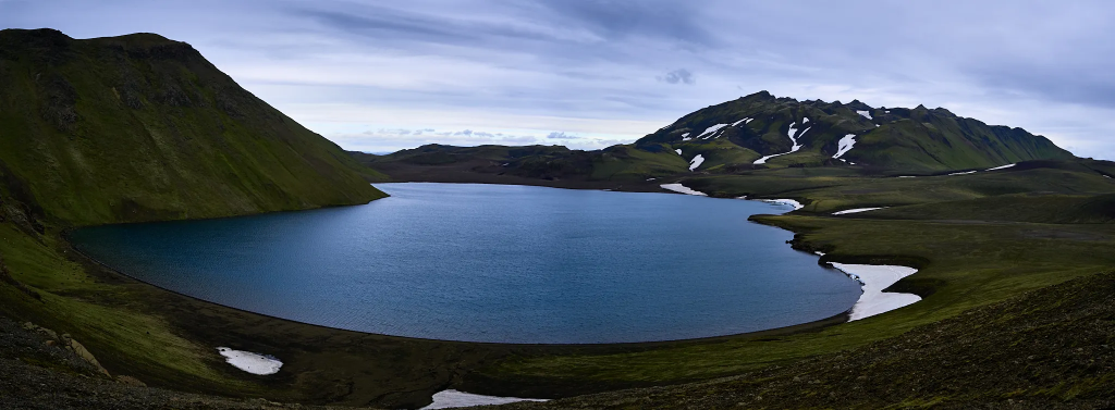
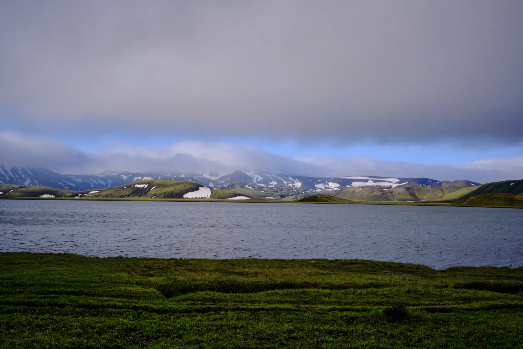
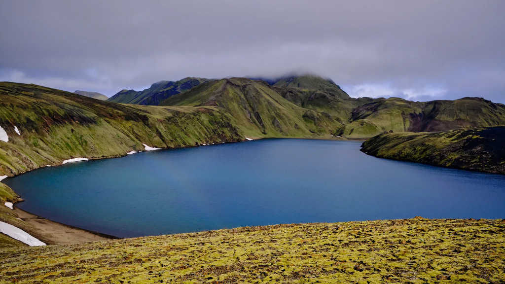
After a while, I reached the last black valley. It looked like it wasn’t that black – there were quite a lot green patches. In the middle of the valley, a small stream ran into the Hrafnabjargavatn lake, which is located 550m above sea level. This was the first of the many lakes I would encounter in the next few days. I crossed this stream without removing my shoes or socks.
Hrafnabjargavatn lake and he stream that I crossed
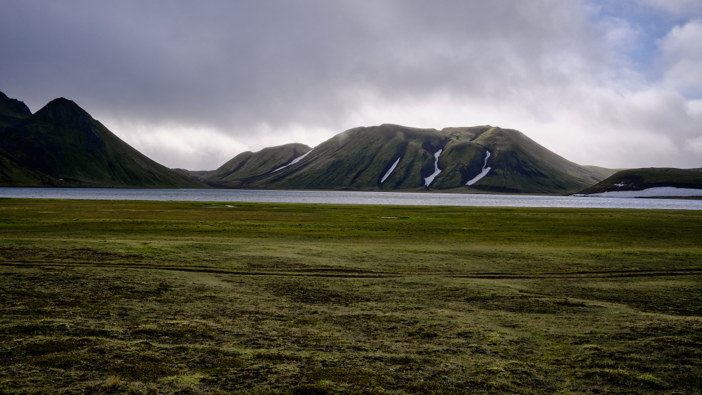
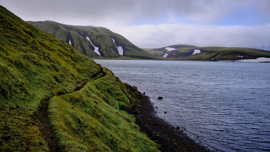
After a long and tiresome ascend through the black volcanic sand, brown rocks and small snow patches, and after another 4km, I arrived to another lake – Herbjarnarfellsvatn. It is located at 625m above sea level, and the trail is surrounding several tens of meters above it. Some parts of the lake were still covered in snow, and I was thankful that the trail allowed me such a great view of this magnificent lake.
Lake Herbjarnarfellsvatn
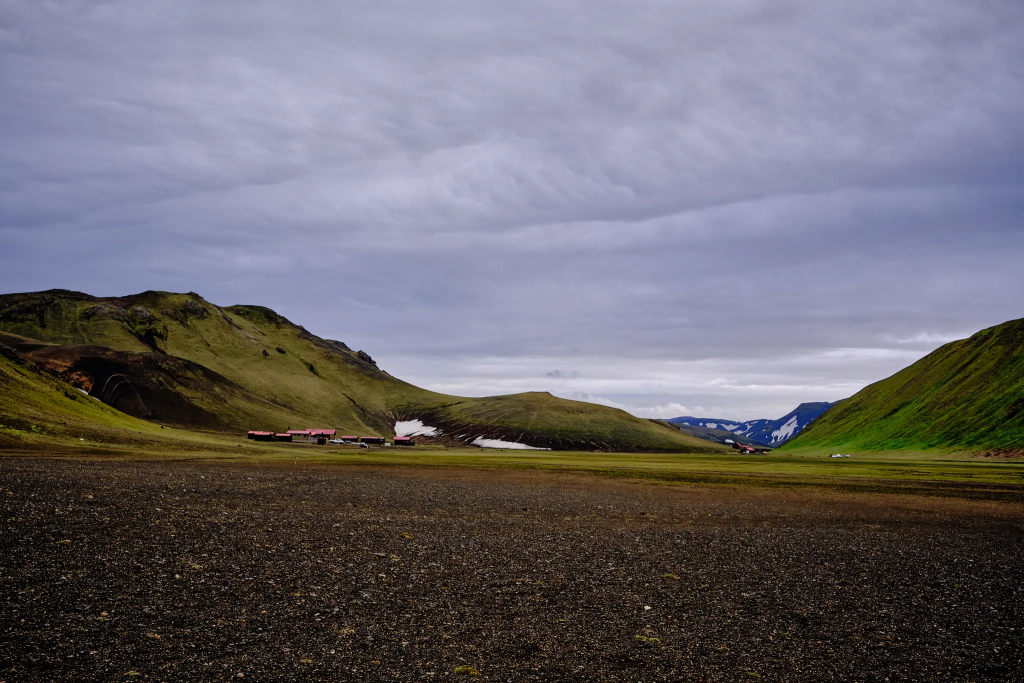
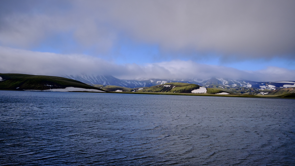
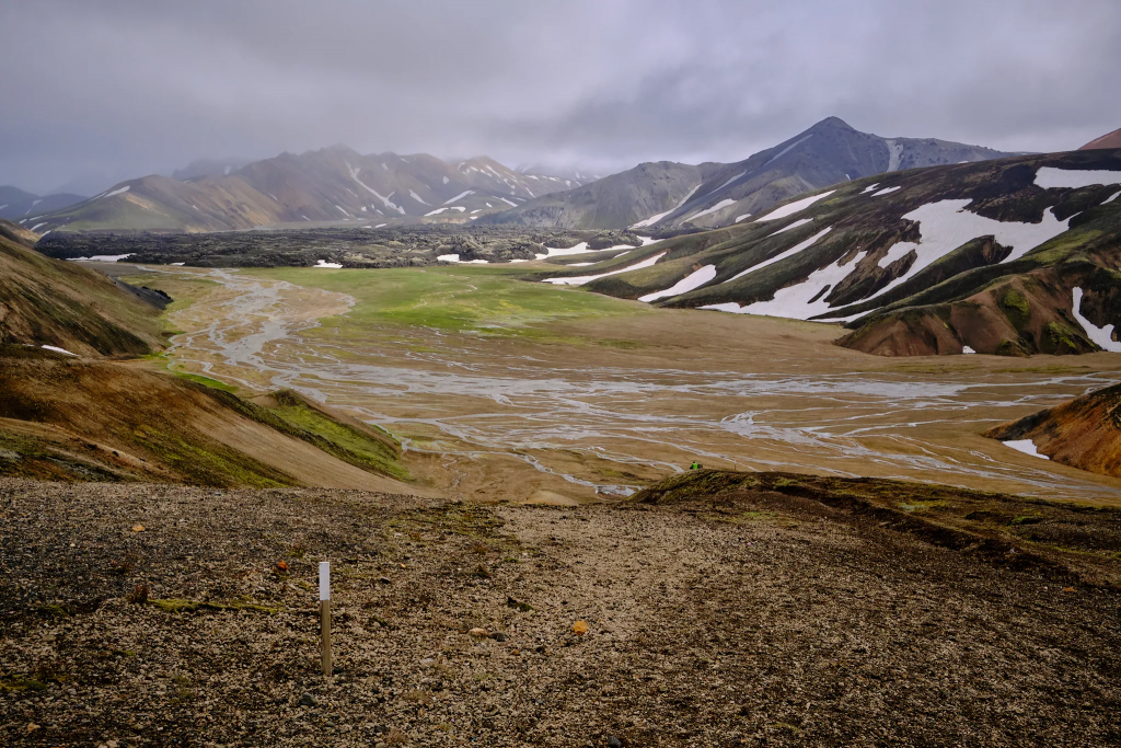
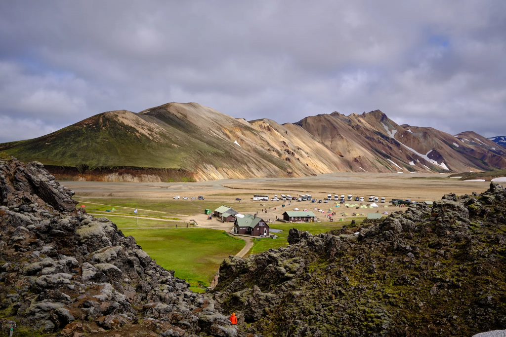
The lake was about 2.5km from the final destination of the second day – Landmannavellir. I could see the camp from far away. In fact, there are two places there – the first is a horse farm, and about 500 meters after, the camp itself.
A few words about Icelandic pronunciation. When you see double l (ll), like in vellir, you pronounce it as “tl”. So, Landmannavellir is read like Land mannah vetleer.
Landmannavellir – view from above.Landamannavellir. The horse farm is on the left, the campsite is further on.Icelandic horses. The day is finally over. 🙂A stormy night ahead.
I arrived shortly after 18:00. The ranger that welcomed me, told me there are going to be strong winds tonight, and probably rain. Frankly, it wasn’t hard to guess what the night will look like. The wind blew tirelessly, with some very strong gusts, and I had to boil the water for the food on the tent porch. When I started to eat, another pair of hikers arrived. A couple from Belgium. Surprisingly, I learnt that they travelled the same trail! On the first day, they started an hour before me – which explained the fresh foot tracks that I saw, and their tent was around 300 meters from mine, on the other side of a hill. Since I left early on the second day, they were the ones who followed my footsteps, and wondered who I was. I suggested they will put big rocks on the tent polls, because we expect a tough night, and went to sleep.
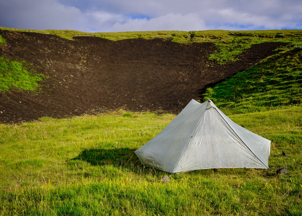
It was a miserable night. After 40km with ~13kg backpack, no prior training and a bad shape – my feet muscles hurt so much, that I woke up from the pain every half an hour. The wind turned into a nightly storm, and there was a strong rain – but my wonderful and trusted Tarptent Stratospire Li, felt like a fortress.
During the hike, I started to treat my possessions with great respect. I learnt to love my tent, that protected me from rain and strong Icelandic wind, and the walking sticks that held the tent firmly above me, and the Therm-a-rest NeoAir XLite sleeping mat that allowed me a good night sleep, and the sleeping back that warmed me.
Eventually, when you are reaching the basic truths of our existence – dry clothes during a storm, a stomach full of warm food, tired but functioning legs – you begin to be attached to here and now, the moment that you live in, and focus on short term plans, how to survive the night and the following day.
Day 3: Lakes, mountain passes, rain and friends
Landmannahellir → Landmannalaugar, 8 hours, 16.5km, other hikers count: 2 and then a lot
A beautiful morning followed the miserable night. The rain stopped, and the strong wind became a breeze. I had a relatively short day ahead.
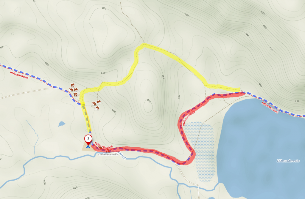
There are two ways to get back on the trail from Landmannahellir. The first one is to go a little back, near the horse farm, and go up the hill. It is a 150-200m ascend, and I am sure that the view on the Löðmundarvatn lake worth it. In fact, the poles with the white caps mark this. The second way is to go with the dirt road for about a kilometer on the river bank, stopping for a few minutes at the famous Landmannahellir cave, and turn left. After another kilometer, you will reach the trail again. Different maps show this part differently, but eventually it is a one hour walk whichever way you choose.
Red – the path with the cave, that goes on the dirt road. Yellow – the path that goes on top of the hill.
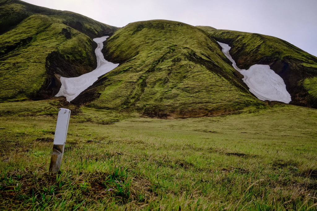
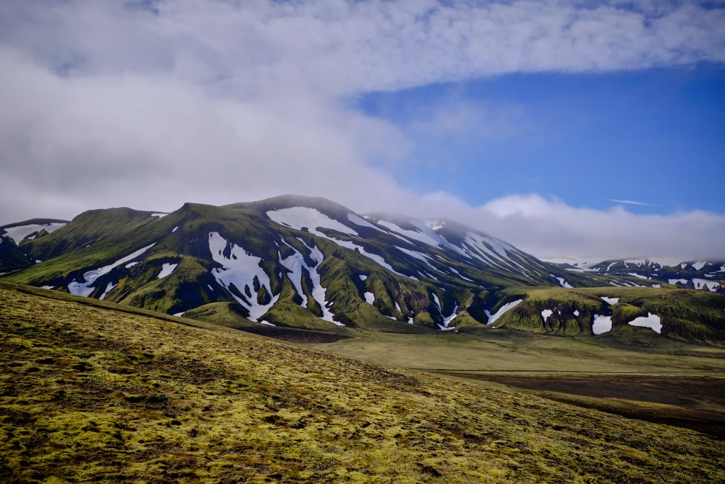
The view became mostly hills and mountains, full of snow patches, lakes and a lot of low green vegetation.
Helliskvisl river – this is were I’m headingHelliskvisl river – looking back
I started to walk on Helliskvisl river bank, and saw a mountain, its peak covered with clouds. It was very quiet, and I could smell a promise of a good weather.
A promising day on the Helliskvisl river
It wasn’t long before I arrived to the Lodmundarvatn lake, to which Helliskvisl is connected. Several sheep stopped to stare at me. The trail went near them and twisted on the mountain side, only several meters from the lake.
Dirt road, leading to Lodmundarvatn lake, and a lone photographer Lodmundarvatn lakeGreen, blue, white and greyThe trail is twisting along the lakeLow clouds above the mountains above Lodmundarvatn lakeThe snow melts, leaving space for the greens of Icelandic summer
The trail climbed up, and within half an hour, I saw aanother lake, Lifrarfjallavatn. This lake is only accessible to travelers on foot. This is one of the most beautiful lakes I saw during my hike. There was a light rain, and I was lucky enough to see a rainbow above this magnificent lake.
The trail goes up, along a small stream fed by the melting snowLifrarfjallavatn lake with a small rainbowMore mountains with snow patches – something that I will see a lot over the next few days
From here, the trail goes down towards a big dirt road, named Landmannaleid, with relatively a lot of traffic of 4×4 buses and cars. The road itself later connects to a bigger, F208 road.
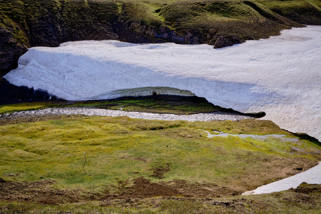
When I crossed the road, I saw a pastoral snow bridge, with a stream running under it. The Belgian couple caught up with me near the snow bridge, and we continued together.
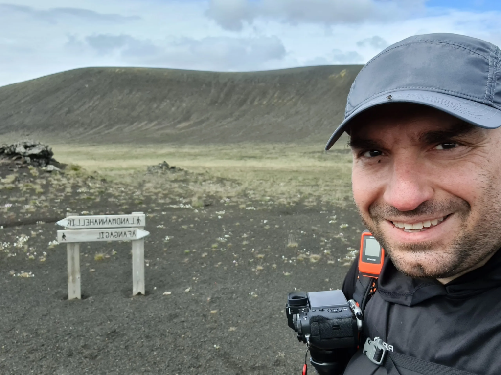
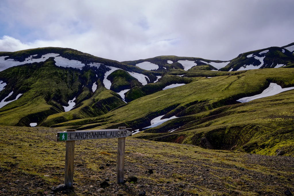
Finally, a sign with “Landmannalaugar” on it! Snow bridge with a stream underneathI wanted to go under the snow bridge so much, but it was too cold and didn’t seem safe to do so.
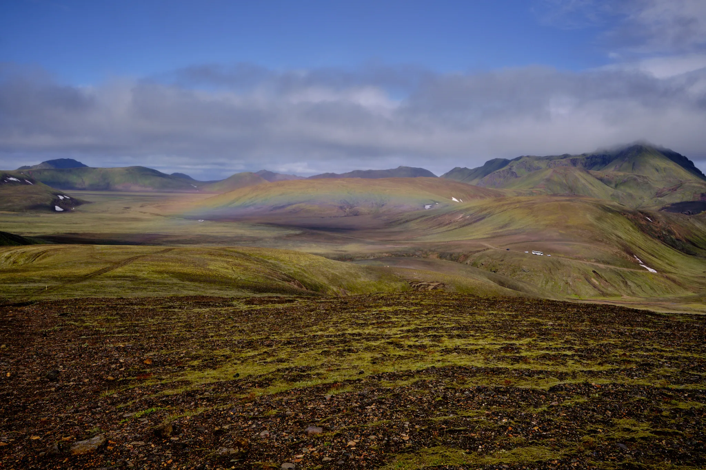
And then began a big climb. I turned back, and saw a wonderful rainbow.
A rainbow
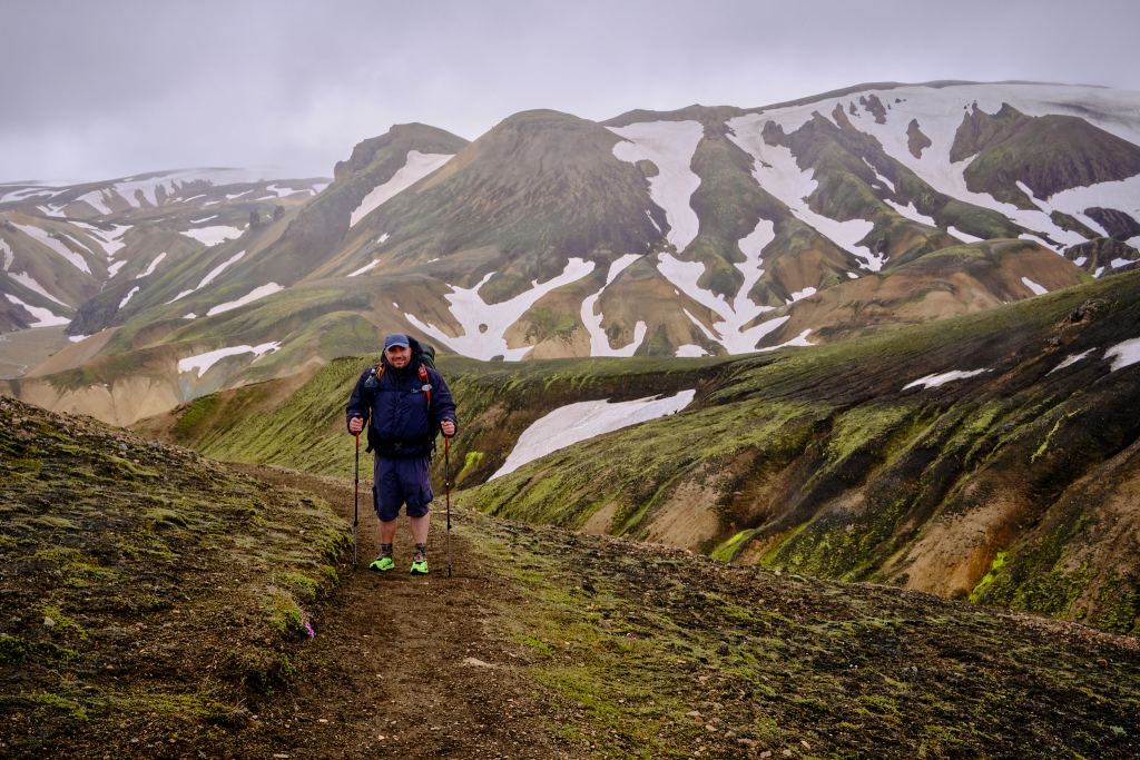
The next four kilometers consisted of climbing up through some rough weather. As we went up, the a light drizzle became a rain that required to put the rain cover on the backpack. A cold wind blew and froze my hands. I was very sorry that I didn’t bring any gloves. My hands were so cold, I had difficulties double-pressing the phone button, to snap a picture. Part of the time we walked on snow, but the combination of my trail runners, merino wool socks and walking, kept my feet both warm and well ventilated. Across the whole 110km of the journey, not a single blister appeared on my feet – despite crossing many rivers and streams.
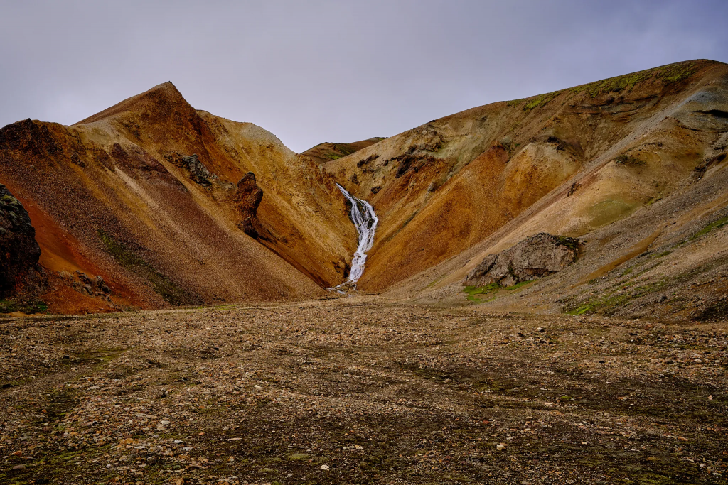
The green vegetation was replaced by rocks I haven’t seen before. They were black and shiny as a mirror, with very sharp edges that could easily cut any rope or backpack. Most of them were very small, but some were as large as a car wheel.
These black rocks are called Obsidian. They are formed as a result of a quick rhyolite lava cooldown.
Almost no vegetation – just black Obsidian and white snow.Brown, green, white and me 🙂As we went on, the mountains became browner.
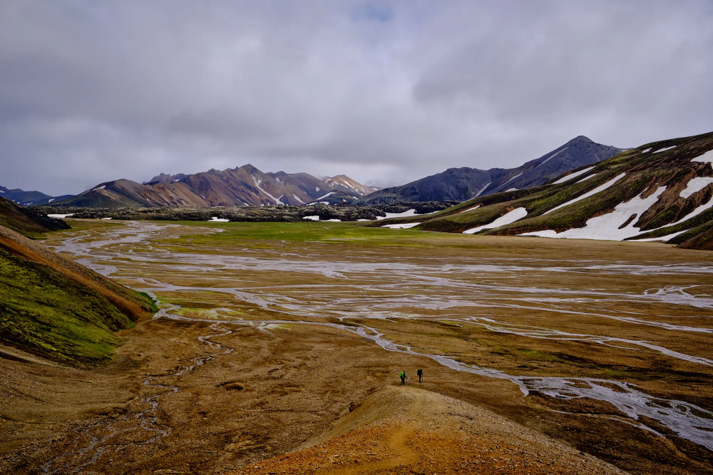
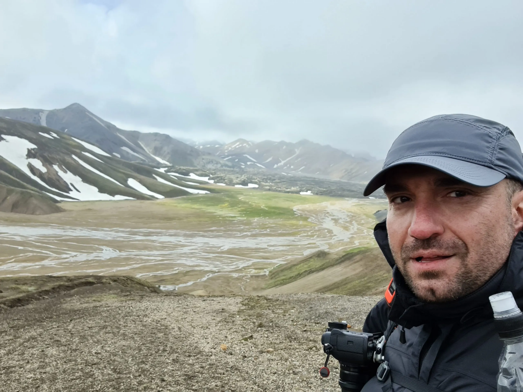
And then, without a warning – I saw the Landmannalaugar valley, and on its bottom a wide river that split into many dozens of smaller streams across a big plane. On the right side there was a beautiful fall, running down from a rhyolite mountain. Another thing that really surprised me, was the amount of people I saw below me – most are day hikers. After 3 days of almost complete solitude, I saw dozens of other travelers.
Down to Landmannalaugar. One of the last poles with the white cap.A river that splits into dozens of smaller streams.The waterfall, flowing down from a rhyolite mountain.
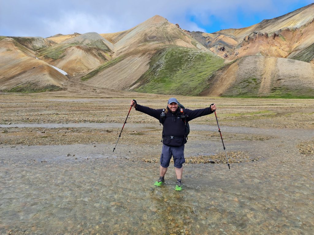
I descended. My Belgian friends couldn’t figure out the best way to cross the valley without getting their shoes wet, and I just went straight, through the streams, enjoying the cold water that chilled my weary feet.
Landmannalaugar valleyGoing through the streams 🙂Scottish break – dry the socks and rest
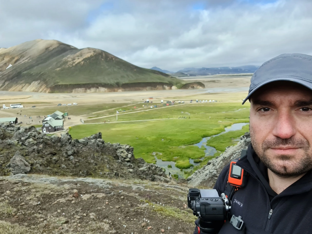
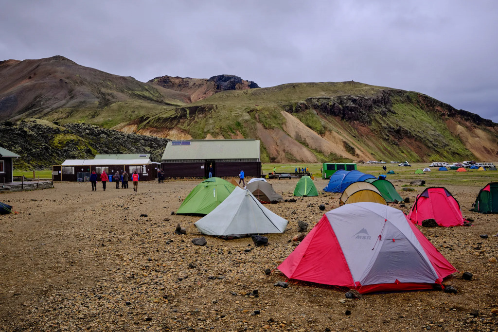
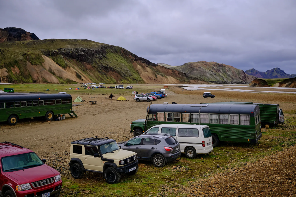
After a short walk in the valley, I arrived to a path, with two metal cables on both sides. This is the most touristy part of the area, and it is pretty accessible. Many dozens of people and 15 minutes later – and I was in the Landmannalaugar campsite.
After three days without hardly seeing any people, Landmannalaugar felt like New York. A lot of hikers and travelers, going around buses, tens of toilet rooms, Mountain mall (!!!), tens of tents! It felt like an organized mess. As much as I enjoyed the solitude of the first three days, the ability to sit near a table and just speak with people, made me happy.
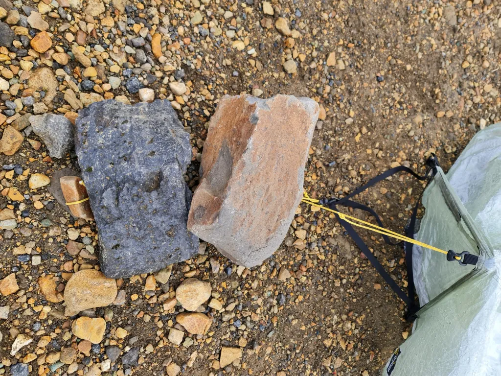
Unlike the first two campsites, the ground was so hard, I could use my aluminum stakes. Some people managed to hammer in enormous steel stakes, but the last thing I wanted to do is to break my aluminum steaks. Luckily, whenever there is a hard ground, there are big rocks – and there were a lot of them here. I took my spare rope and first aid scissors, cut the rope into several segments, and using the big rock/small rock method, quickly set up my tent.
Big rock/small rock method: tie a rope around the small rock, and put a big rock on top of the rope. This way the rope won’t slide. You can stack several big rocks, to increase stability.
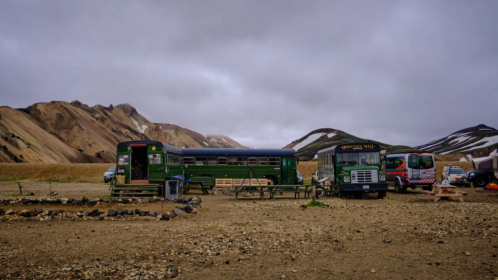
The rest of the time I spent preparing my meal and walking around the camp. I bought a local sandwich, an apple and light gloves from the Mountain mall – which is basically three old buses connected together. It was the best apple I ate my whole life. There is quite a big variety of food and things to buy at the Mountain mall, as well as the ranger shop – including freeze dried Real Turmat meals.
I didn’t go into the hot springs, because sometimes people get Swimmers itch, and I didn’t want to spend the next few days itching.
Swimmers itch is a phenomena connected to some parasites originating from ducks, that sometimes arrive to the Landmannalaugar hot springs. It is relatively rare, and most people are not affected. The hot spring are always full with people.
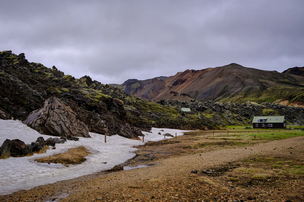
“Mountain mall”The campThe snow did not completely melt yet (16/07/2022)
And this was the end of the Hellismannaleið trail. 55km in 3 days, mostly alone. A lot of solitude, a lot of conversations with myself, enjoying the wonderful views, dealing with little difficulties that had a potential to become big. Going up the hills and the mountains, and coming to realization that when it is hard – you may rest, take a deep breath, and move on.
Eventually, what’s important is not to give up and enjoy the trail.
We use cookies to ensure you get the best experience, including for user sessions and default WordPress
functionalities. Some features may not work without them.
Learn
moreCookies Policy